These photos were kindly provided by Derek Cutts and show a variety of locations around Rainham station from October 1966 before the old station buildings were demolished and the new station built.
Photo 1
This is a view of the main Rainham station building taken from the coastbound platform. The large Rainham sign is fixed to the toilet wall and there are maps of the railway shown on the station building wall. It shows the Nelson Confectionery kiosk which is closed at the time. There is a stationmaster standing next to a pile of sacks by the station window but the platform is otherwise deserted. The adverts on the wall promote Carnaby Street shirts and Cockburns port along with “Chatham News for all your local news”. There is an old footbridge going out of shot to the coastbound platform.
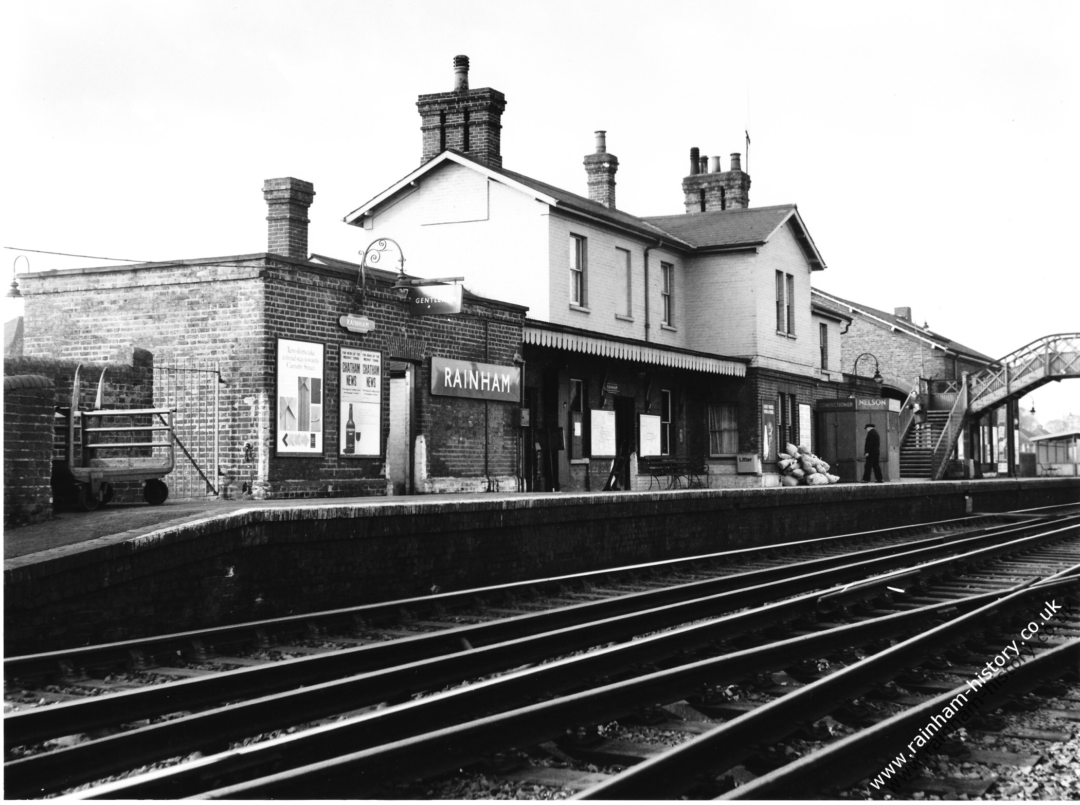
Photo 2 shows the London bound platform with a solitary passenger waiting in the somewhat shabby looking shelter on the platform. You can see the new looking houses on Tufton Road in the distance. The tracks showing have 3 rails so it suggests that the electric rail was already installed at this stage.
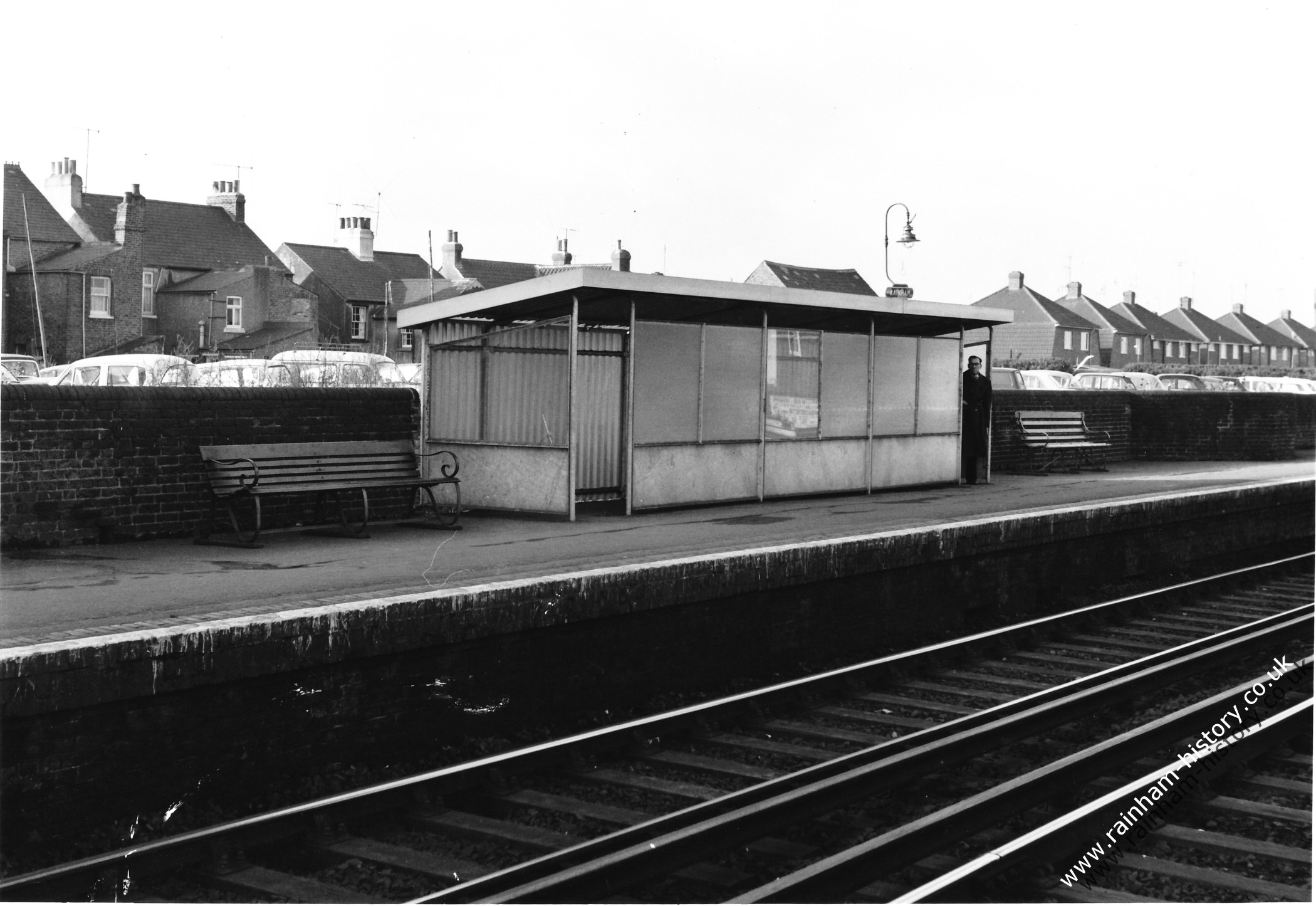
Photo 3
View of the station building from Station Road showing phone box on the corner. Multiple cars are visible in the picture, Austin A40 Farina registration 402DOD, Bedford CA van number plate 152 JKP. Over the railings is a Vauxhall Victor. The sign warns it is a private road which leads through to the station car park passing directly in front of the station entrance.
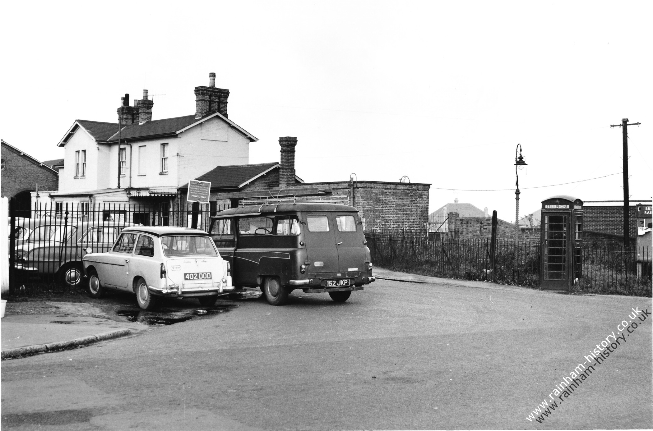
Photo 4
This photo is of Rainham station car park and storage building. There is a canopy with motorbikes parked underneath it. Cars visible include a Ford Cortina MK1 facelift model, C plate registration (1965), Austin Mini saloon and beyond the fence a Mini van and another Cortina. There is another white car Vauxhall Velox PB or Cresta PB with number plate 5213D with GB plates on it parked in front of the motorbikes.
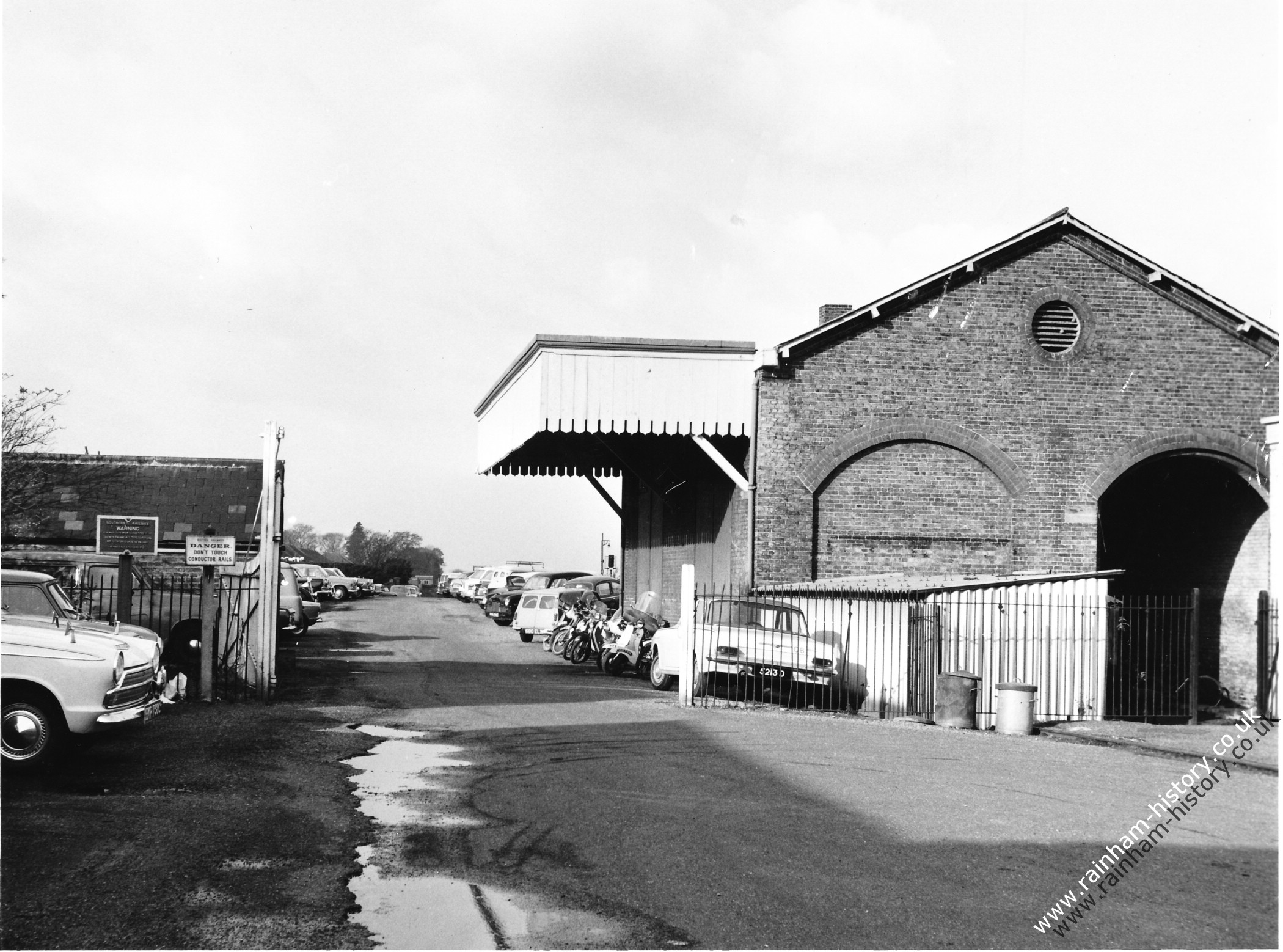
Photo 5
View of the Signal Box control room from Station Road showing the telephone box and sign for British Railways Rainham Station. There is a poster urging you to “Go by ship and train to the Continent and see more on your journey” The station buildings are out of shot to the left of the picture.
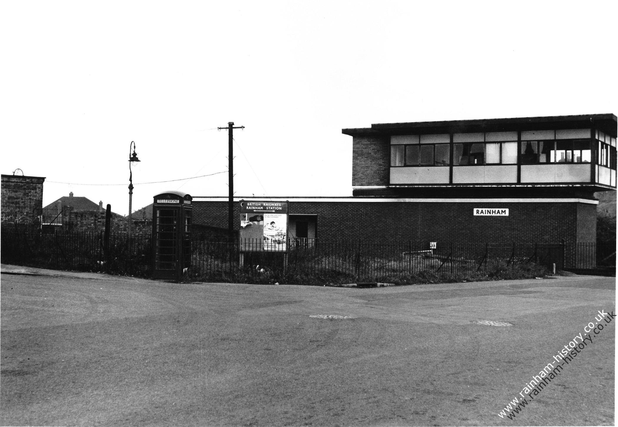
Photo 6
This is the key photo for dating the series. It shows the coastbound platform with the Wakeley’s Oast in the background before it became the RWCA Community centre in the early 1970s. The shelter for waiting passengers looks quite tatty and run down but the posters give a great view of 1960s life. One of the posters has the name Eric Lawson, Station Road Rainham which was an estate agent advertising property in the Medway Towns Area. There is an advert for the Woolwich Building society (bought up by Barclays Bank in the 2000s) and Coronet Real Fruit yoghurt – taste the real fruit!
Football at Priestfield Stadium Gillingham is advertised showing matches against Swindon on 12th November 1966, Bristol Rovers on 16th Nov, Grimsby (Town) on 10th December 1966 and Scunthorpe (United) on 17th December.
Medway College of Art is advertising their Session for 1966-67 and below that is another advert for Cockburns port. In the background to the left of the photo the new houses of Parkfield Road are visible.
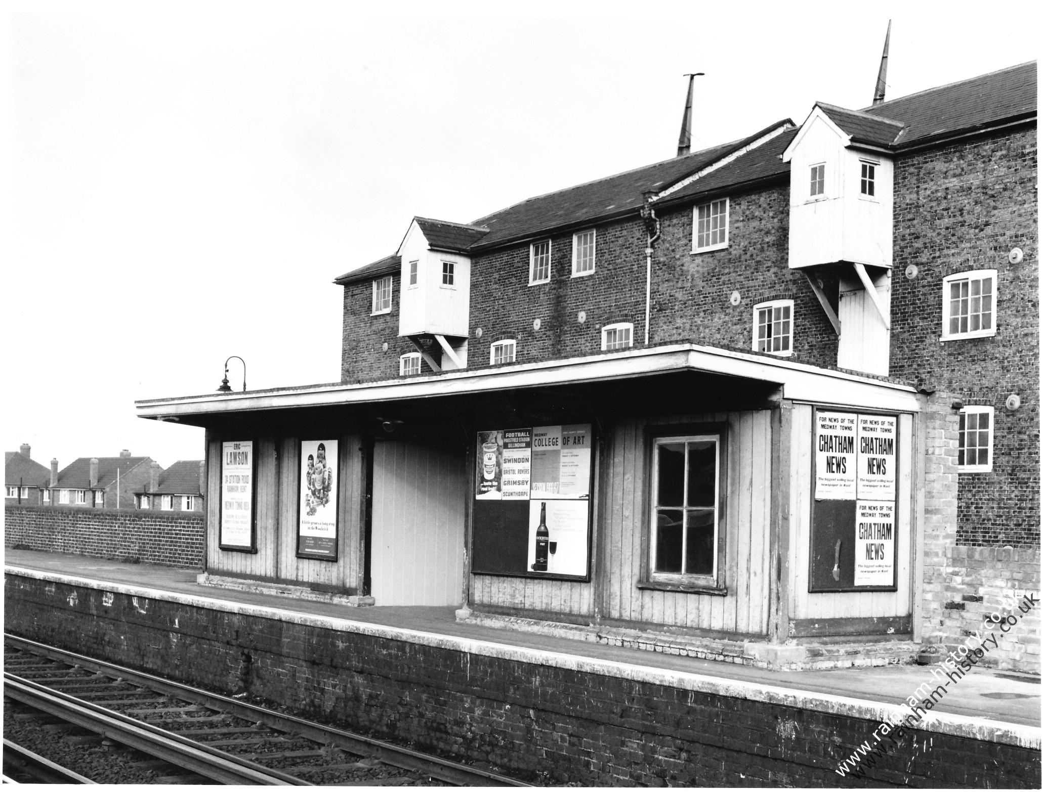
Photo 7
One of the most interesting pictures of the set shows the front of the main Rainham Station building with a Renault 4 car registration 8853 KO parked outside near a No Parking sign! The Renault 4 was only introduced in 1961 so the photo must be later than this. The station car park and cars from photo 4 are also visible in the background but this picture gives the wider picture and context of the buildings in relation to the station car park. There are various boards on the wall of the building with British Railways headings. One hoarding promotes Cut Price Off Peak Travel so much the same promotions as today!
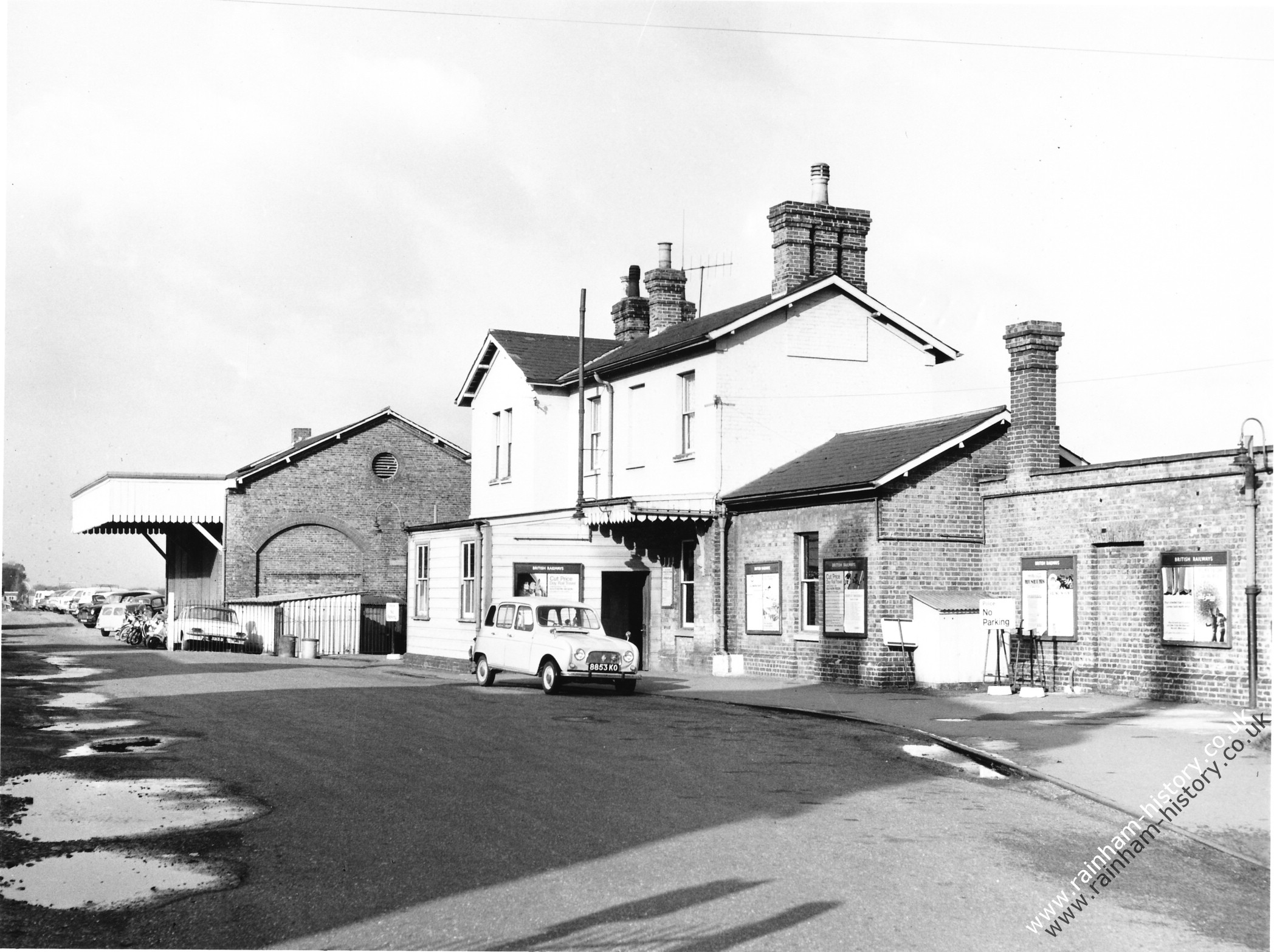
Photo 8
This shows a view of the Station buildings from the coastbound platform with the footbridge over the tracks and a passenger waiting on the platform. There is a poster for Chatham Reliance Building Society.
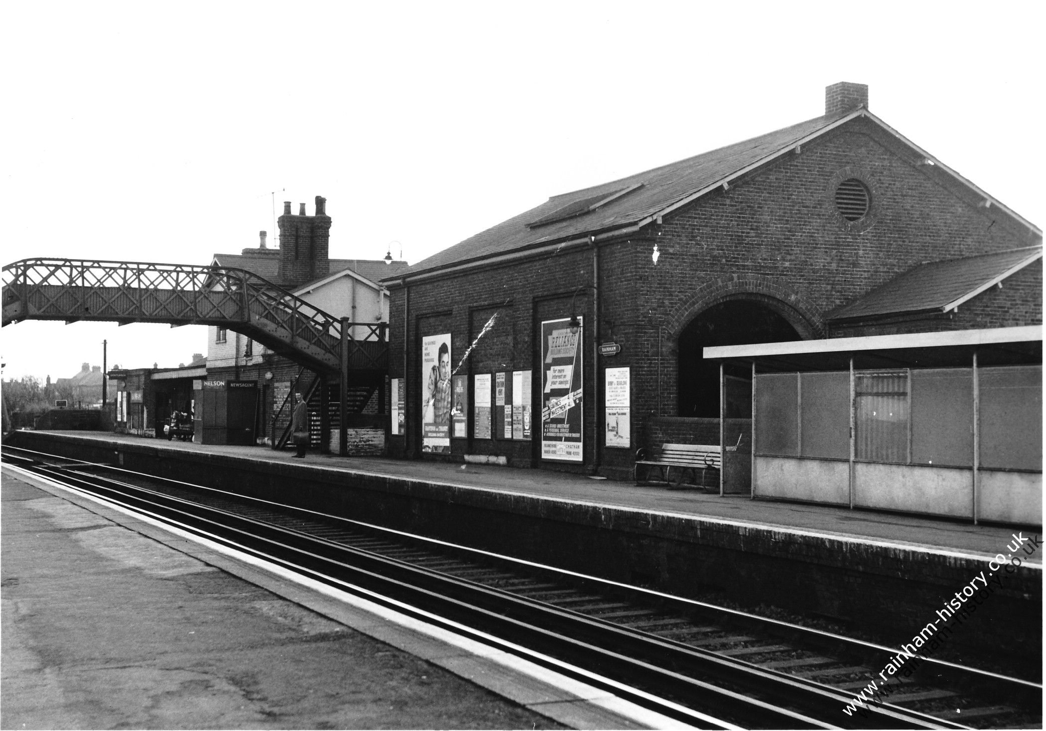
Photo 9
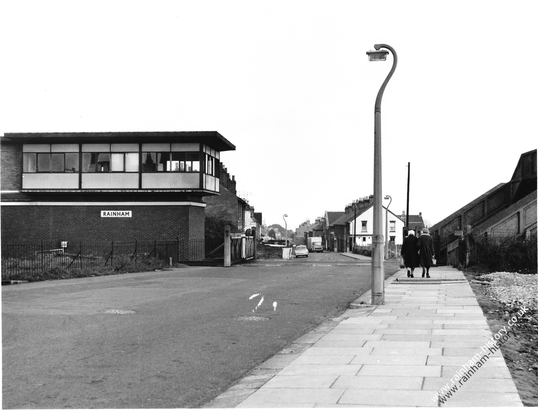
This shows a view looking down Station Road with the Rainham signal box on the left hand side of the picture. In the distance you can see a Ford Cortina and the allotments on the right hand side that became the new station car park in 1969.