Rainham Roads
Roads around the Rainham - old photos of how roads used to look in days gone by
Old Photos of Smallholders Club Springvale, Wigmore, Woodside/Springvale. Smallholders club was one of the first premises in Rainham to have a telephone and the telephone number for the Smallholders club in Wigmore is listed here.
The phone number was Rainham 41 Wigmore & District Smallholders Club Springvale although by 1924 this was already 16 years after the first phone directory for Rainham was published that had 17 telephone numbers listed for local businesses and houses.


2 Springvale, Gillingham Kent ME8 0JG 01634 263408
-
Photos
-
Rainham Roads
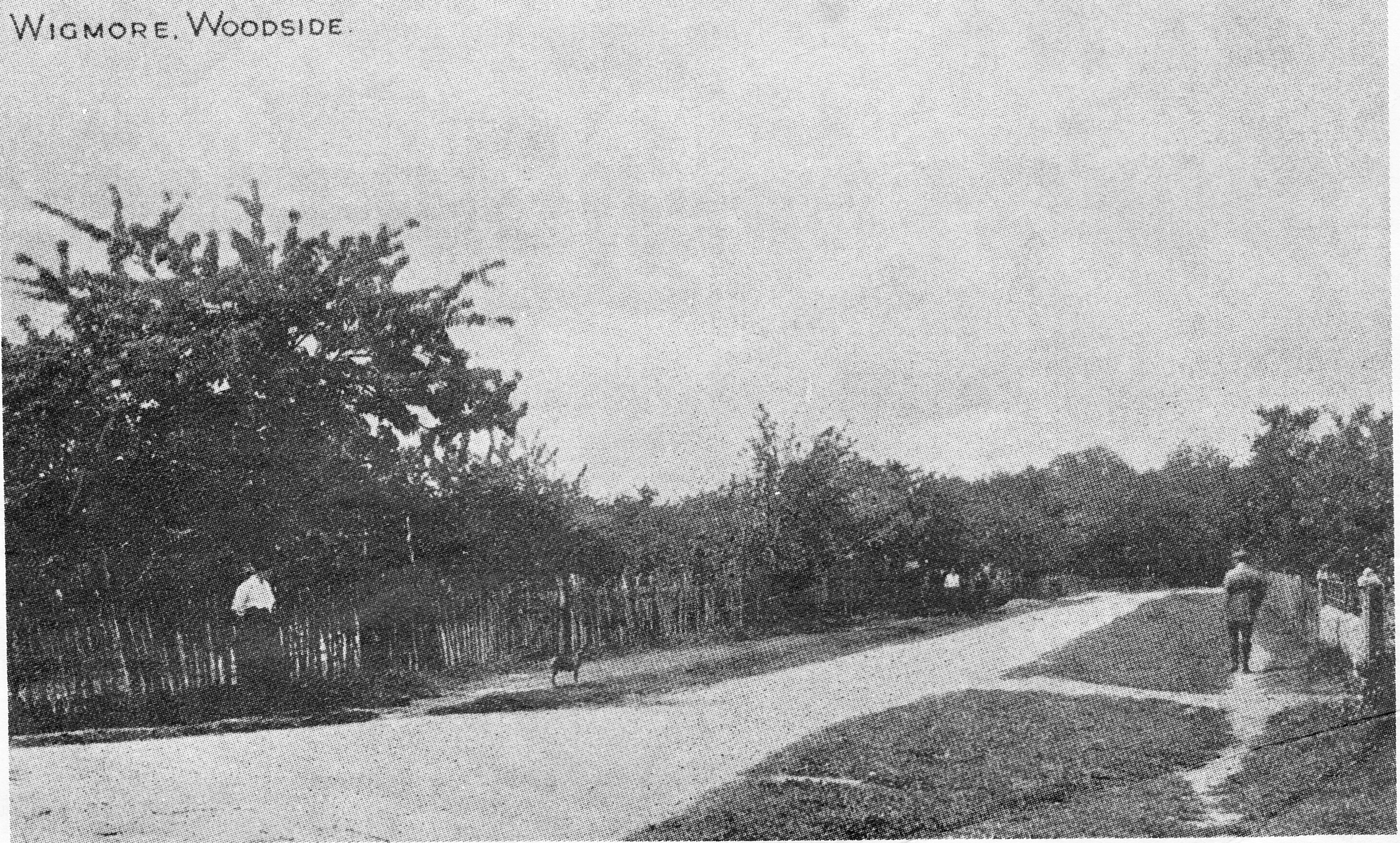
Old Photos of Woodside originally known as Woodside Road, Wigmore, Gillingham Kent in 1916
Old Photos of Woodside Wigmore in 1974
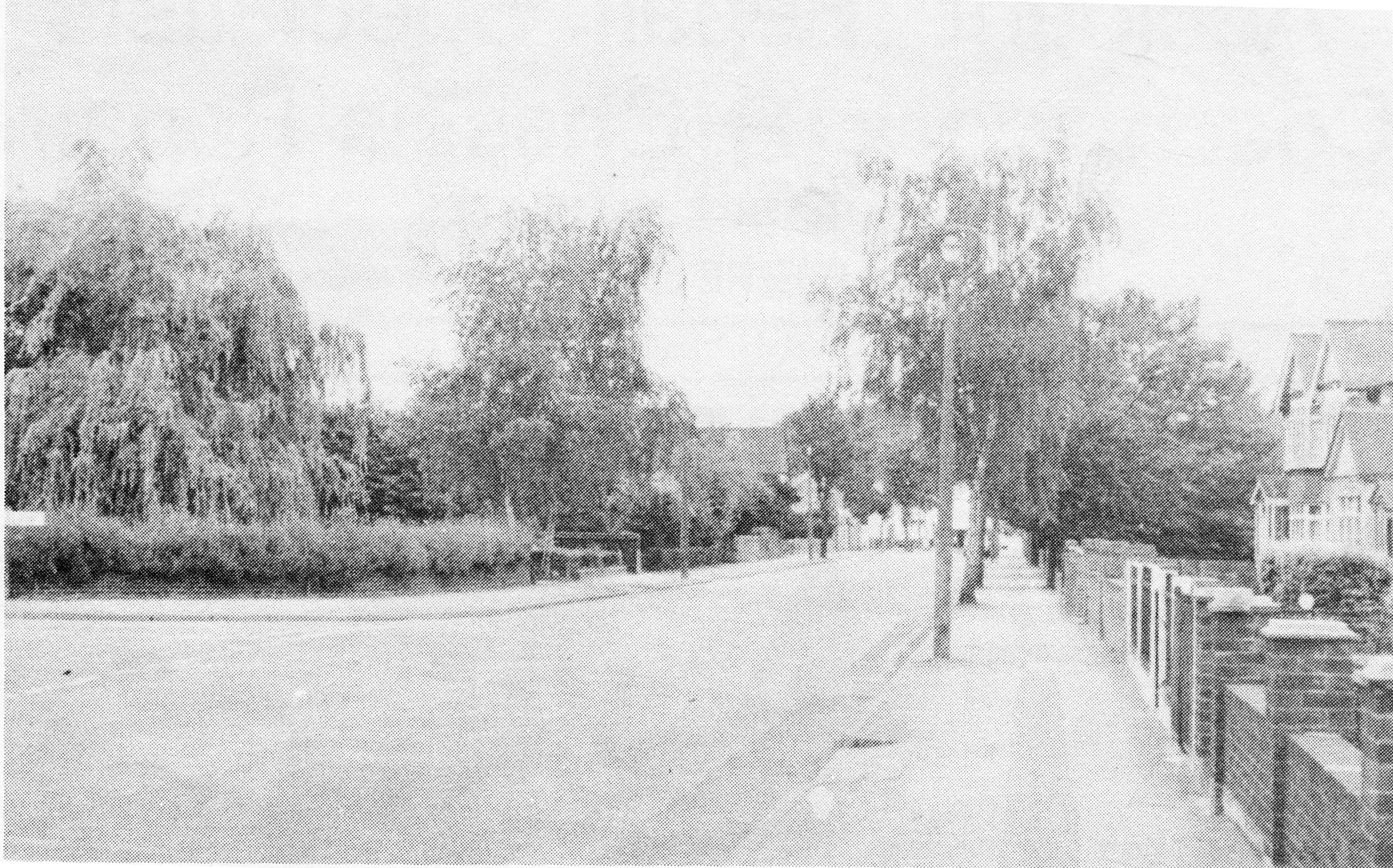
Old Photos of Woodside Wigmore in 2001

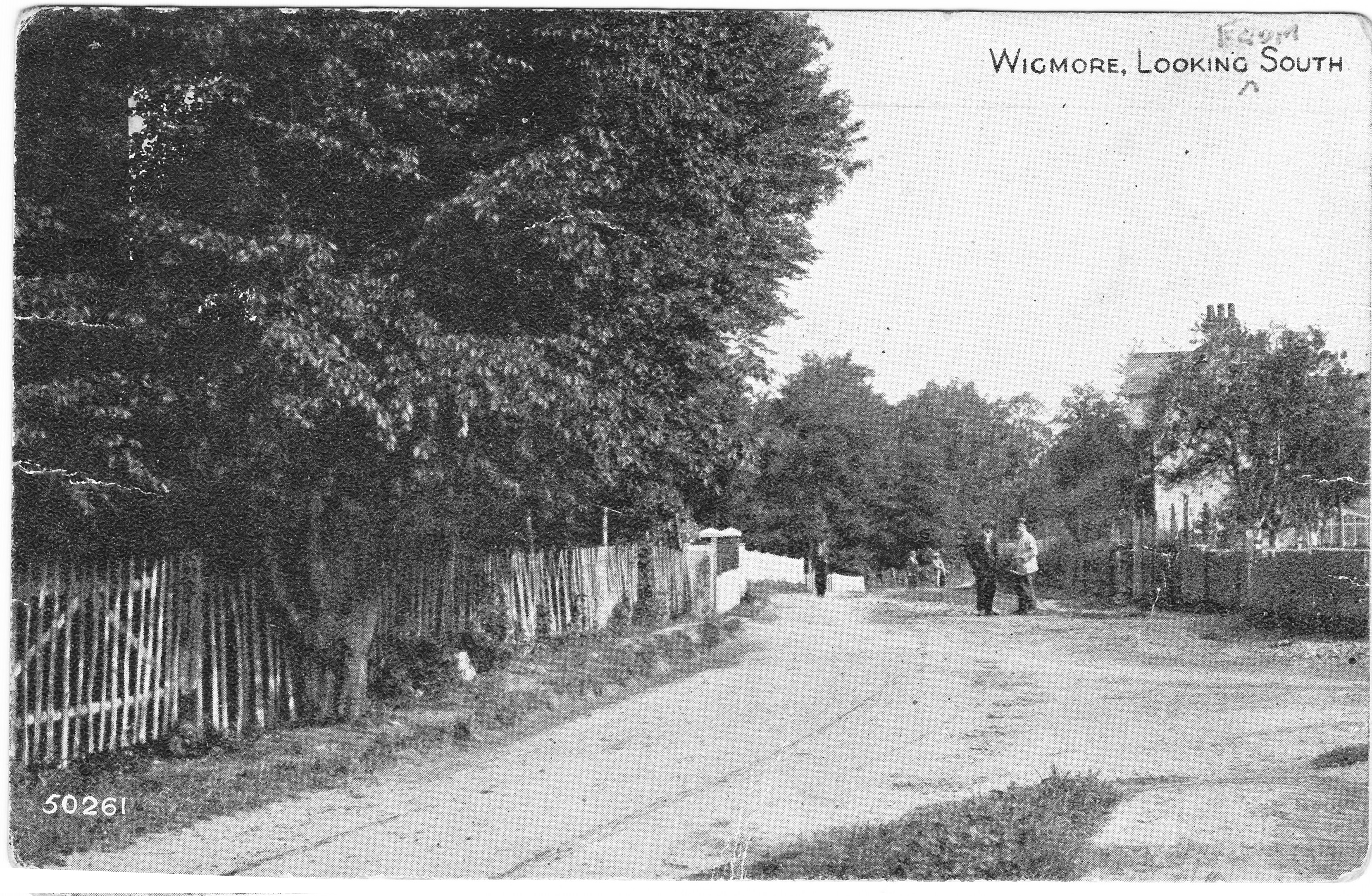
Woodside Hoath Lane junction approx 1920
Woodside junction with Hoath Lane in 2003

-
Photos
-
Rainham Roads
These are Old Photos of London Road Rainham Mark Kent taken in the last century along with some more recent photos showing latest changes along the A2 at Rainham Mark. The Co-op was replaced by Town and Country Cars which is now Hidsons. The Belisha Beacon became the Hop and Vine pub which is now Dominos Pizza.

Old Photos of London Road Rainham Mark Kent approx 1930. Sngn on building says "Esi-Run Villas Show home open £395"

Old Photos of London Road Rainham Mark Kent 2003 showing Hop & Vine pub and Town & Country car dealers

Old Photos of London Road Rainham Mark Kent 2003 showing Hop & Vine pub and Texaco garage
-
Photos
-
Rainham Roads
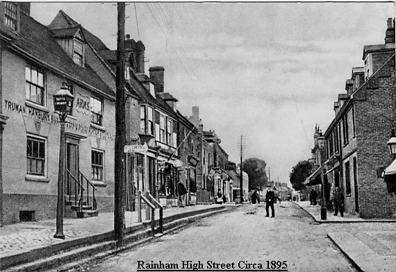
High Street Rainham around 1895 with pub Waterman's Arms on left hand side (Truman Hanbury)
Rainham High Street c 1910
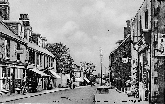
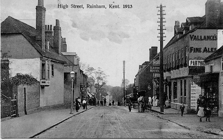
Photo of Rainham High Street around 1913 showing Lion Hotel (now Green Lion pub) on right hand side
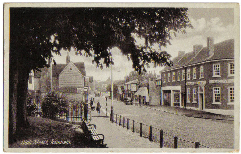
Old Photo of High Street Rainham Kent in 1950 showing Barclays Bank on corner of Station Road and prior to Rainham's Coronation Clock being installed
Same location on High Street Rainham Kent but taken in the snow of 1987

-
Photos
-
Rainham Roads
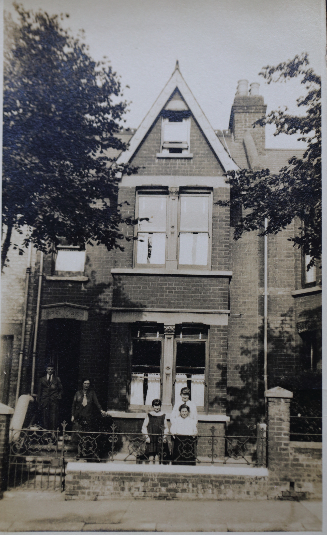
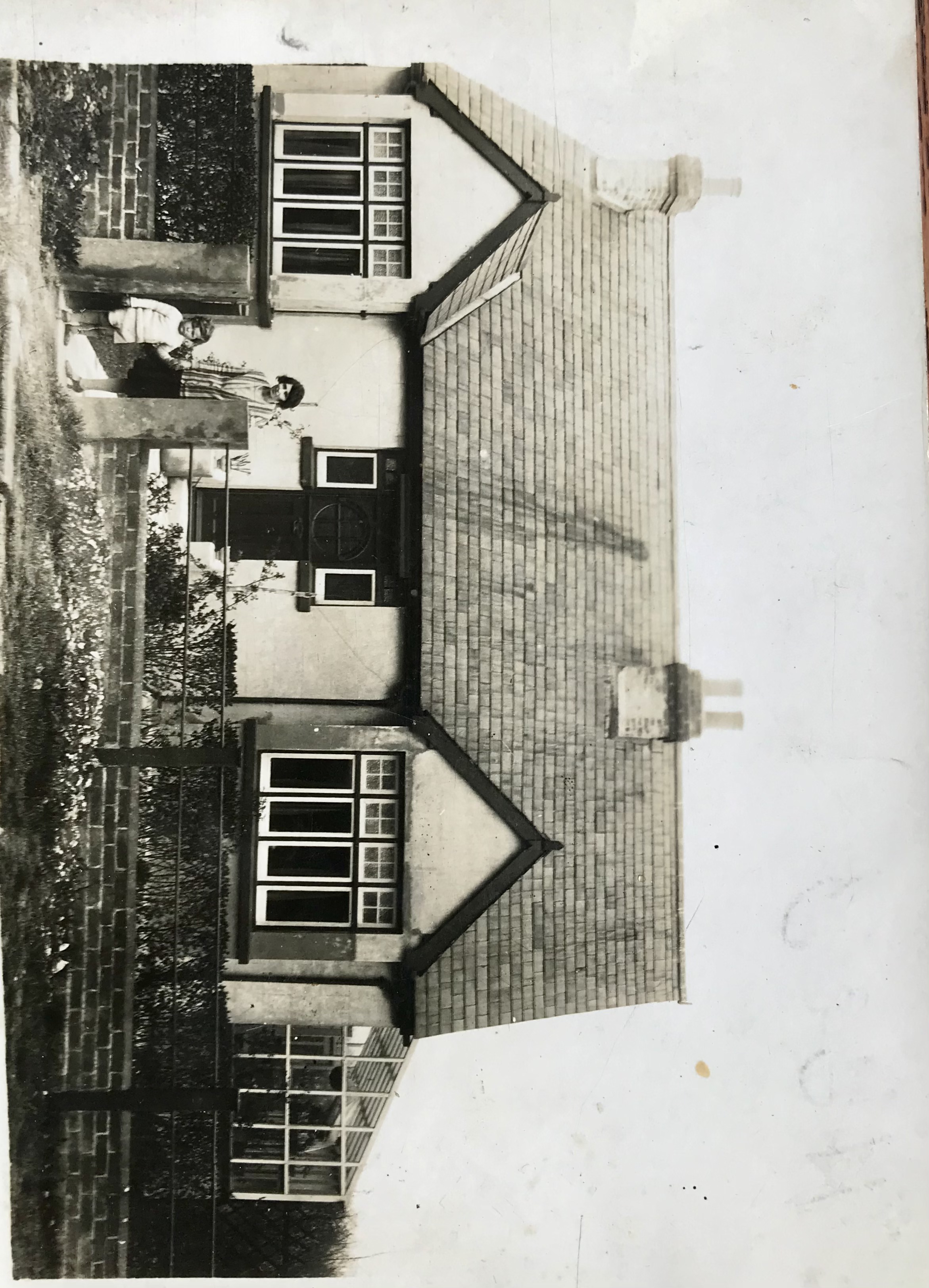
These old photos of 87 Marshall Road Rainham Kent were taken around 1928 and 1932. The huge pile of flints has decreased a bit between the photos. One of the interesting things in the deeds for our house is a covenant that prevents us from selling flints from the house. I wonder if it was a common issue with building at that time and the ground having so many flints in it.
You can read about the history of the Rainham Mark Building estate - Edwin Road & Marshall Road here
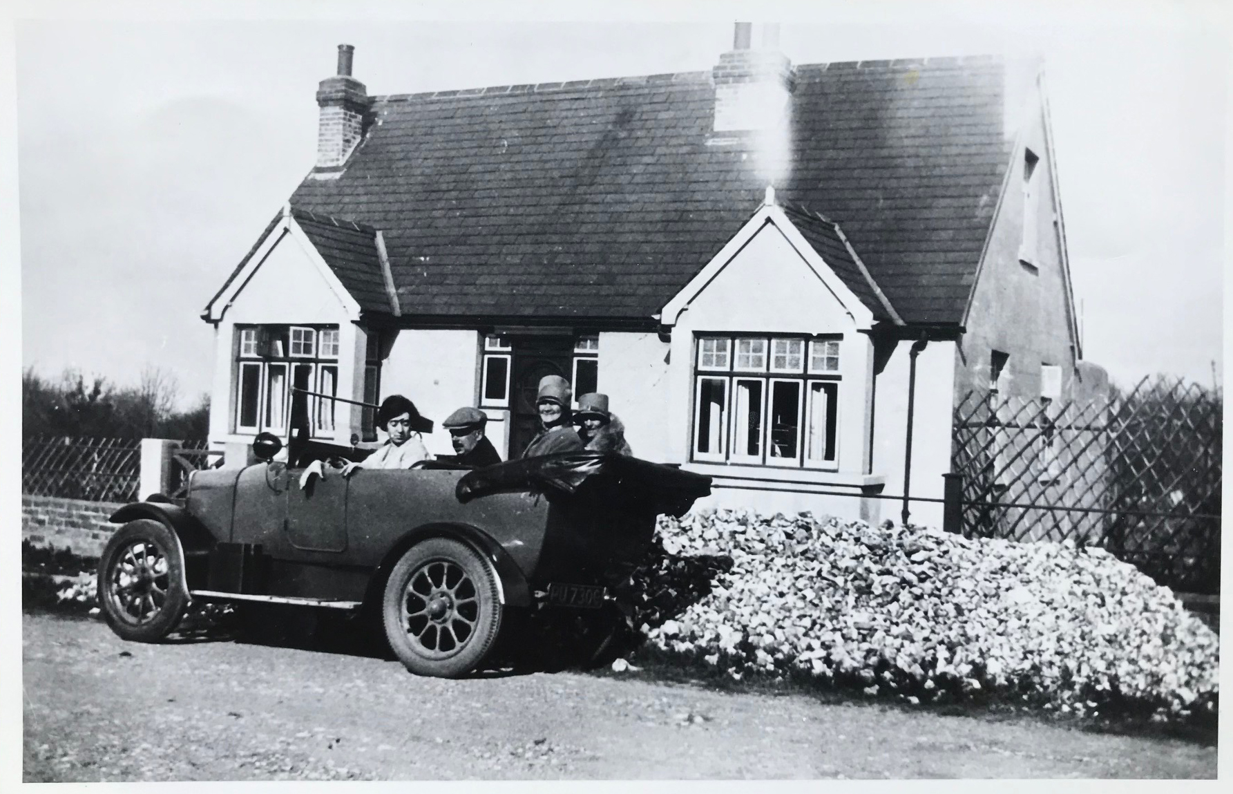
Above, 87 Marshall Road in 1928
Above, Marshall Road in 1932. You can see a conservatory has been added at this point and the fascia boards have been painted black but the paint on the walls is looking somewhat tired.
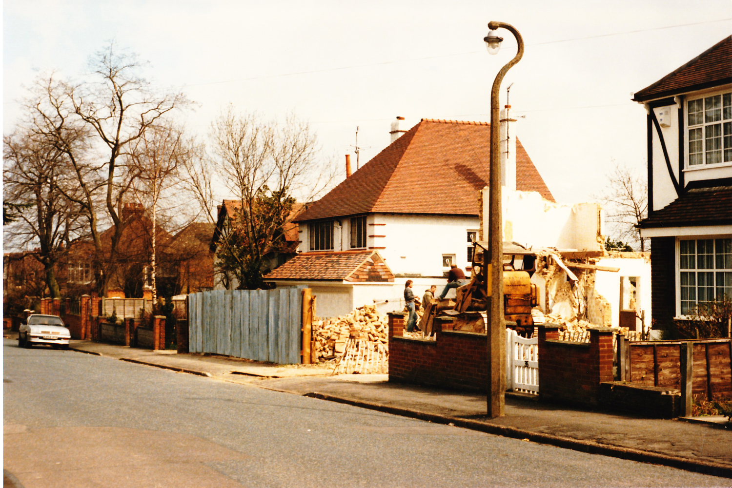
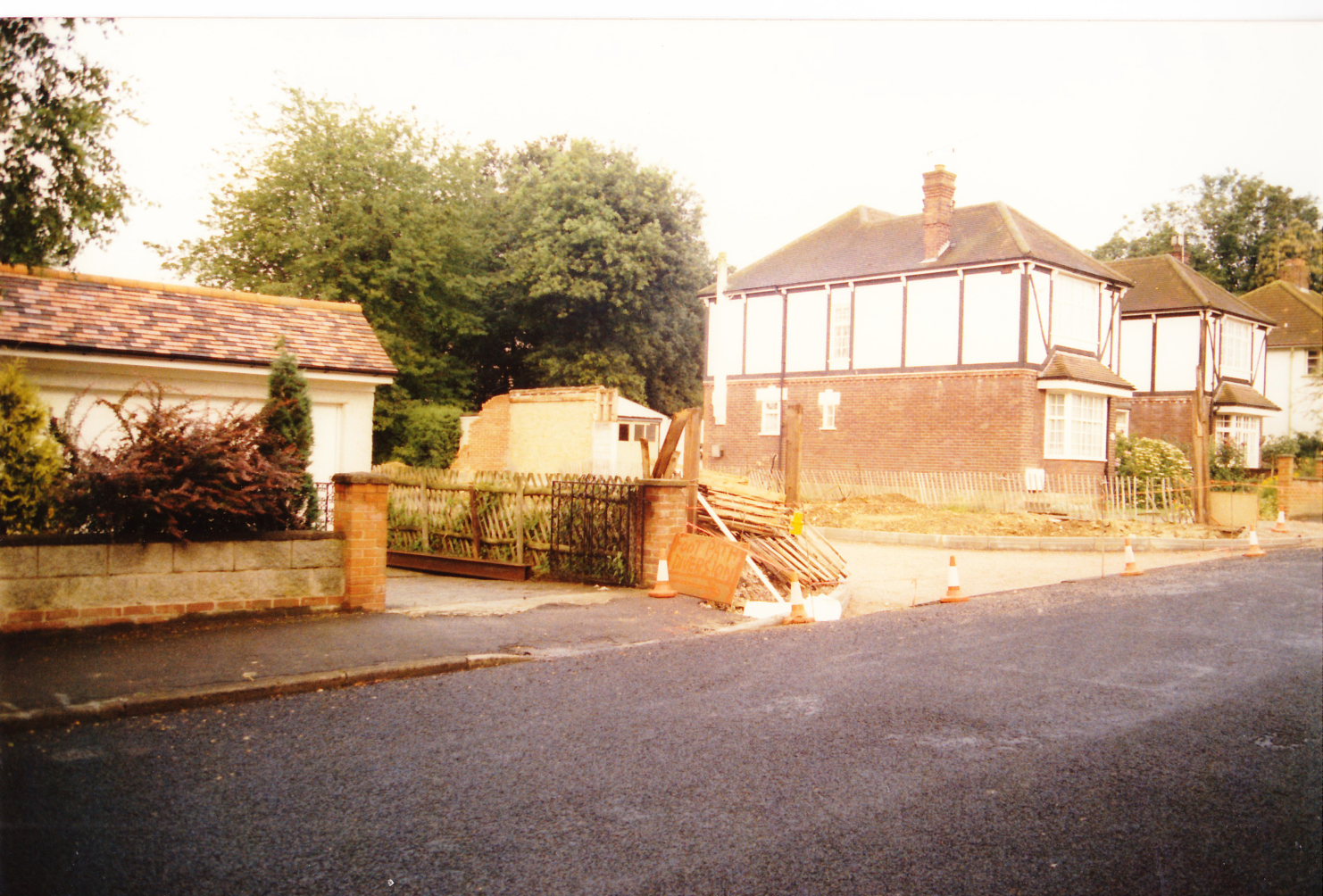
The photos below were taken in the late 1980s when the house at 33 Marshall Road was demolished to construct the Charlotte Drive estate
-
Photos
-
Rainham Roads
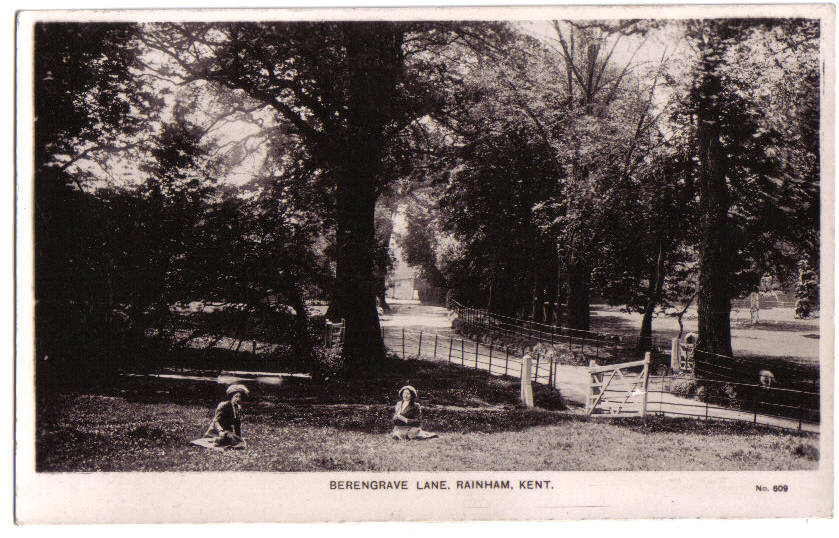
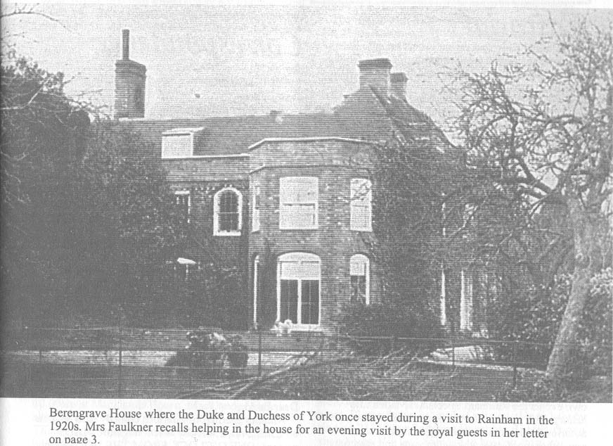
These are various old Photos of Berengrave Lane Rainham Kent taken at different points over the last 100 years


Berengrave/Berengrove House prior to demolition
-
Photos
-
Rainham Roads
Old Photos of Bredhurst Road Wigmore Gillingham Kent. This photo was taken in approx 1920

Photo taken at approximately the same spot in 2003

-
Photos
-
Rainham Roads
Pictures of historic hempstead kent. This photo is of Hempstead Hill looking towards the site of the old smallpox isolation hospital situated off Hoath Lane Wigmore. This photo was taken prior to the building of the A278 Link road to join the A2 to the M2 at junction 4 and appears to show that the road splits at the bottom of Hempstead Hill near Spekes Road and goes in the direction of Hoath Lane and Woodside as well as towards Darland Banks/Gillingham.
The road now only goes to the left towards Darland Banks and the right hand fork is a tunnel under the A278 Hoath Way nicknamed the Love Tunnel.
The buildings above the junction are the Smallpox Isolation hospital, named in the photo as Wigmore Hospital.


Hempstead Valley shopping centre shortly after construction in 1978
-
Photos
-
Rainham Roads
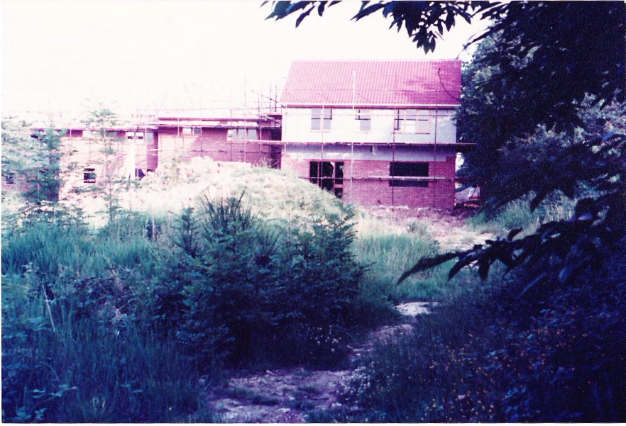
The estate comprising of The Goldings and The Platters off Marshall Road was built from around 1979. These are some photos taken of the construction of the Goldings/Platters Farm estate from Marshall Road in 1980. During the building work several Dene holes were discovered which delayed the construction to excavate and then to fill the holes for houses to safely be built.
View Larger Map
-
Photos
-
Rainham Roads