Jas has kindly sent in this edited image of the Oast Community Centre in Rainham combining a current photo with one showing the hops being loaded from approx 1930s


Photos
Jas has kindly sent in this edited image of the Oast Community Centre in Rainham combining a current photo with one showing the hops being loaded from approx 1930s
I've been experimenting with showing old and new photos together with a slider to compare them. Unfortunately I've had to create a separate webpage to host the Time Machine in order to get the coding to work
Click here to view the Rainham Time Machine

This one of Hoath Way in around 1930
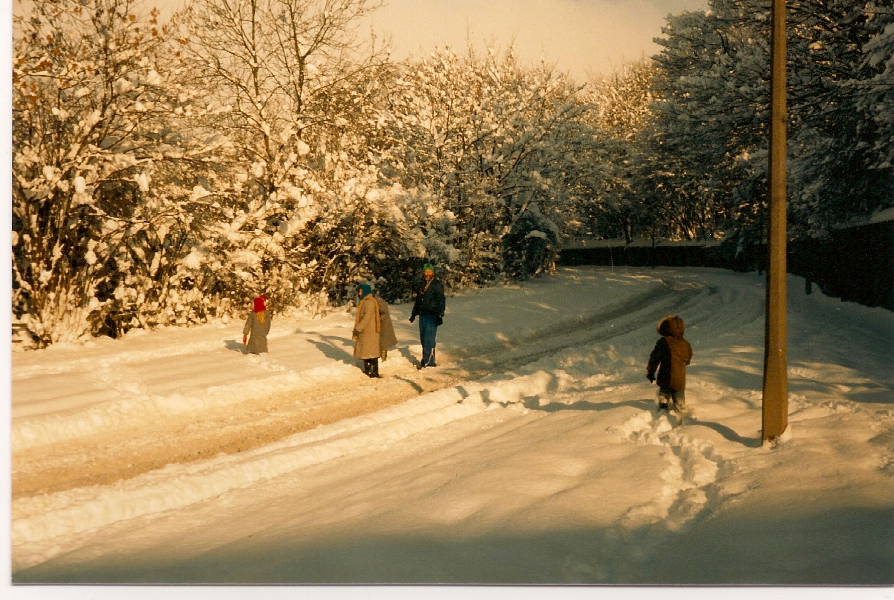
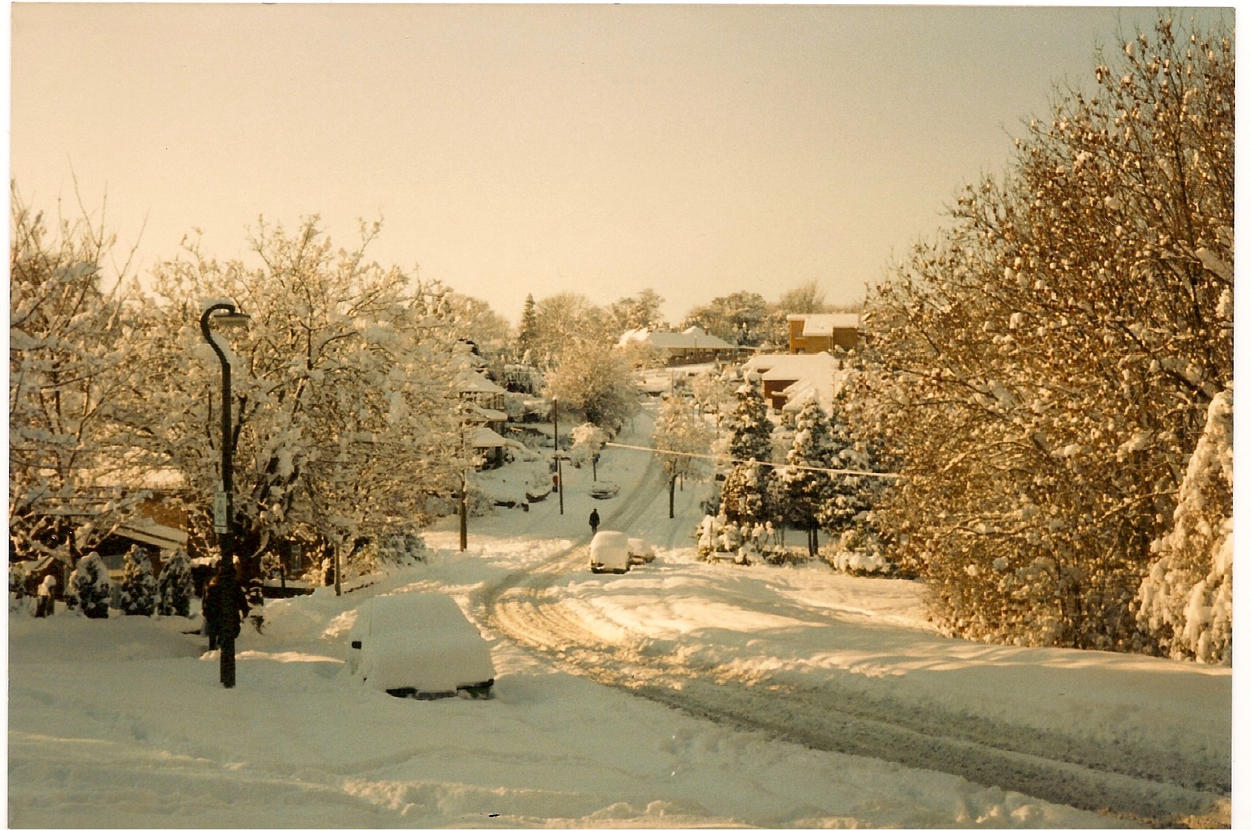
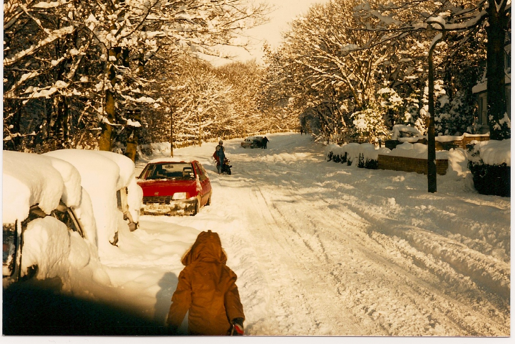
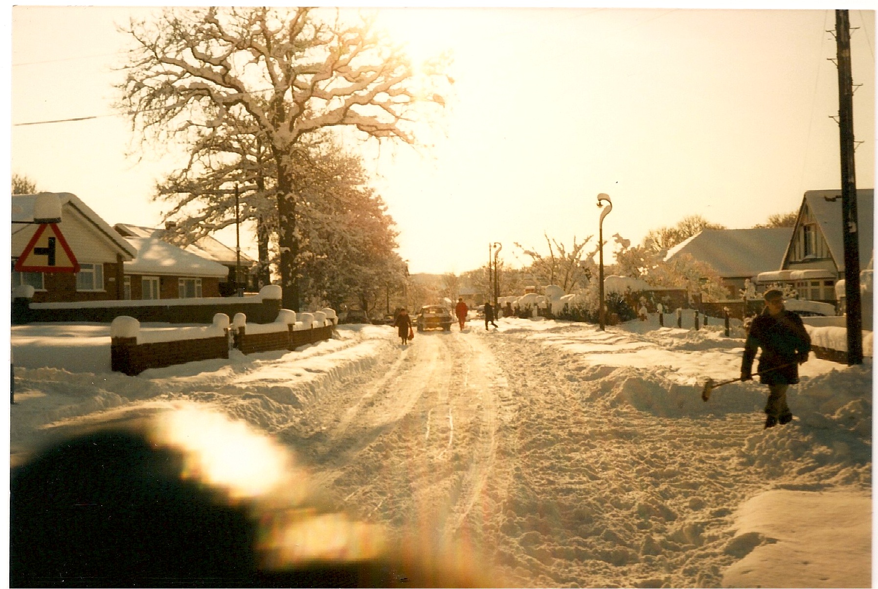
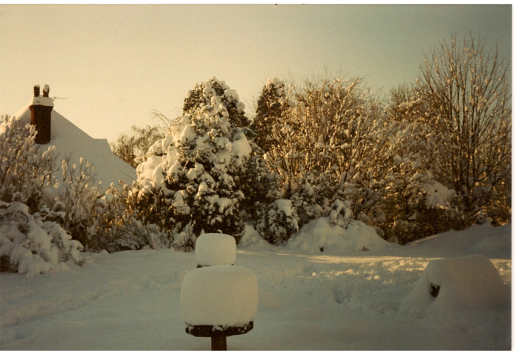
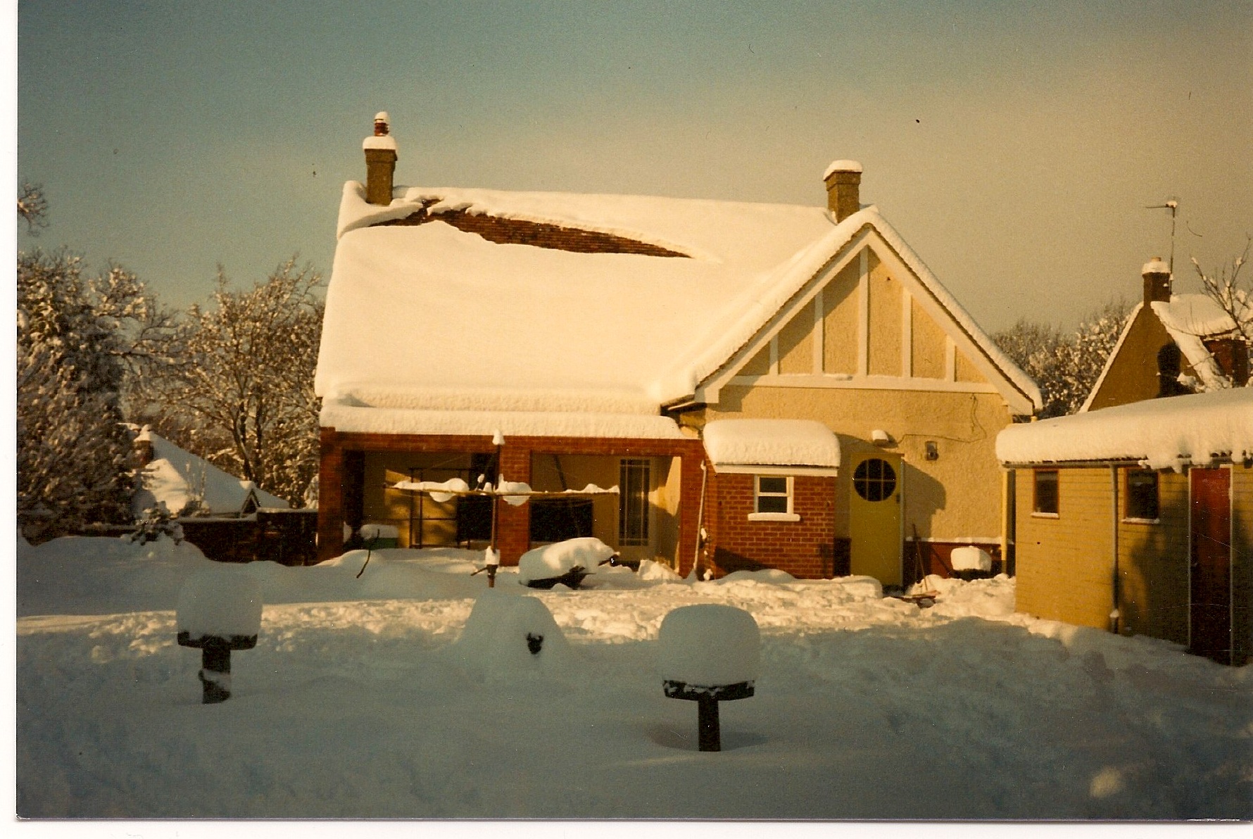
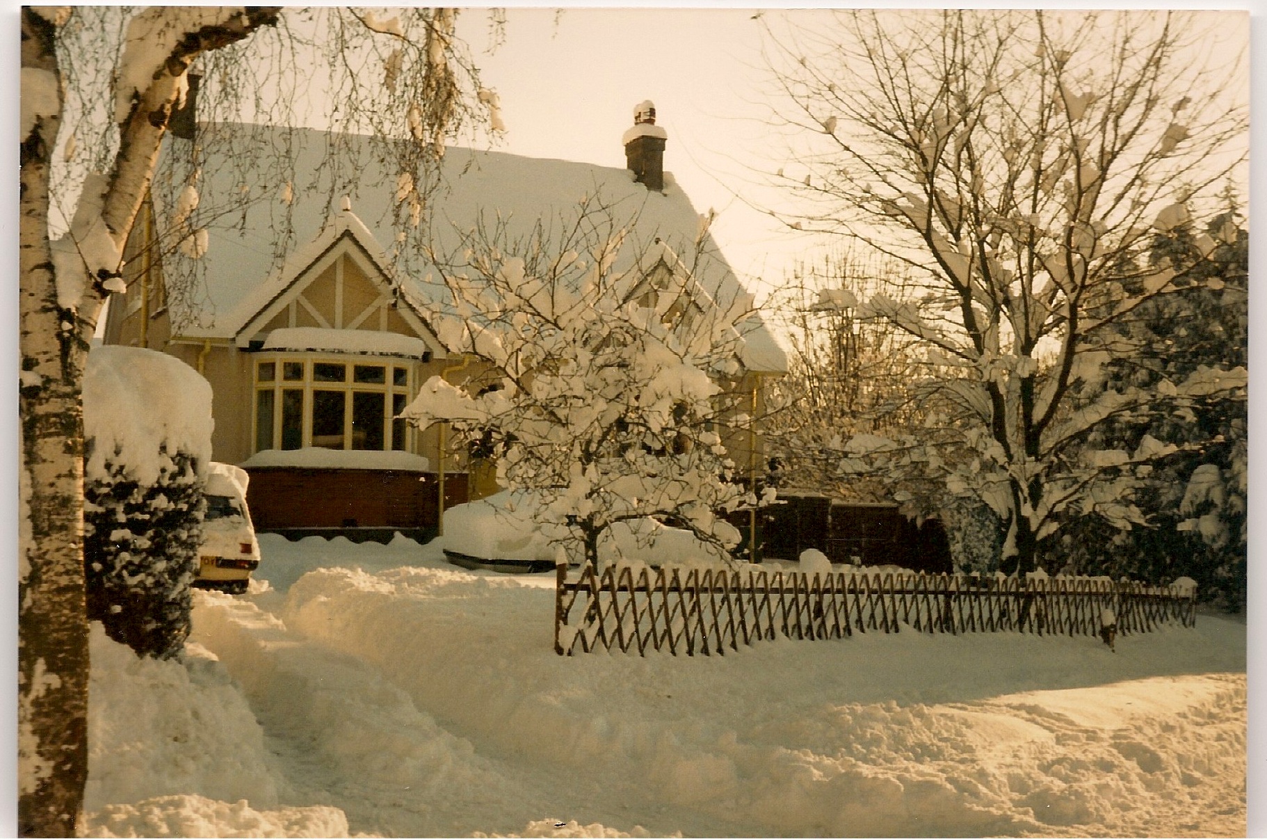
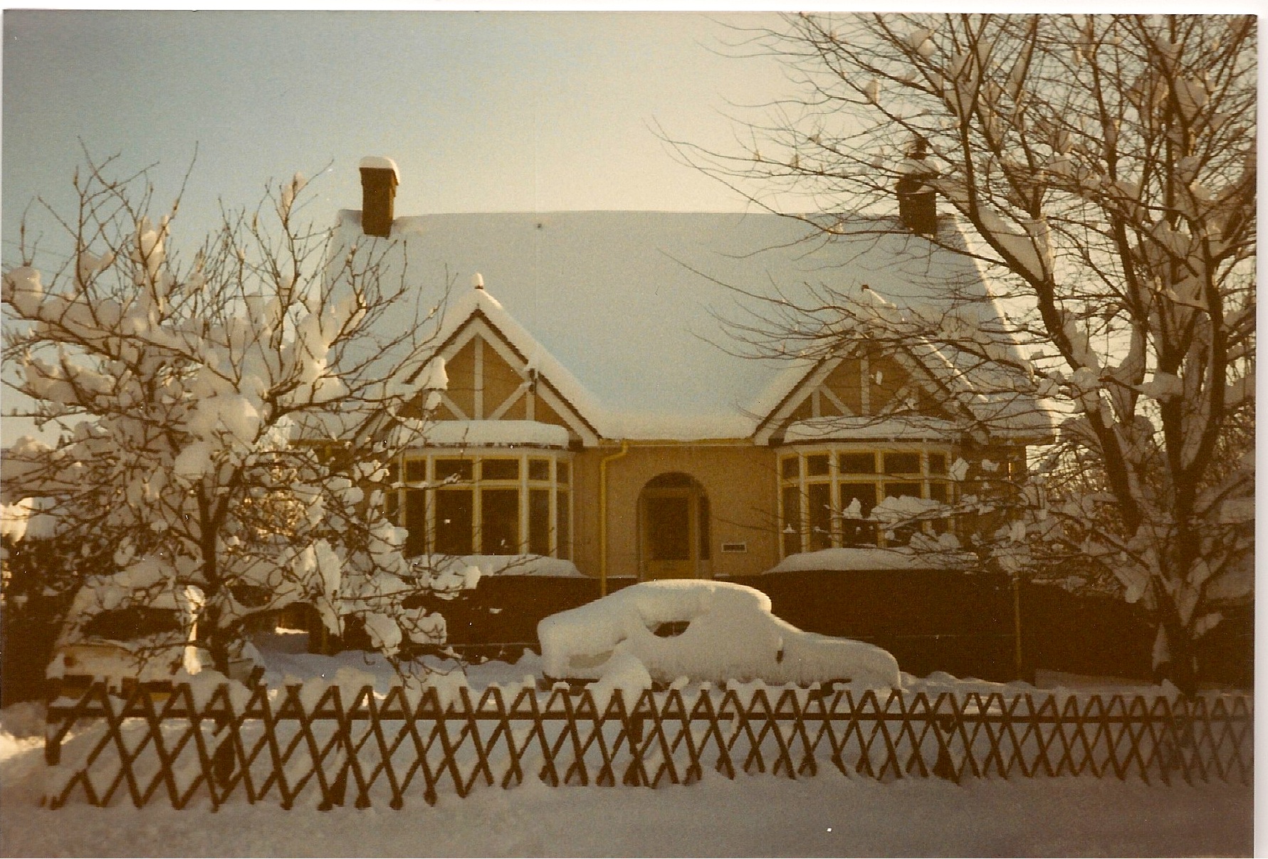
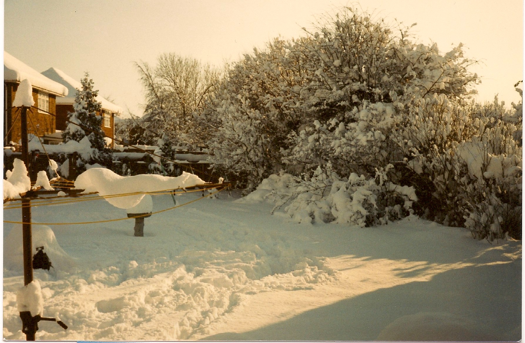
The photos kindly sent in show the serious quantity of snow that fell in January 1987. You can see how deep the snow is on the roads and how they are totally impassable. The whole of Medway as well as the wider Kent area were majorly affected by the snow and the amount of snow cut off various areas enough to warrant army food drops in some places.
I remember when trying to clear the snow from paths and the road was the problem of where to put it. There had been so much snow fall in a short time that if you cleared the paths you had to block part of the road and if you cleared the road the paths ended up getting blocked.
I can also recall driving from Bredhurst to Boxley after the snow had been cleared and being amazed how high the snow was at the sides of the road where the snow ploughs had cleared the way through. The snow was so high & deep that there was still snow melting months later at the top of Boxley Hill.
Thanks to Tony Gutteridge for these fantastic pictures
1) Looking up Hempstead Hill towards Gillingham Business park (tunnel would be to the right hand side of the photo)
2) Looking down Hempstead Hill towards Hempstead. Spekes Road to the left in the dip
3) Hoath Lane looking north towards Courtney Road
4) Hoath Lane looking South towards Woodside and Wigmore Road
5) Snow at 27 Wigmore Road in 1987
6) Snow at 27 Wigmore Road in 1987
7) Snow at 27 Wigmore Road in 1987
8) Snow at 27 Wigmore Road in 1987

9) Snow at 27 Wigmore Road in 1987
10) Snow at 27 Wigmore Road in 1987
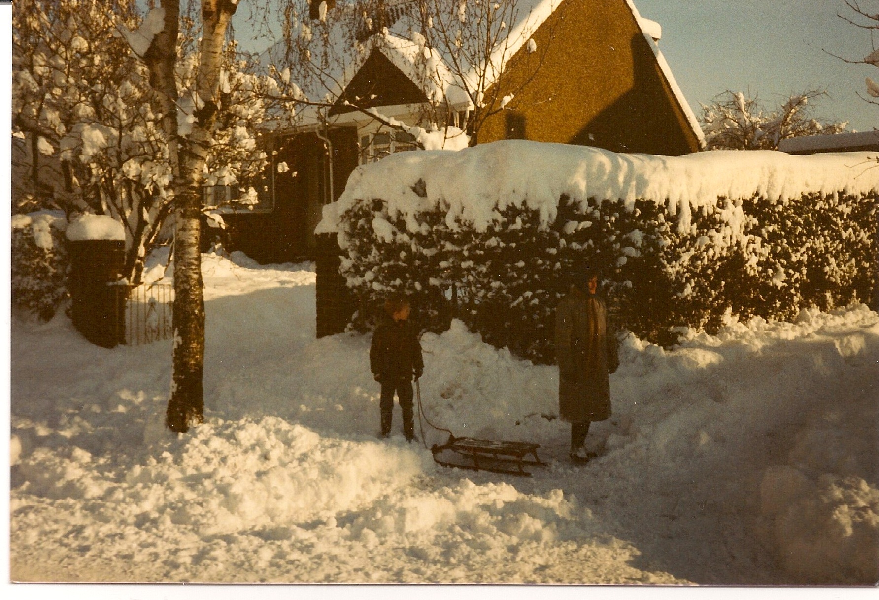
11) Slightly lighter snow at 27 Wigmore Road in 1987
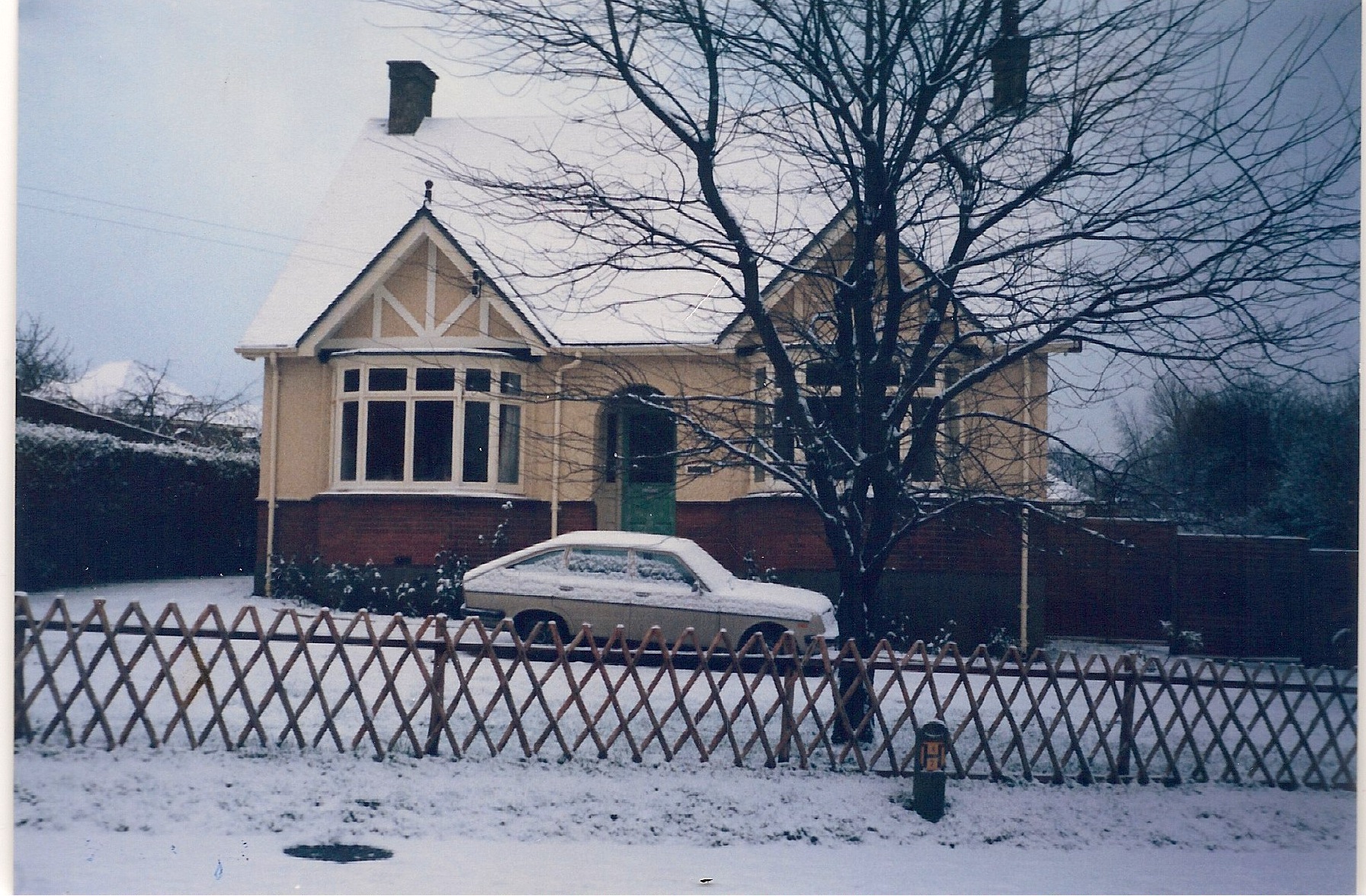
12) Snow at 27 Wigmore Road in 1987
13) Snow in the garden of 27 Wigmore Road in 1987
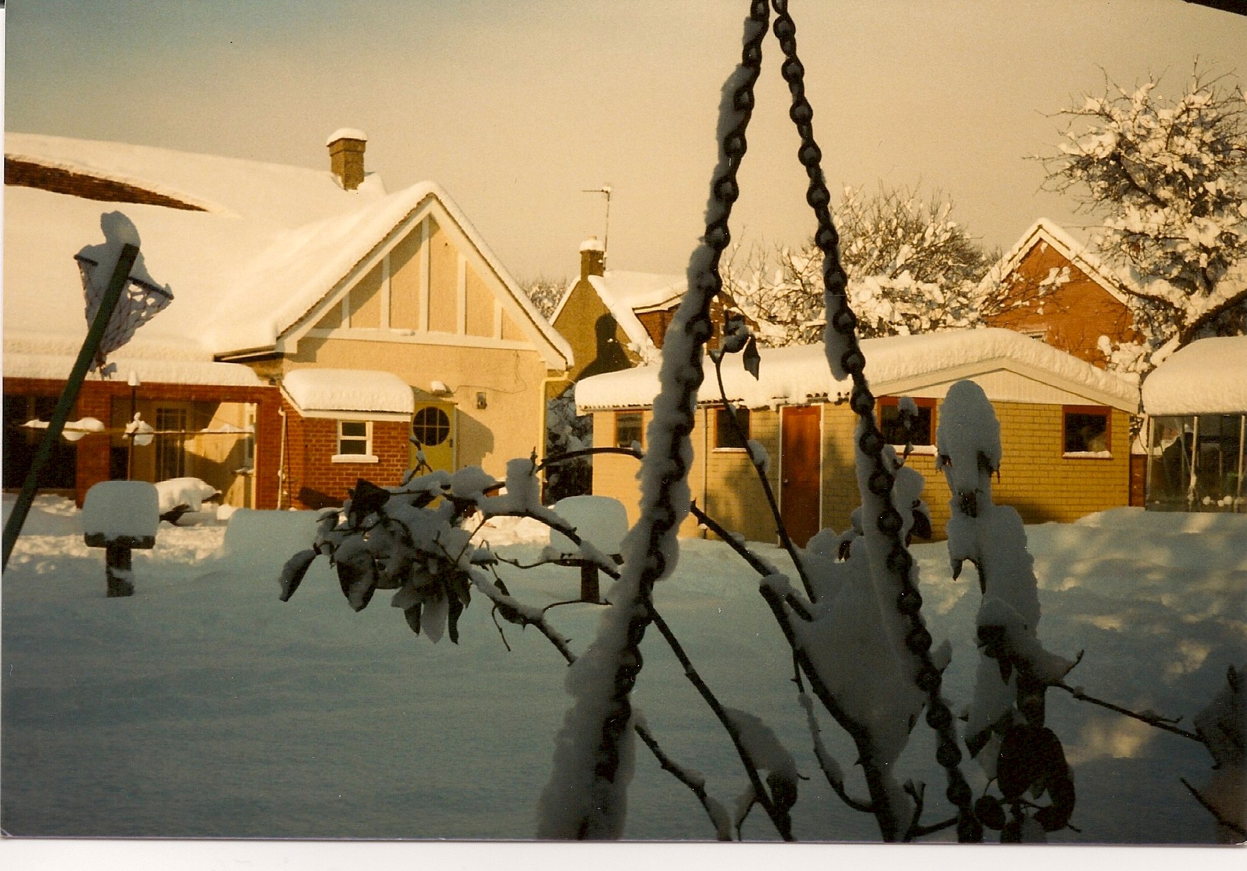
14) Snow in the garden of 27 Wigmore Road in 1987
This photo is of the Rainham Rangerettes performing at Gillingham Carnival in the 1970s. Do you recognise anyone or know the date it was taken?
The car being driven with the music system on seems to be an Austin Maxi registration AKE934K

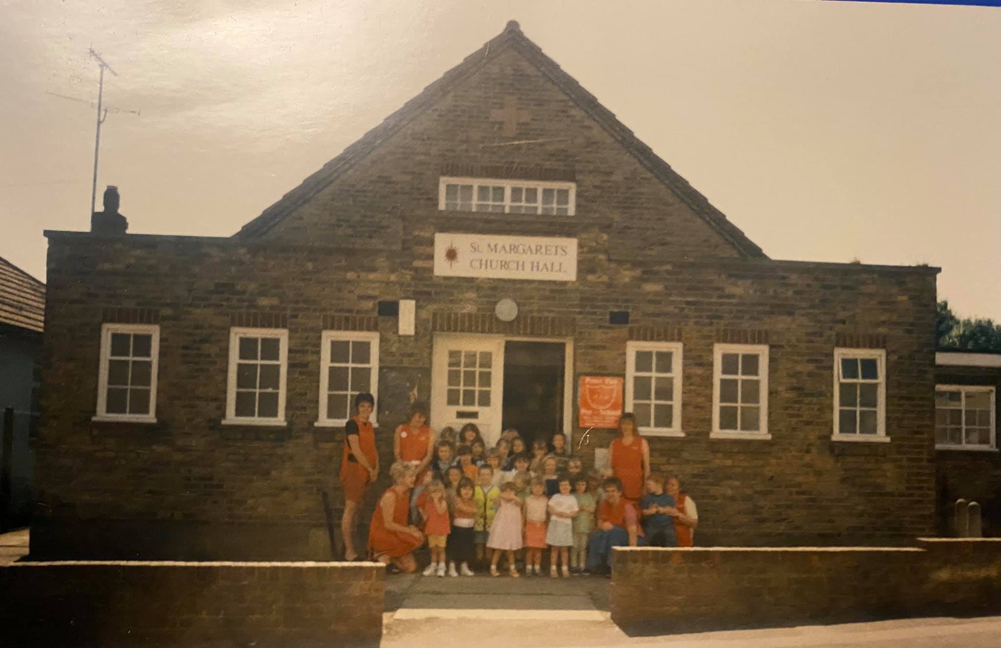
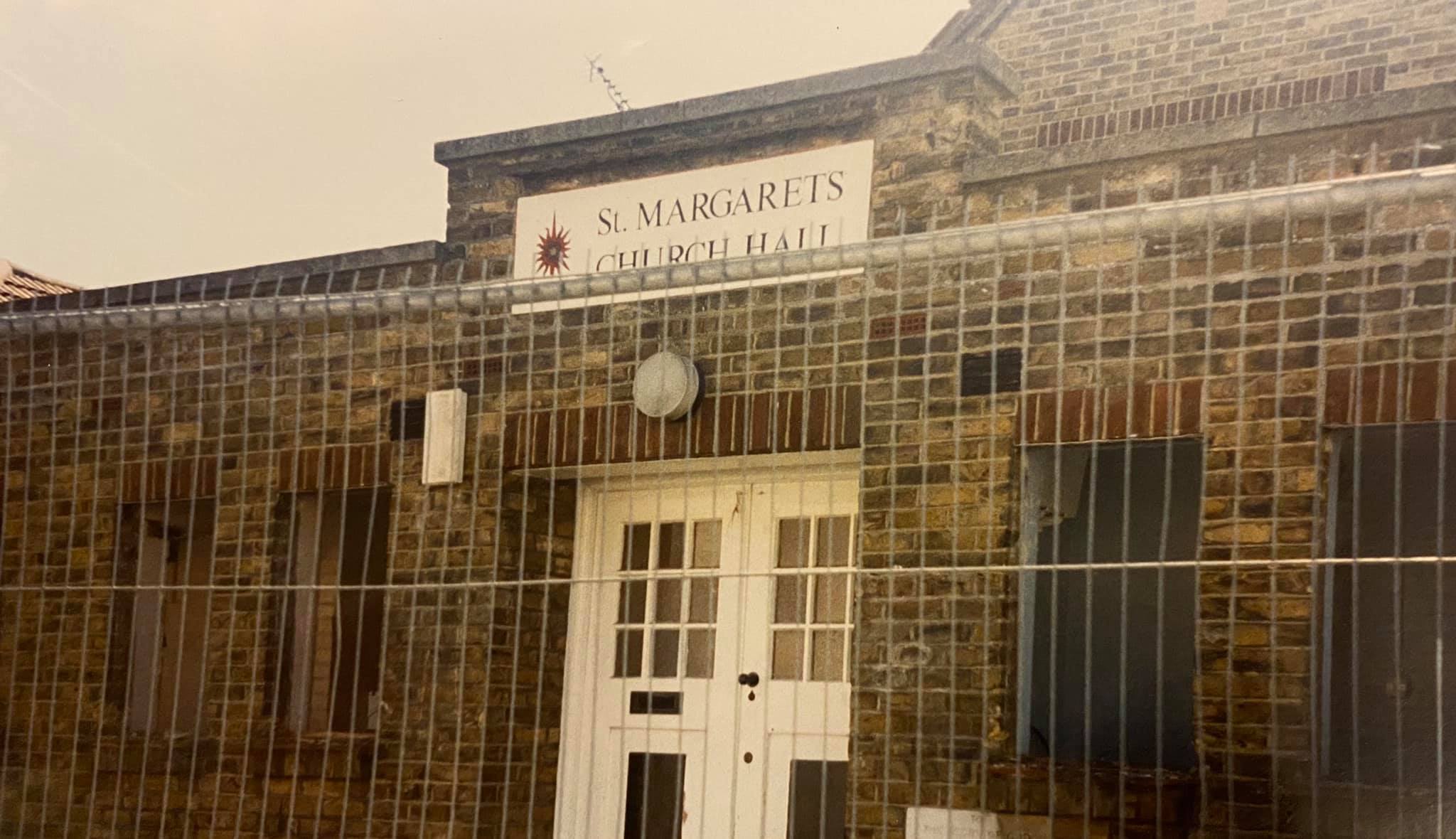
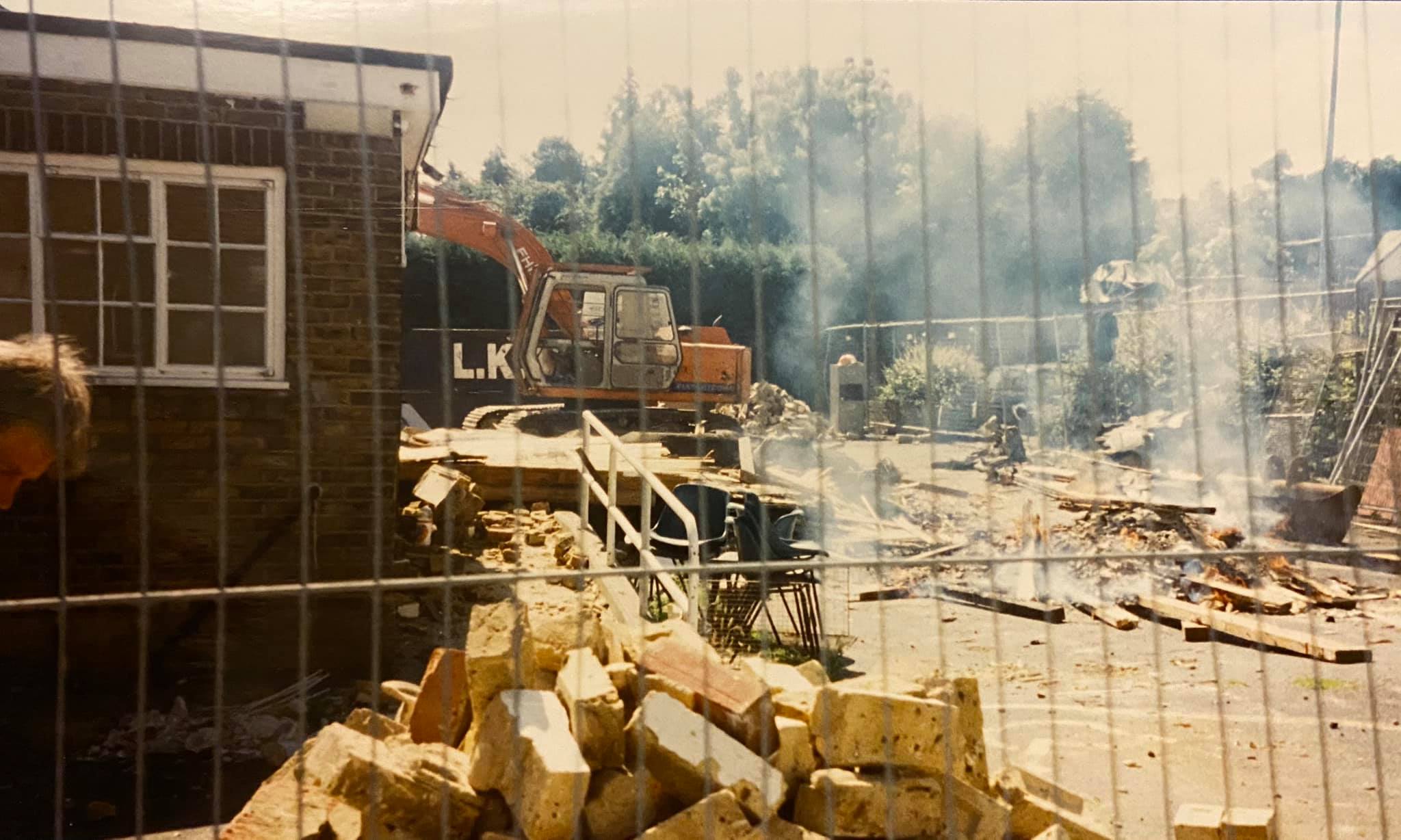
St Margarets Church Hall was built on Orchard Street Rainham and opened in 1937. By the late 1990s the hall had become outdated and it was decided that a replacement could be built nearer the church on land that was freed up by the cancellation of the Rainham Bypass project
Construction of the new Millennium centre began in the late 1990s for opening in the millennium celebrations and the old church hall in Orchard Street was demolished to make way for new flats in 2001.
These photos were taken by Virginia Smith, proprietor and manager of the Peter Pan preschool.
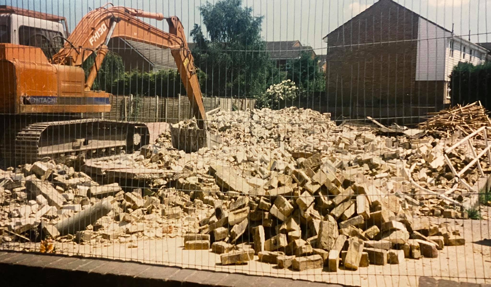
Former Church Hall site, now flats on Hurst Close/Orchard Street

There used to be various premises where the local Co-operative society traded from around Rainham - some were supermarkets and some were department stores. Now only the small convenience stores are left but generally these are not in the same locations as the historic sites where they used to be.
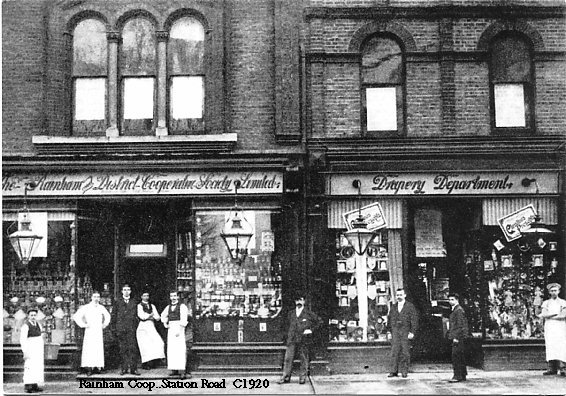
Some of the local sites I can remember:
The Rainham Coop Store stood opposite St Margaret's Church next to the White Horse pub and sold items such as clothing, shoes and homeware. It was demolished in 1997 and the site left vacant for some time before the NHS Rainham Healthy Living Centre was built. The store had an upstairs/upper floor called Rainham Co-operative Hall that was used by various groups for meetings and social events like dances.
Sandra Perkins has been in touch and said "My Mothers parents and my Grandparents, Royston & Ethel Black were Old Time Dance teachers at the Co-op. Upstairs in the hall was one of many places they taught, they lived in Rainham most of their married lives until their deaths"
These photos of the demolition in November 1997 were kindly provided by Peter Manning
The scene in 2001 following the demolition looking towards the church & White Horse pub.
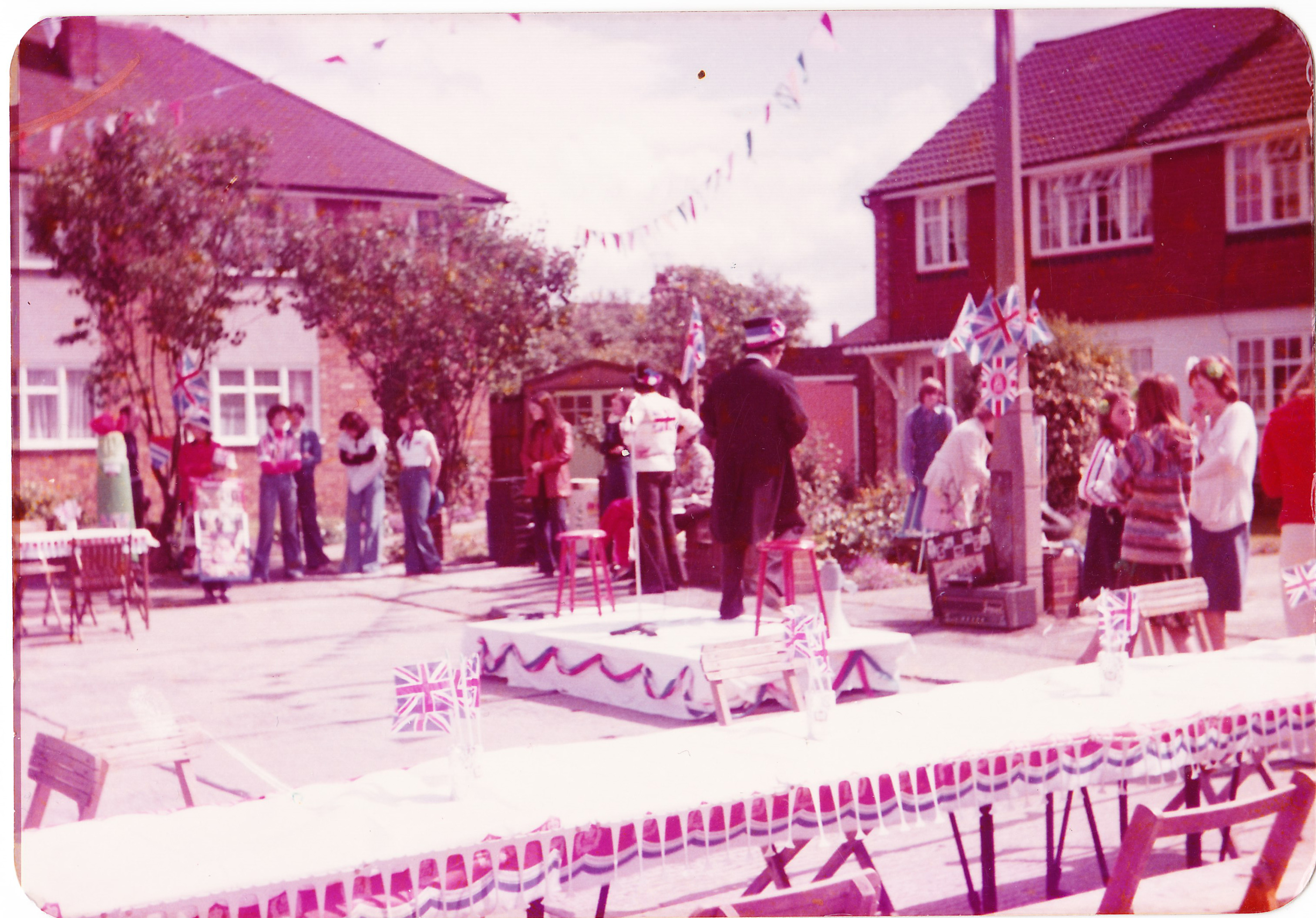
The Queen's Silver Jubilee in 1977 was an event that had celebrations across the country and Rainham was no exception. These photos were taken in Roystons Close of the party and Chalky Bank Road (of the bunting), Rainham in June 1977. Photos thanks to Eddy Newport.
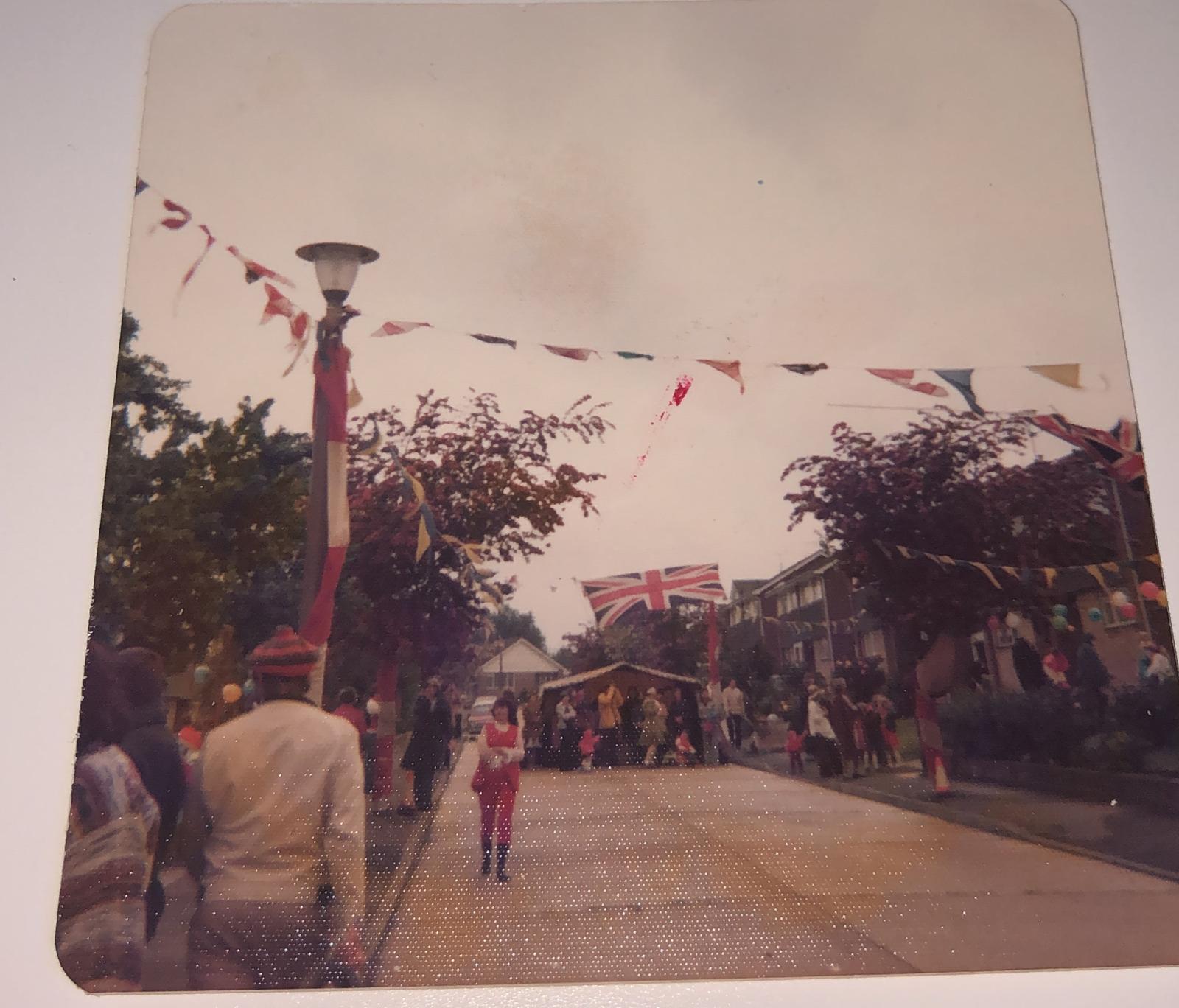
The photo below was of the street party in Bettescombe Road Rainham in June 1977

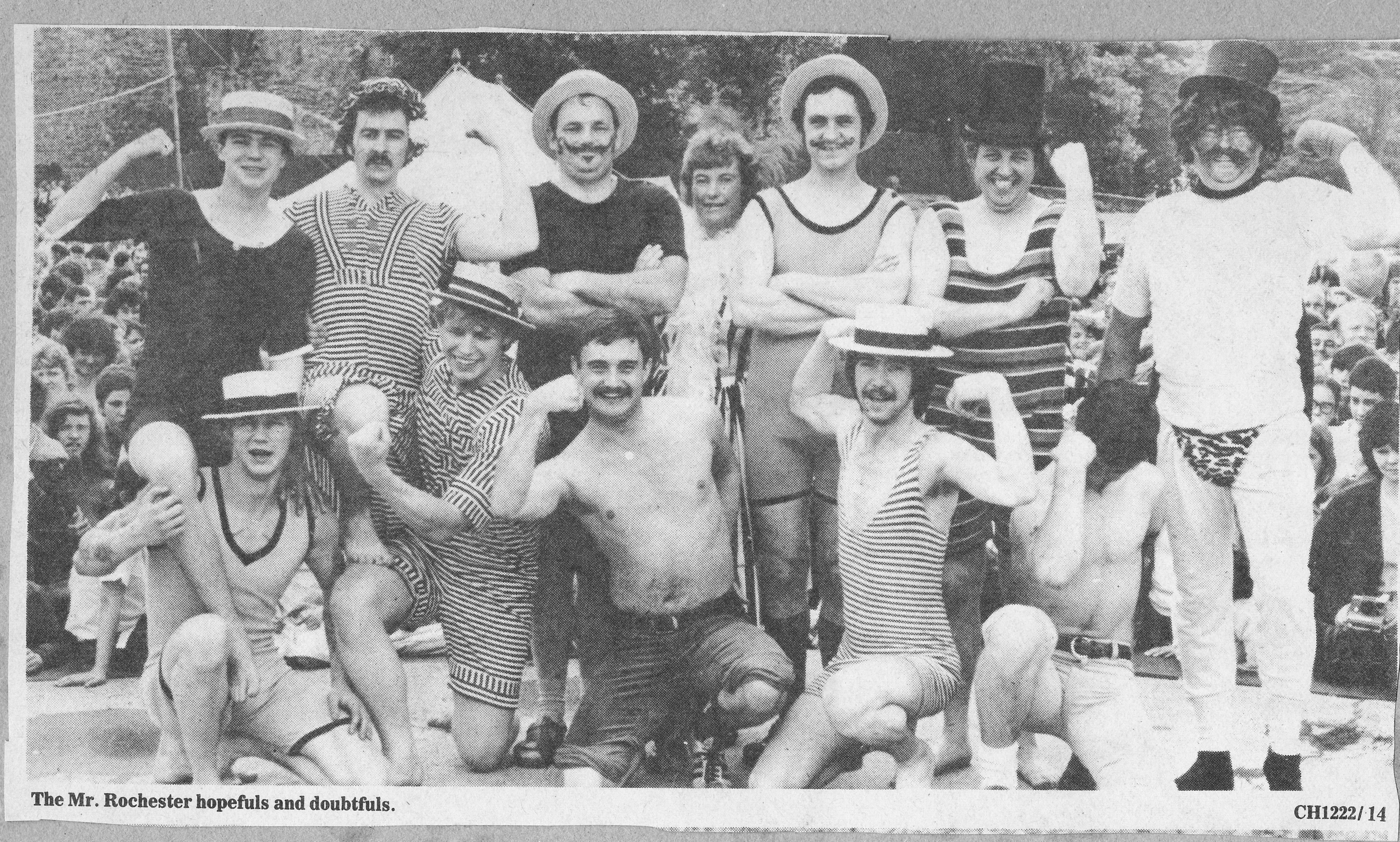
This photo is of the Mr Rochester competitors at the 1981 Dicken's Festival, do you recognise anyone?
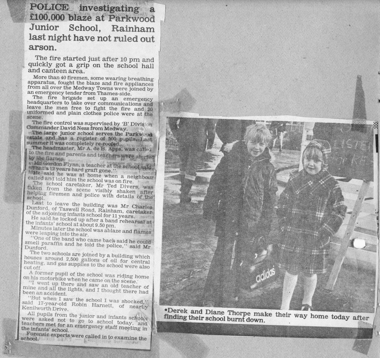
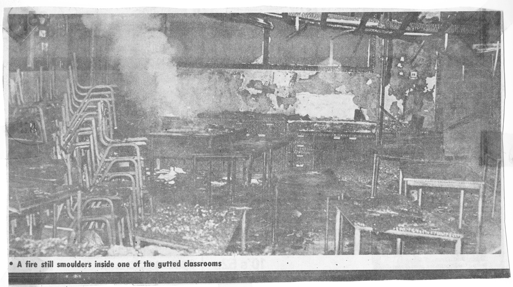
There was a huge fire at Parkwood Junior School, Deanwood Drive in February 1979 where virtually the whole school was gutted. The fire started around 10pm and 40 firefighters were needed to tackle it. Police didn't rule out arson but I've not seen any subsequent follow ups to show if it was ever found to be deliberate or not.
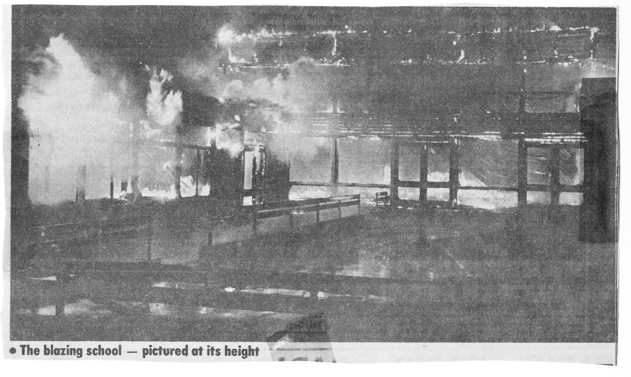
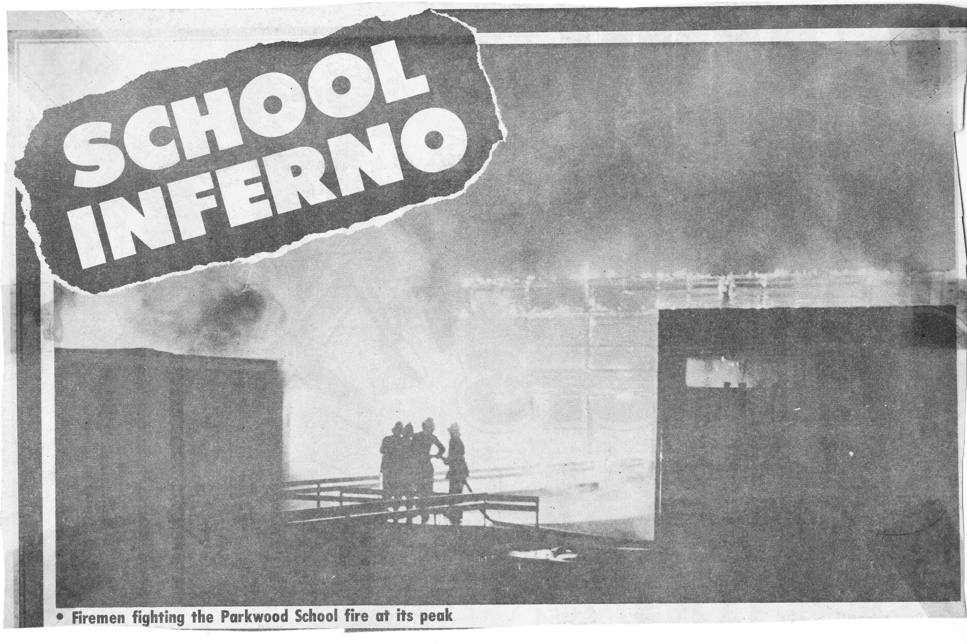
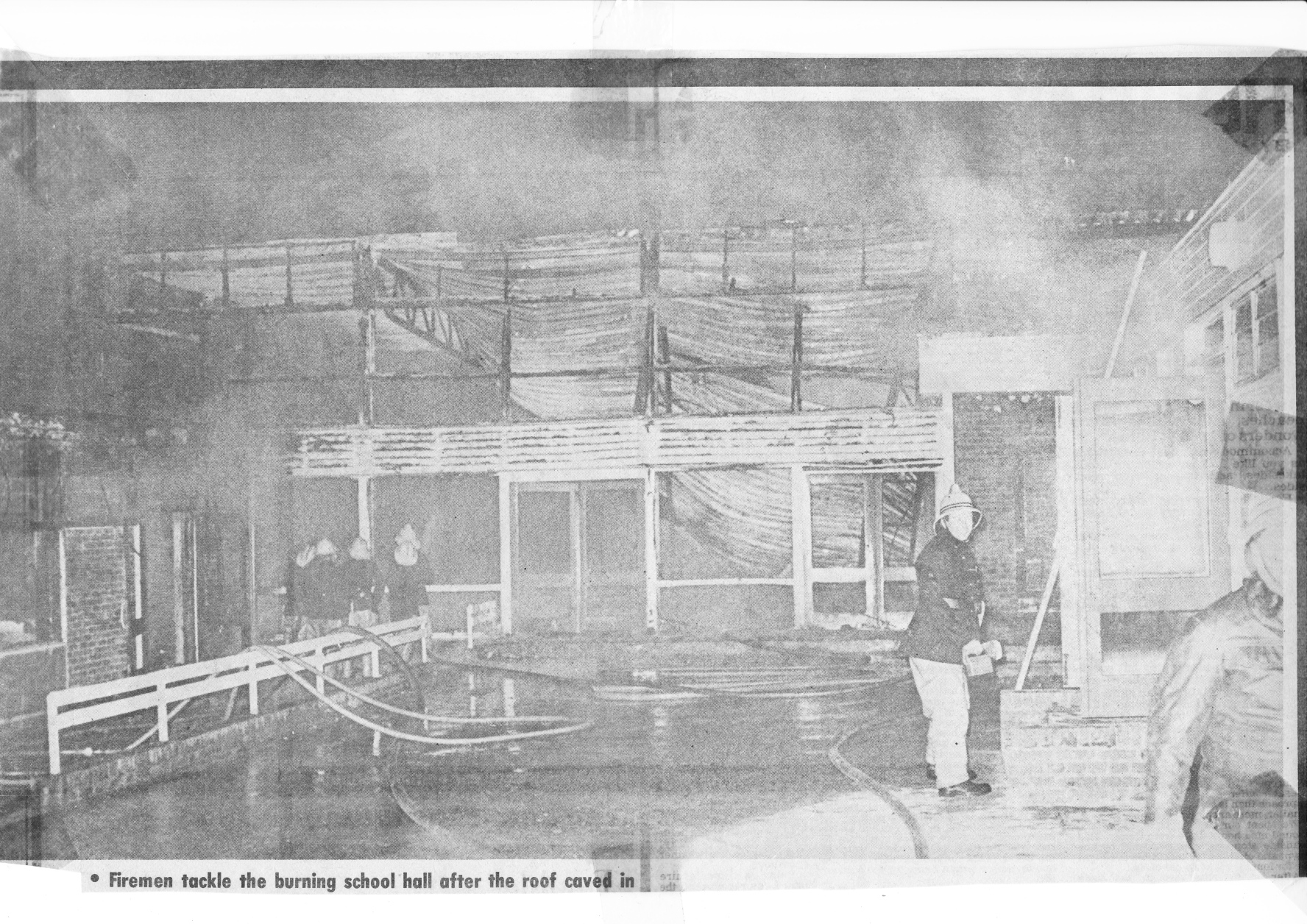
Headmaster Mr A de B Apps was called to the fire, caretaker at the time was Mr Ted Divers. Charles Dunford, caretaker of the Infants school was the last to leave the building before the fire took hold
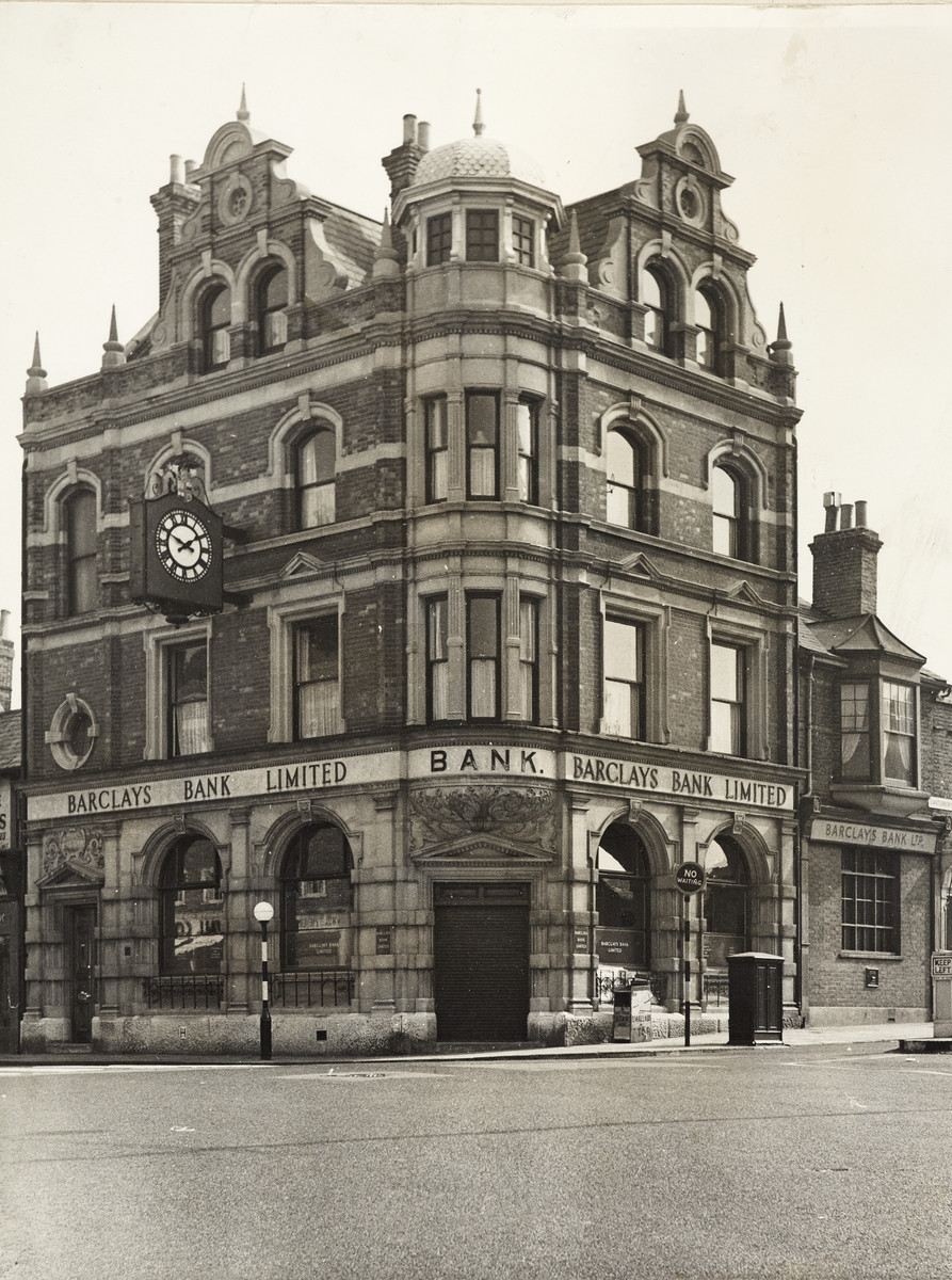
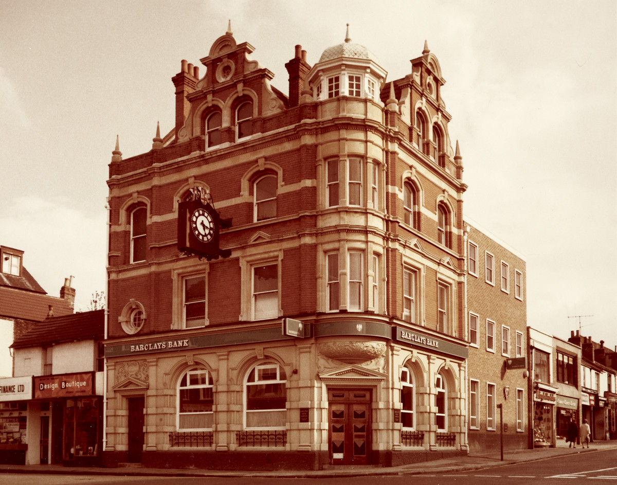
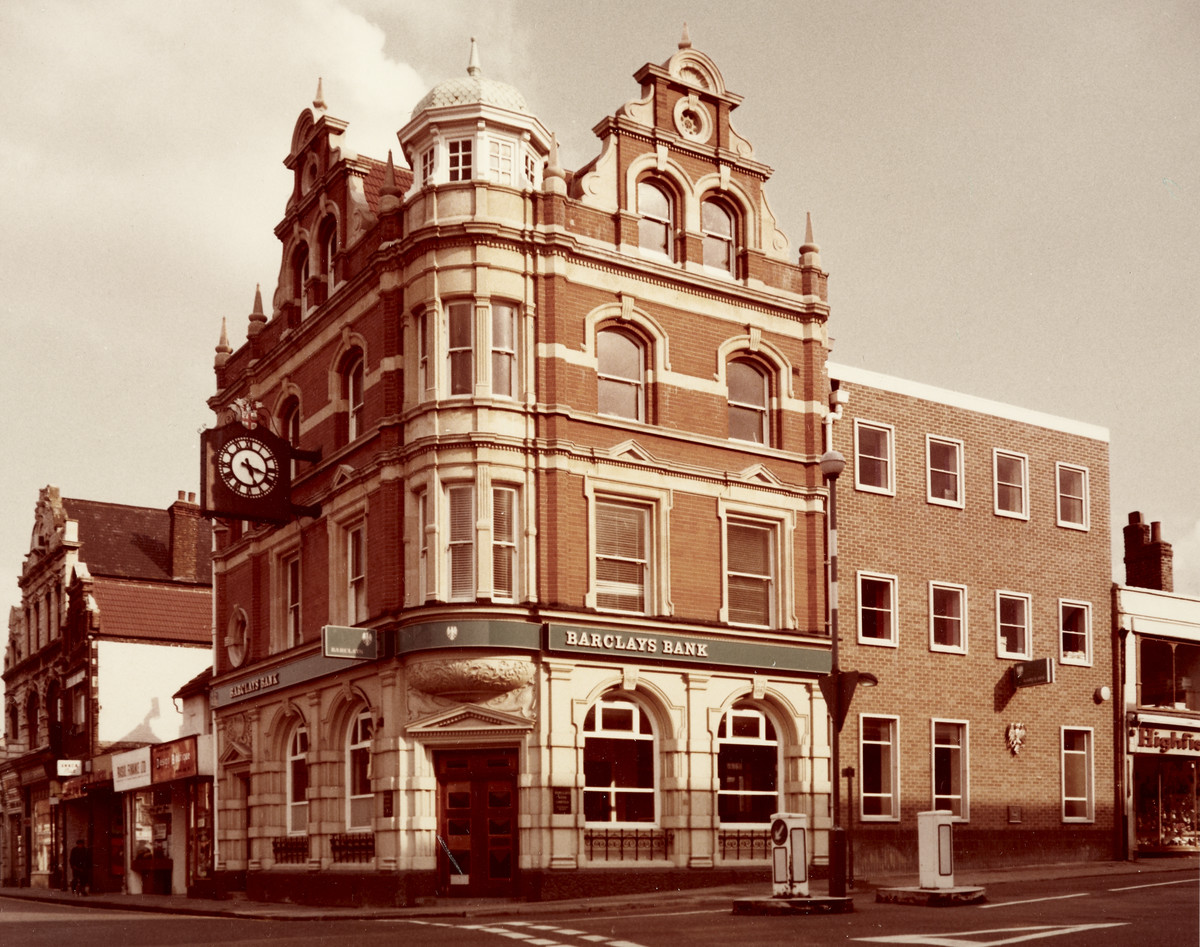
The Gillingham (Kent) branch of Barclays Bank was opened in 1898/99 by the London & Provincial Bank and it was amalgamated with Barclays in 1918. The branch was originally called “New Brompton” until 1902. It was based at 77 High Street from 1920.
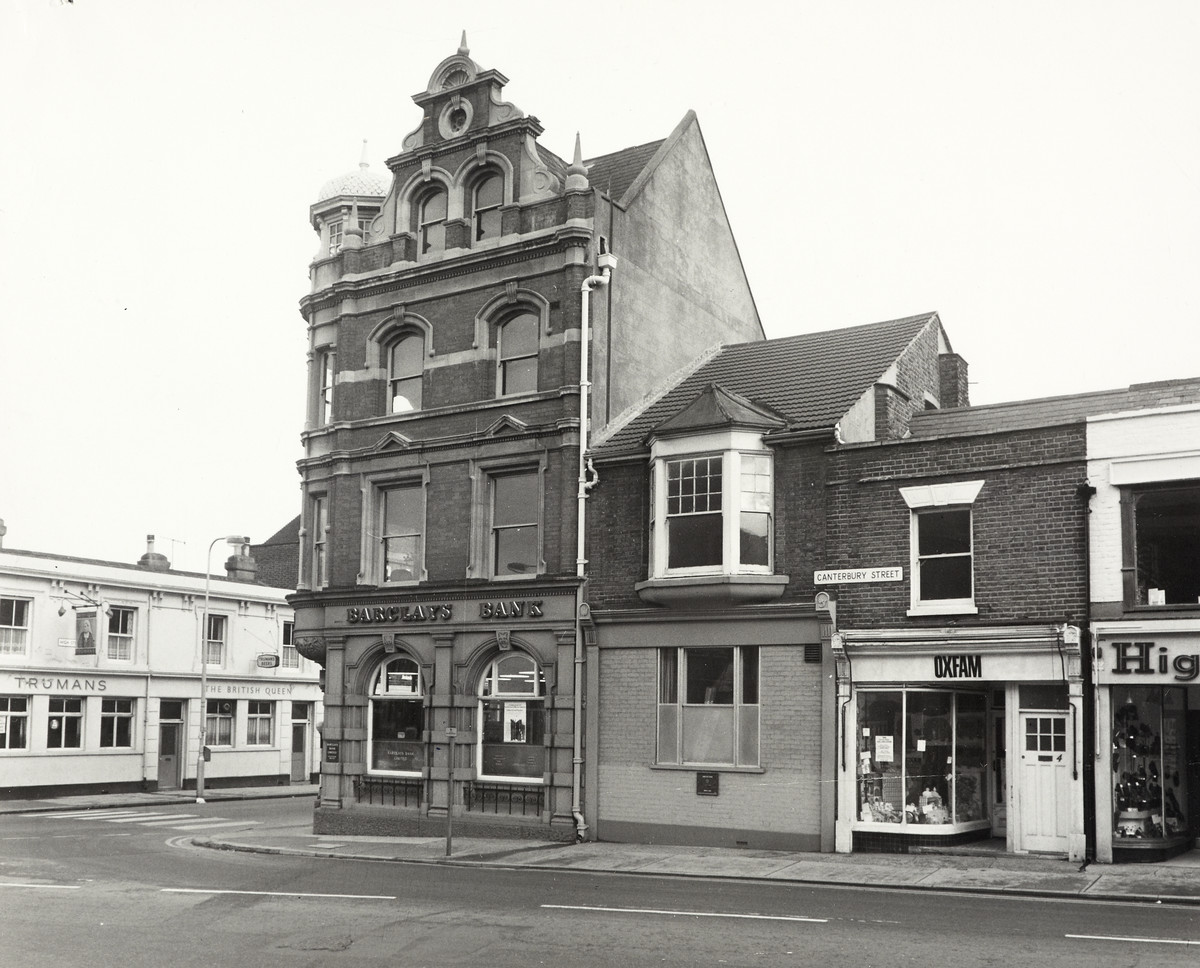
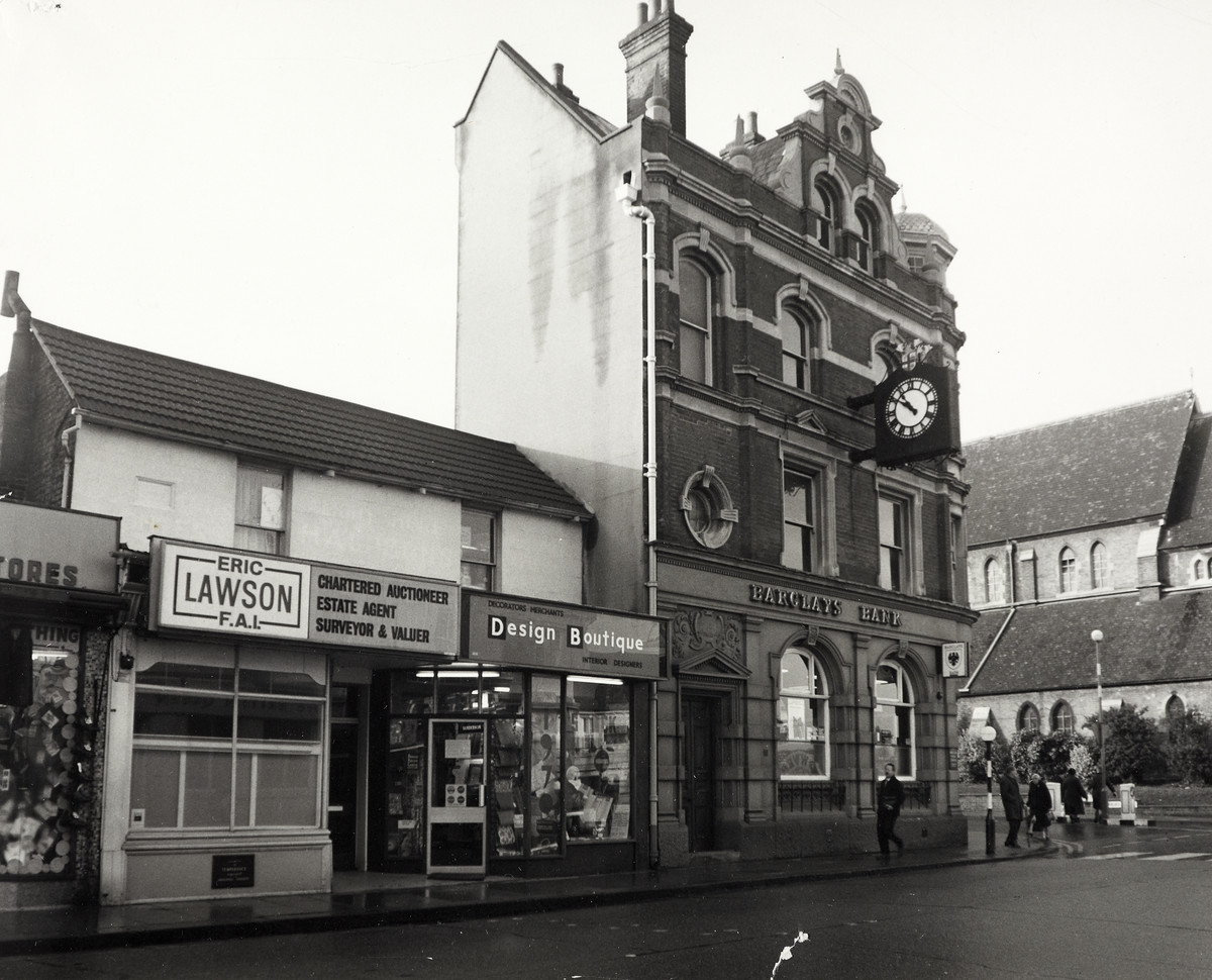
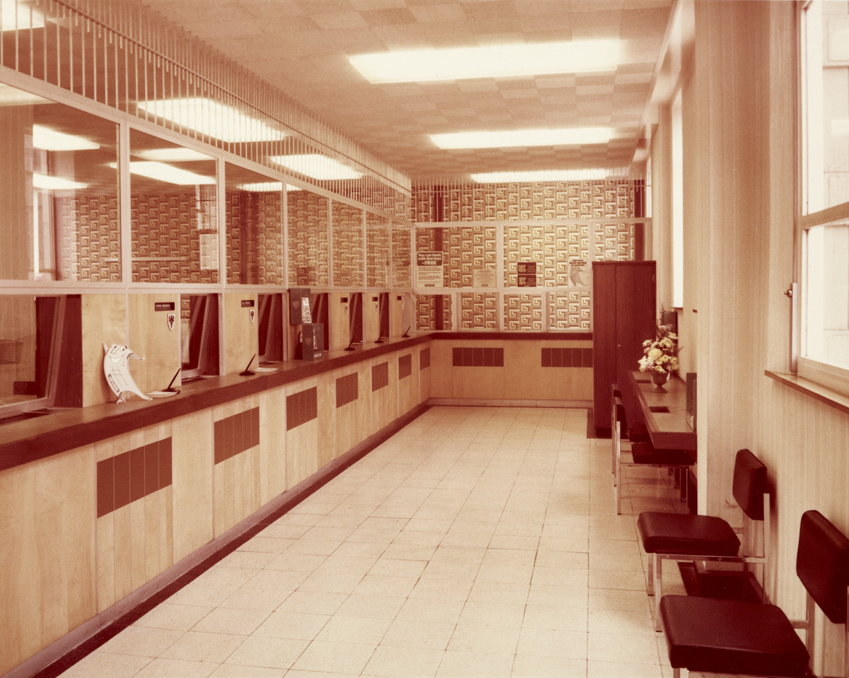
These old photographs of the Barclays Bank Gillingham branch are from the 1970s and one earlier c.1957
It's interesting to see the development of the building next to Barclays Bank on Canterbury Street over the years. In 1957 it's a very ornate building with bay window upstairs and part of the bank. By the early 1970s the roofline has been changed and the downstairs windows replaced. By the late 1970s the building has been demolished and replaced by a modern brick built 3 storey structure although still part of the Barclays branch from the logos on the front of the building.
The pictures also show the Oxfam shop, Design Boutique, Eric Lawson Estate agent and Highfields. It appears from the photos that Highfields moved next door when Oxfam moved into their old shop. You can also see the Truman's British Queen pub in the background of one photo.
Barclays Gillingham branch closed on 6 February 2015 and the business transferred to Chatham, High Street.
Photos and info courtesy of Barclays Group Archives
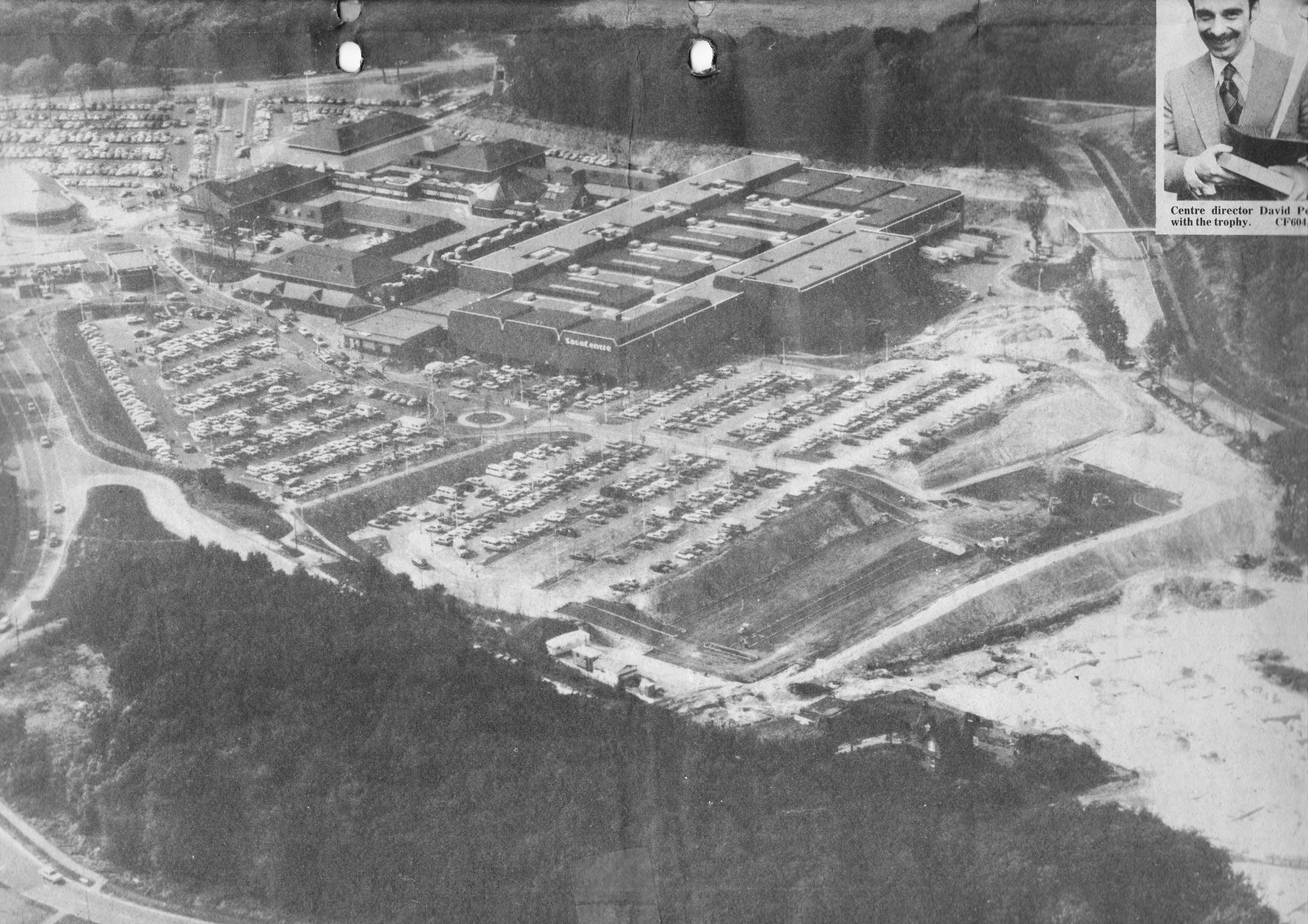
This photo of Hempstead Valley was taken in 1981 showing the amount of woodland still left at the time and the huge size of the shopping centre in the middle of what was woodland. In the distance you can see that the Hungry Fox pub isn't yet built and no access via the rear of the centre from Hempstead Valley drive.
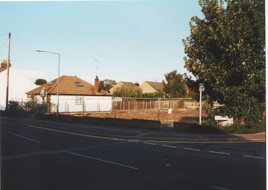
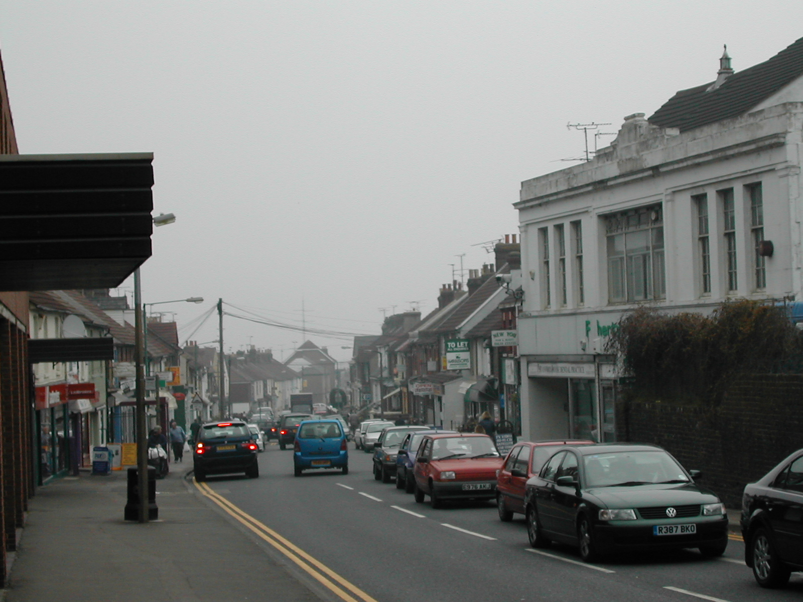
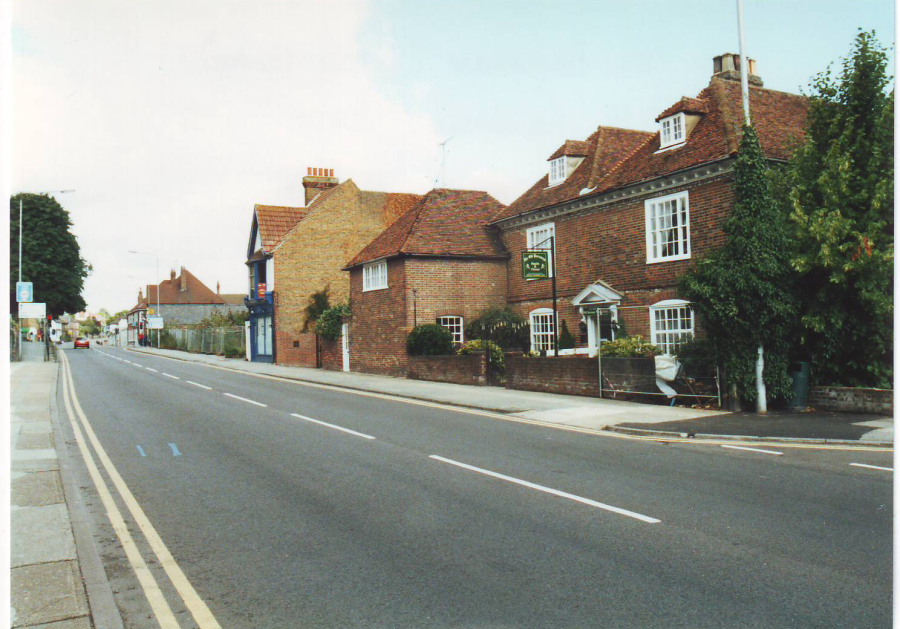
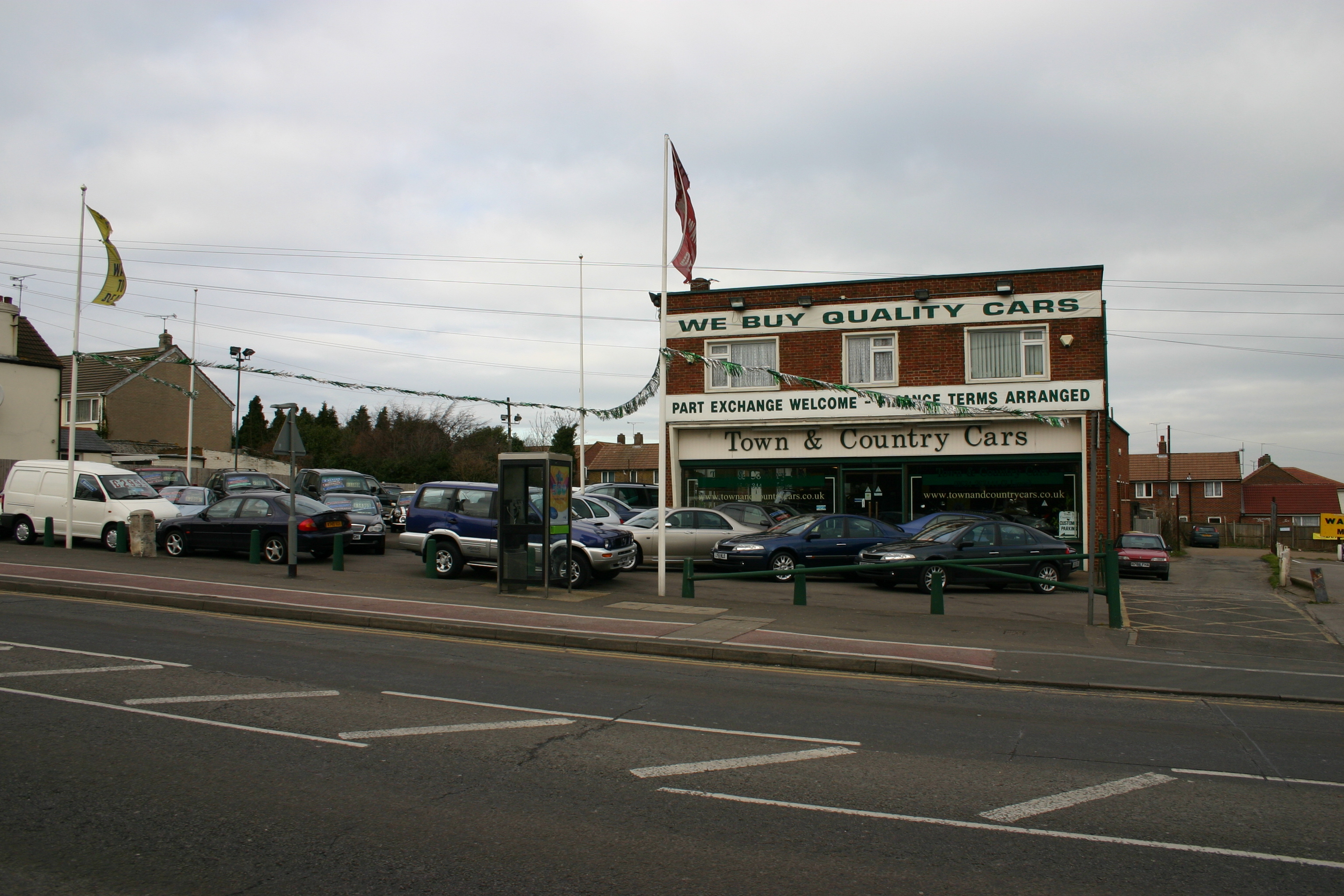
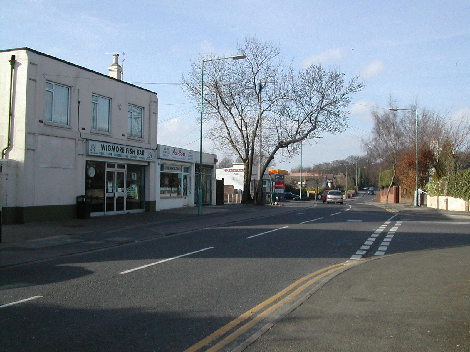
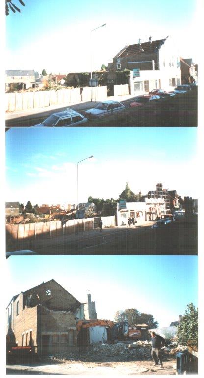
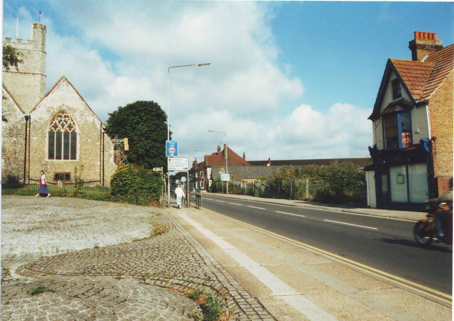
Roads around the Rainham - old photos of how roads used to look in days gone by
Old photos by decade