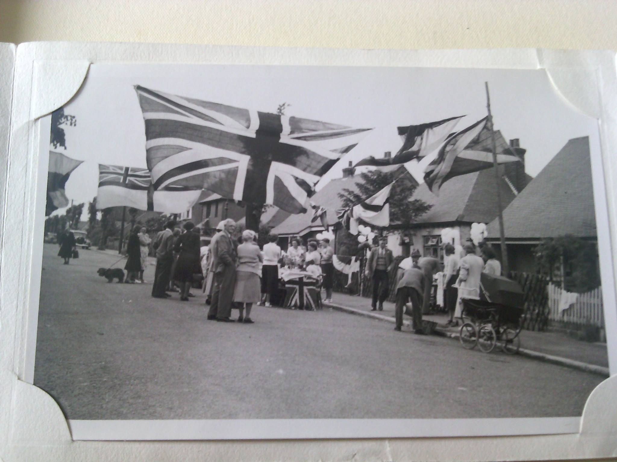
This photo was shared by Daisy May
This was the Herbert Road Street Party in June 1953 for Elizabeth R 1953 Coronation
1 comment

History Articles
This photo was shared by Daisy May
This was the Herbert Road Street Party in June 1953 for Elizabeth R 1953 Coronation
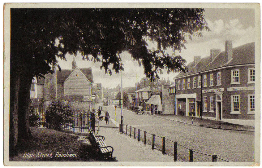
These shots of Rainham High Street show how it has changed over the years.
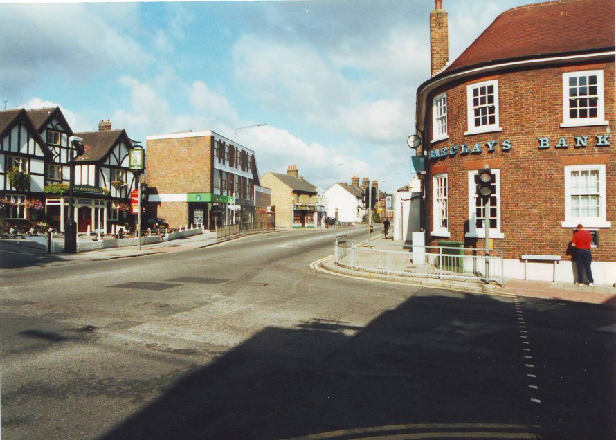
This photo was taken around 1940 showing what is now Barclays Bank in the foreground to the right. To the left is The Cricketers pub. Rainham Shopping centre was built in the late 1970s on the woodland area with access created by demolition of the row of houses and blacksmith shop. The Cricketers pub has been rebuilt in this picture so it's further from the A2.
This one of same location was taken around 1950, you can see the fence round the war memorial after the bench. The Coronation clock is missing so the photo was prior to 1953.
In roughly the same location in 2018 this photo shows Barclays without the two shops at the end of the building.
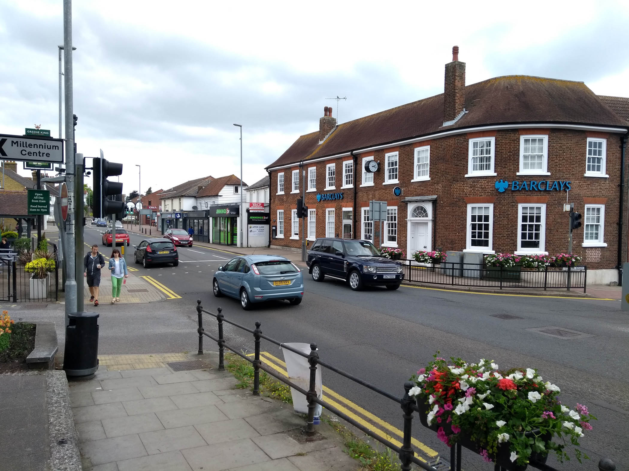
The photo below was taken in 2001 showing Barclays Bank and The Cricketers pub
The photo below was taken in 2004
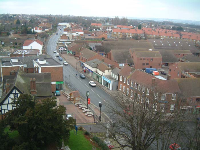
The same shot from Rainham Church tower in 2012 - this time more leaves on the trees obscuring Barclays Bank
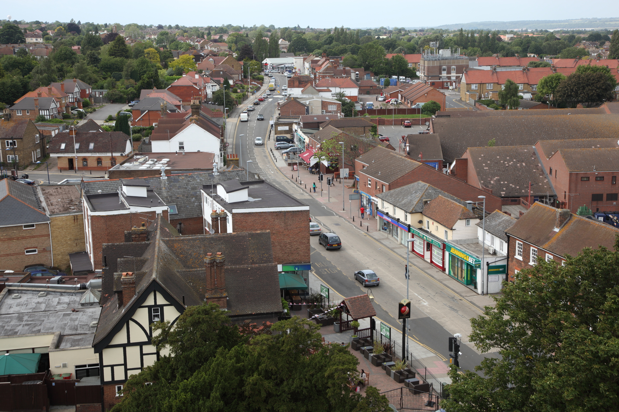
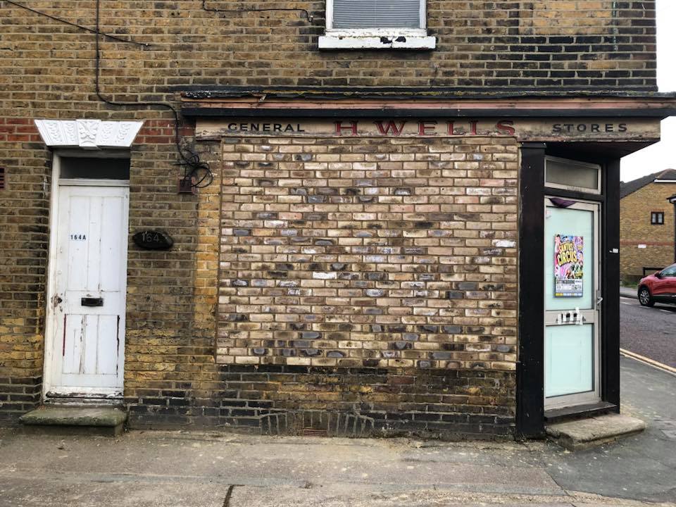
Photo:Peter Matthews
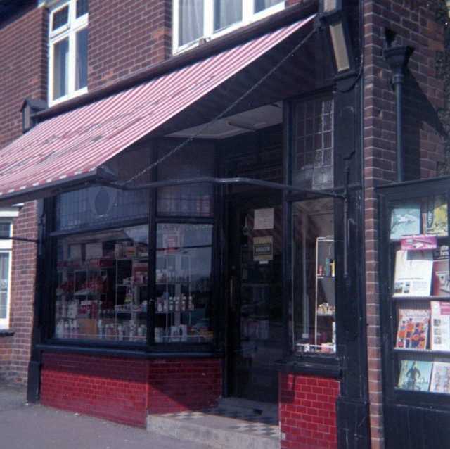
In the 1970s it was a corner shop owned by Vic & Florrie Morris
Lydia Post remembers that Mr and Mrs Wells had this grocery shop in the 1950s...there were little grocery shops everywhere.. Just a few houses up Station Rd where the Chinese take away is was Mr Chandlers grocery shop...and opposite..what was later the post office just below railway crossing that was a hardwear store..There were always pots, pans, baskets etc hanging from beams in the ceiling...they sold all.manner of things. I could tell alot about Rainham...moved here in 1937 aged 5 and have seen SO many changes
A couple of doors down from Henry street in Station Road..was a barber shop...a Mr .Pearce. Us children would go on a Saturday morning or in school holiday for a trim...He had a waiting room in which there was a machine on the wall (no not what you think) we would all stand in a circle and hold hands..one of us would put a coin in the machine and we all got an electric shock !!!wouldnt be allowed these days...I think it was designed for men not for kids...It was a horrible feeling but you daren't refuse to join in or else you would be called chicken
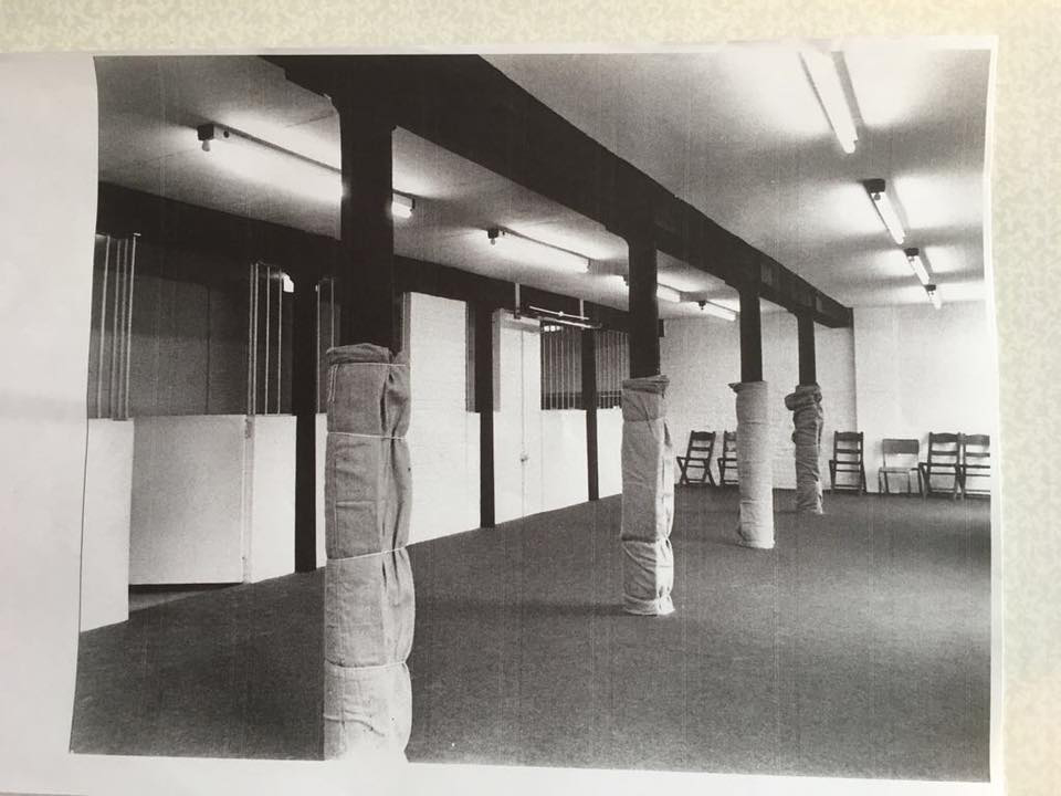
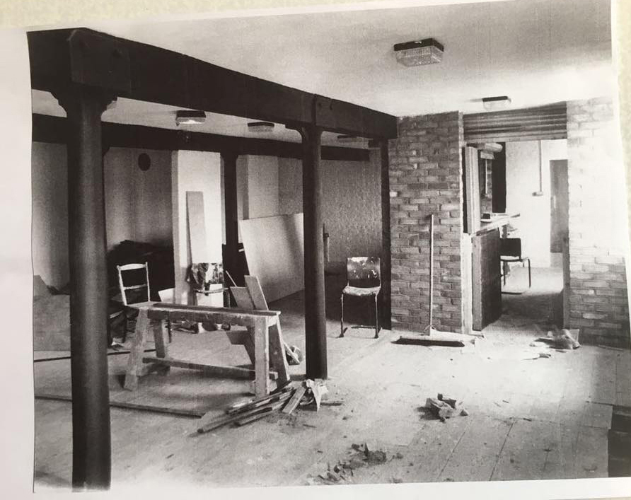
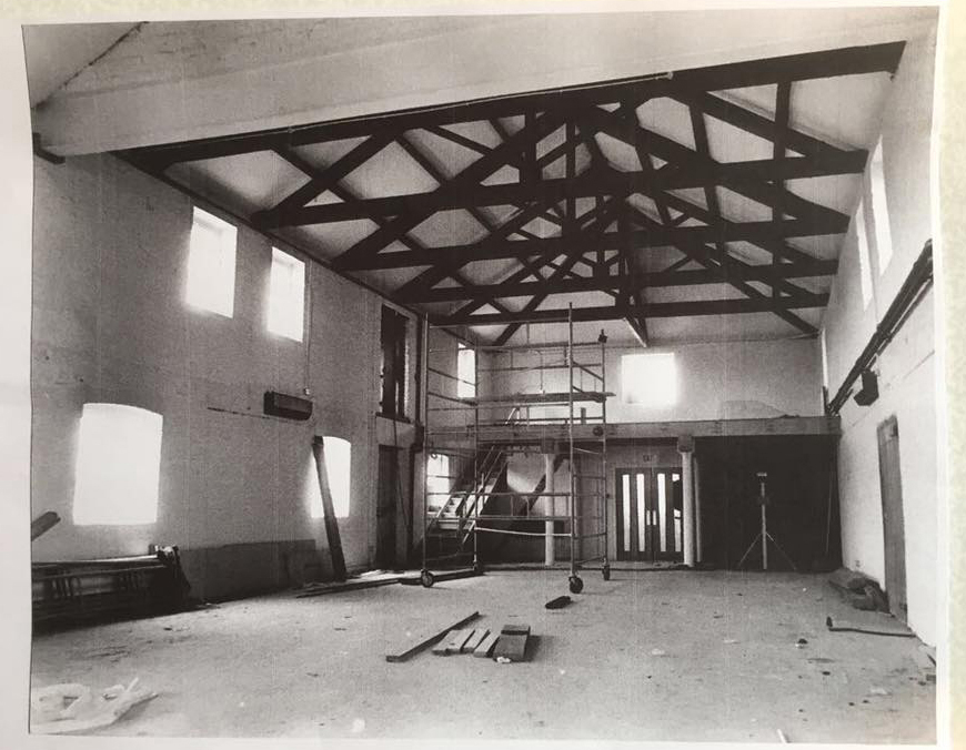
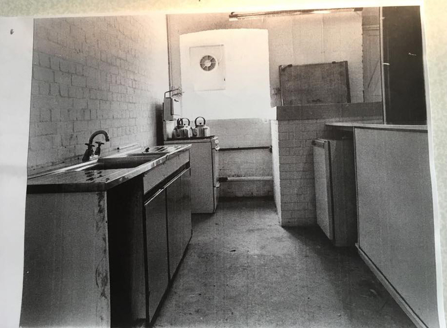
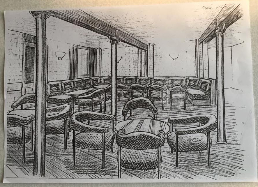
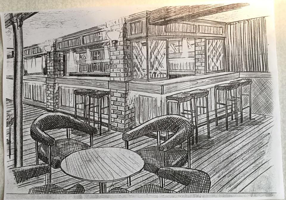
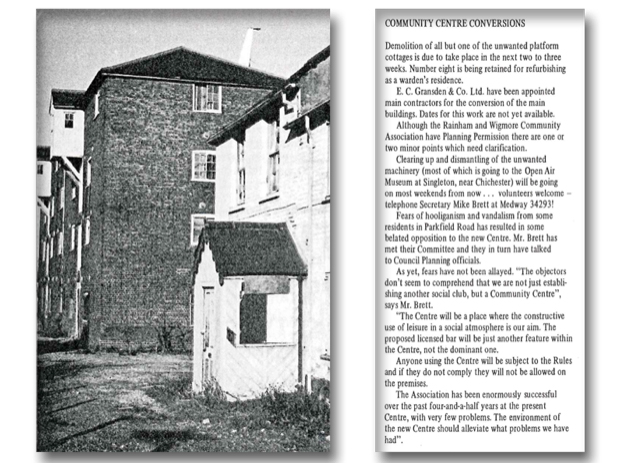
The Oast was purchased in 1970 for use as a Community Centre by RWCA (Rainham and Wigmore Community Association) and work took much of the 1970s to prepare it to a suitable state to open. It's celebrating 40 years as a Community Centre and hosting a Beer Festival to both raise funds and celebraet the date.
These photos are from the early 1980s showing the progress in the conversion and the sketches of the planned designs
In 1955 I would have been 8 years old. I lived in Quinnell Street in Rainham and on many a Sunday I was asked by my father to “run an errand” with one of my brothers or sisters (there were ten of us then) to the farm at the bottom end of Mierscourt Road to buy a pint of milk. There were very few shops open in Rainham on a Sunday in those days, in fact, the only two that I remember being open was Nellie Hunters in Berengrave Lane and Smiths sweet shop that was opposite what is now the Rainham Precinct, but then The Church of England School (St Margaret’s), and anyway, shops didn’t sell fresh milk then it was always either tinned condensed sweet milk or sterilised.
We would begin our journey by walking the short distance from our house No 2 Quinnell Street to the A2.. The traffic would have been quite busy in those days as this was the main link to the coast and long before the M2 motorway had been built.
The first building that we would come to was Mr Osborne’s house and business; it is the white building with the flat roof on the corner of The High Street and Quinnell Street. Now used as a commercial premises it was an empty shop in those days and Mr and Mrs Osborne lived above it. I’m told that in earlier years he ran a newsagents here. I can always remember his two Persian cats sitting in the empty shop window. Mr Osborne later had a large bungalow built opposite this building on the Southern side of the A2.
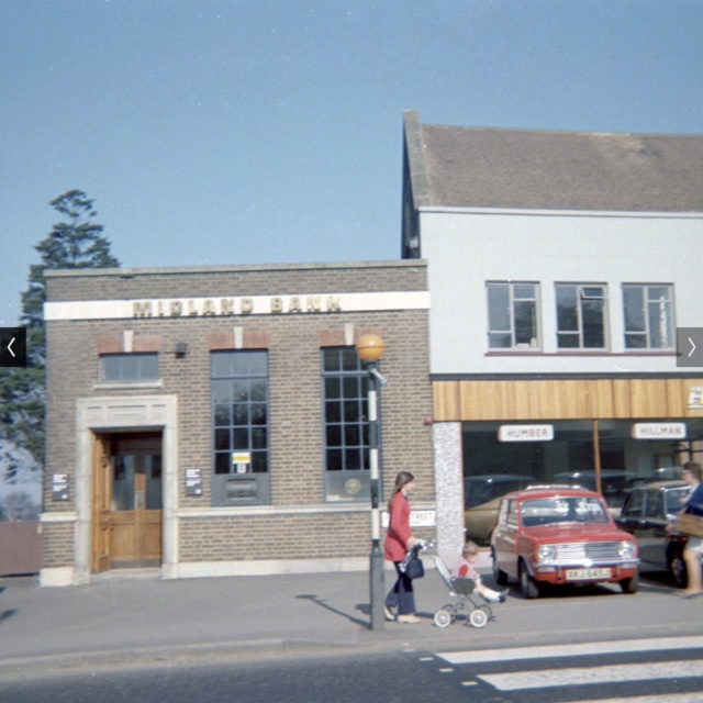
If we had looked right at that point towards Gillingham and at which is now Hidson’s Car Sales, we would have seen Rainham Motor Cycles ( I believe this was how Mr Hidson started his company)), next to this, The Blue Bowl Café and then The Midland Bank on the corner of Berengrave Lane where in 1968 my young brother was hit a killed by a bus that was turning into Berengrave Lane, The top of the road was later blocked off.
We would turn east at Mr Osborne’s place towards Sittingbourne on the North side of the High Street. We would then pass Mr Durell's house which is now Mann’s Estate Agents. Mr Durell owned the small garage that used to be on the corner of Maidstone Road opposite the building which was the Gas Show Rooms and now The Manor Farm.
After Mr Durells house there were three more houses where Miss Wallis, Mr Hewes, and Mr Goldup lived. The houses had long cultivated gardens with lawns and fruit trees, all these gardens backed on to the side of our garden now sadly these gardens have been flattened and covered with tarmac and used as a car park and the houses are now converted into commercial premises and the front gardens which were walled or fenced are now open forecourts.
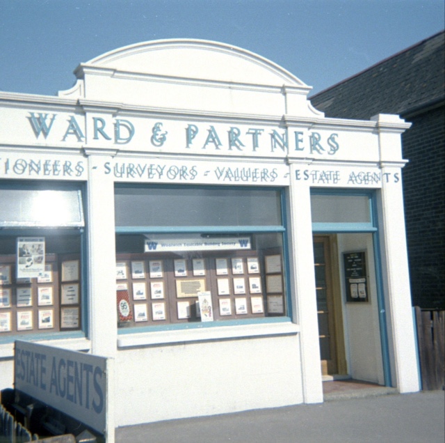
Next to these houses we would pass The Chatham and District Water company building which is now Wards Estate Agents and next to this another private residence where Mr Manktelow lived and again now a commercial premises.
Next was The Telephone Exchange the building which is still there but behind it in what was our playing field is the ugly modern building that houses the new exchange. After this we would walk past Mr Ransley’s house, he was a local coal merchant, again his house and the one next door where Mrs Naylor lived are used for commercial purposes these days.
Then we come to Beveridges The Chemist and the house that went with it, this is all John Morley’s building now. I can remember the forecourt in front of the shop once collapsing and revealing what I believe was a Dene hole or something like that.
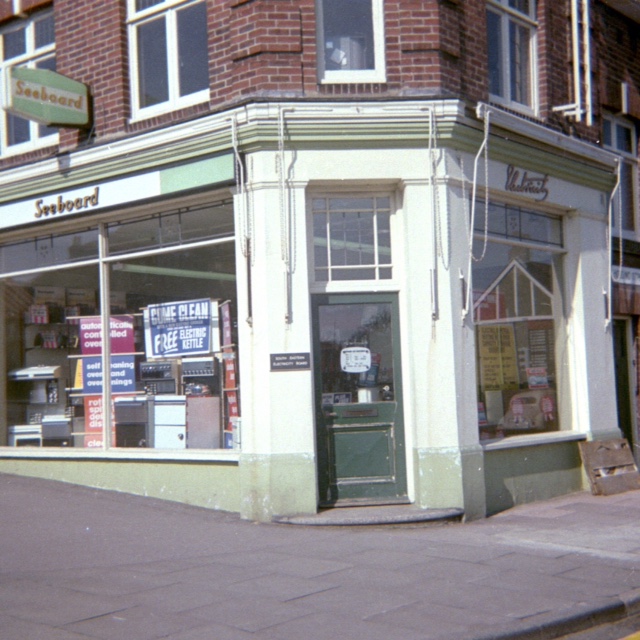
The next building was The South Eastern Electricity .show room this was on the corner of Holding Street and now an Estate Agents the garden backed on to the clinic. .
Crossing Holding Street we would come to a wooden building which was Mrs Barbara Kitchingham’s sweet shop Mrs Kitchingham went on to become Mayor of Gillingham . Next to the shop and part of the same wooden building was a house where mr Branchett lived. This building is now Harrisons Estate Agents
Passing this building, we came to Stuarts Express Dyers and Cleaners and next to this, one of the few existing businesses, Poulton and Sons the Ironmongers. After this we walked by shops such as Guthries, Corals, Ward & Partners before coming to another row of wooden houses where my friend Sheila Hook lived and another gentleman next door whose name I don’t recall. Also part of the wooden buildings was Nicholsons sweet shop. These buildings have now been replaced by Lloyds TSB Bank.
Next was The Rainham Library a tiny shop compared to the new one that was later built in Berling Avenue., After to the library we came to Josephine’s the hairdressers where my mum used to get her hair done and at the end of this block was Holdings the Greengrocer. I clearly remember when old Mr Holding used to weigh out the vegetables on his old brass scales.
Moving past Holdings we came to a slight recess where Frank Rose and Son Grocers shop was and next to this Frank Rule Stationers and then Greens Cycles this is where Patrick Duffs Opticians is today. There was a big house next to Greens which has long been demolished and Grey Fox Estate Agents building has since replaced it.
There was small farm next and, the farm house was set back off the High Street. Mr and Mrs French lived here and they must have kept chickens because Mrs French use to sit at her front gate selling eggs.
Past the farm was Barretts Motor Cars and then The Forge Garage all these buildings were demolished to make way for the entrance to Rainham Shopping Precinct.
We would then come to Barlow’s The Cobbler and next to him was Rainham Radio. My friend from school, Roger Rouse lived with his parents in the flat above the shop.
After Rainham Radio was the Reed Brothers Barbers shop and then Cremers the cake shop where, on a Monday they used to sell out of date cakes for a penny this was probably the only chance I got to get a cake in those days.
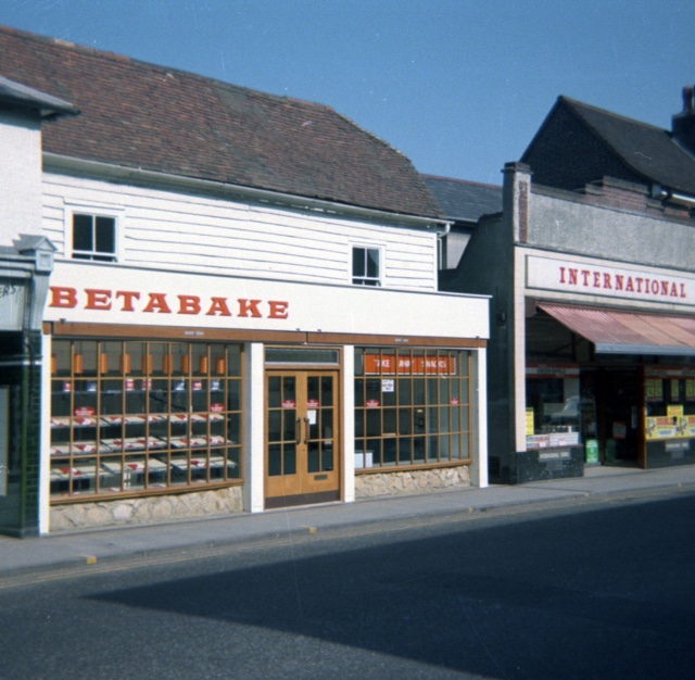
Passing Cremers, we would then come to The International Stores this was quite a big grocery store probably what we would call a small Supermarket today. Looking opposite here across the High Street we would see The Royal Cinema or the Bug Hutch as we called it. This building is now Lukehursts furniture store now but you can still see the roof of the old cinema.
After The International Stores was Guthries ( I think they sold carpets), Ward & Partners and then another of our existing businesses, Barclays Bank on the corner of Station Road.
We would cross Station Road and walk past The White Horse public house. It would have been closed at this time of the day as the licensing hours on a Sunday lunch time were 12 noon til 2pm. Although the pub is still there, it has seen many changes inside since 1955. .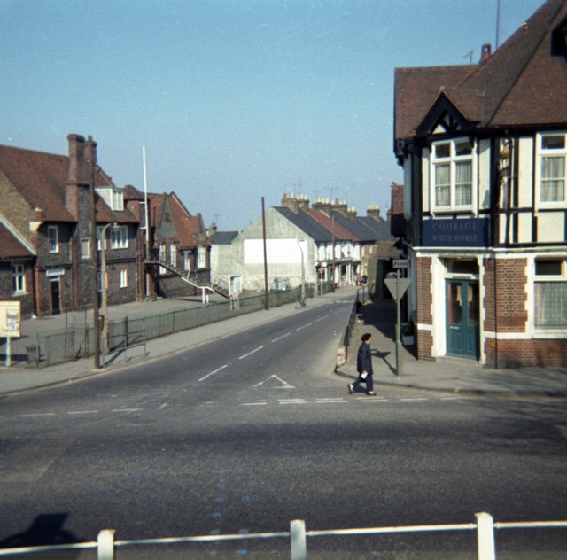
After The White Horse, we came to the Co op stores which have since been demolished and The Rainham Healthy Living Centre constructed on the land. I can remember that there was a hall above the Co op stores where a couple of years earlier in 1953 they held a big party for us kids for the coronation. Its nice to see that the old Palm tree is still at the side of the new building. I can recall looking at this tree from my school in Station Road from when I was five years old.
Passing The Co op we came to Bardens this was a Greengrocers shop which is now The Olive Tree restaurant.
Mr Bridges big house The Old Parsonage was next and I can still remember him and his children riding their horses out of the stables there. This building is now a fitness centre.
We walked on past The Old Parsonage to the Post Office, I believe that there were some buildings before this that later became The Post Office Sorting Office which itself has been demolished to make way for Apple Tree Court.
Passing the Post Office we would walk by Cross the Jewellers, Webbs the Drapers and Mills Outfitters coming to Mountains solicitors on the corner of Ivy Street.
We would cross Ivy Street and pass Oldlands Florists which is now a Tattooist and then to Greens Newsagents. Although this is now a Hairdresser you can still see the old Newsagents sign sticking out from the wall above the window.
We would then cross Pudding Road coming to Jelly’s Outfitters I think this is now Hons Chinese Restaurant. Walking on we would pass Tuckers Watch Repair then a sweet shop and then come to Mr Quinnell’s beautiful mansion in its grounds. The house has sadly long been demolished to make way for town houses and flats. The road that I lived in was named after Mr Quinnell who I believe was a local councillor
Following on from Mr Quinnell’s house we would reach Scott Avenue, many of my school friends lived in this road in the pre fabricated flat roofed houses that have since been replaced by modern homes. Although, in those days the original houses were only a few years old.
We crossed the entrance to Scott Avenue passing Gilberts Builders and Panda Press coming to The British Legion now called The United Services Club. Then we would pass a few more shops the last one being The Chocolate Box.
We would cross the road here to Mierscourt road and the farm was just a short way up the road on the right.
It was now time to walk back home with the milk but that journey is to be told another time.
I’m sure many of you who read this article will remember some of the people and places that I have mentioned and I am sure that I will have missed a few and apologise in advance. I hope you enjoyed my trip down MemoryLlane in old Rainham.
Colin Macgregor
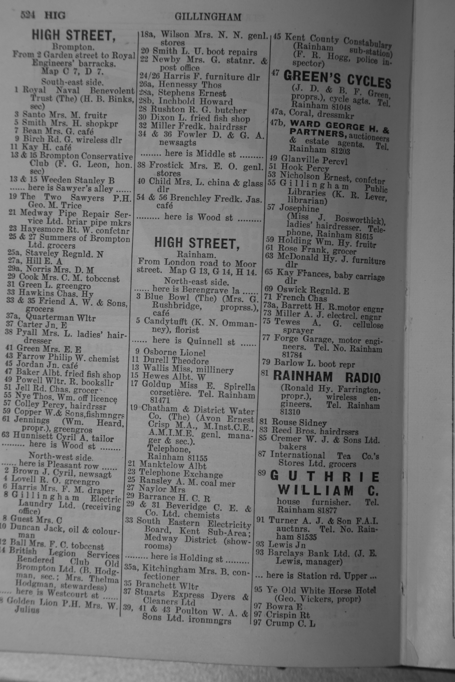
The list of shops in High Street Rainham in 1953 from Kellys Directory many of which are mentioned in Colin's article above
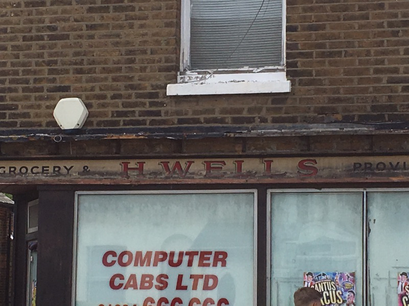
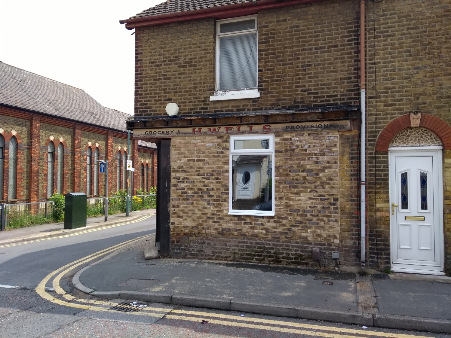
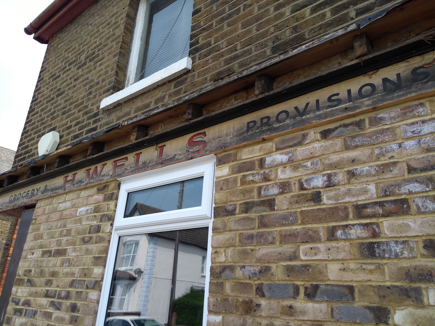
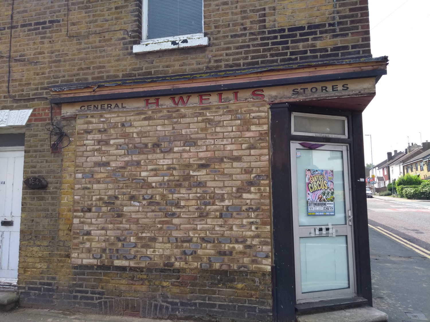
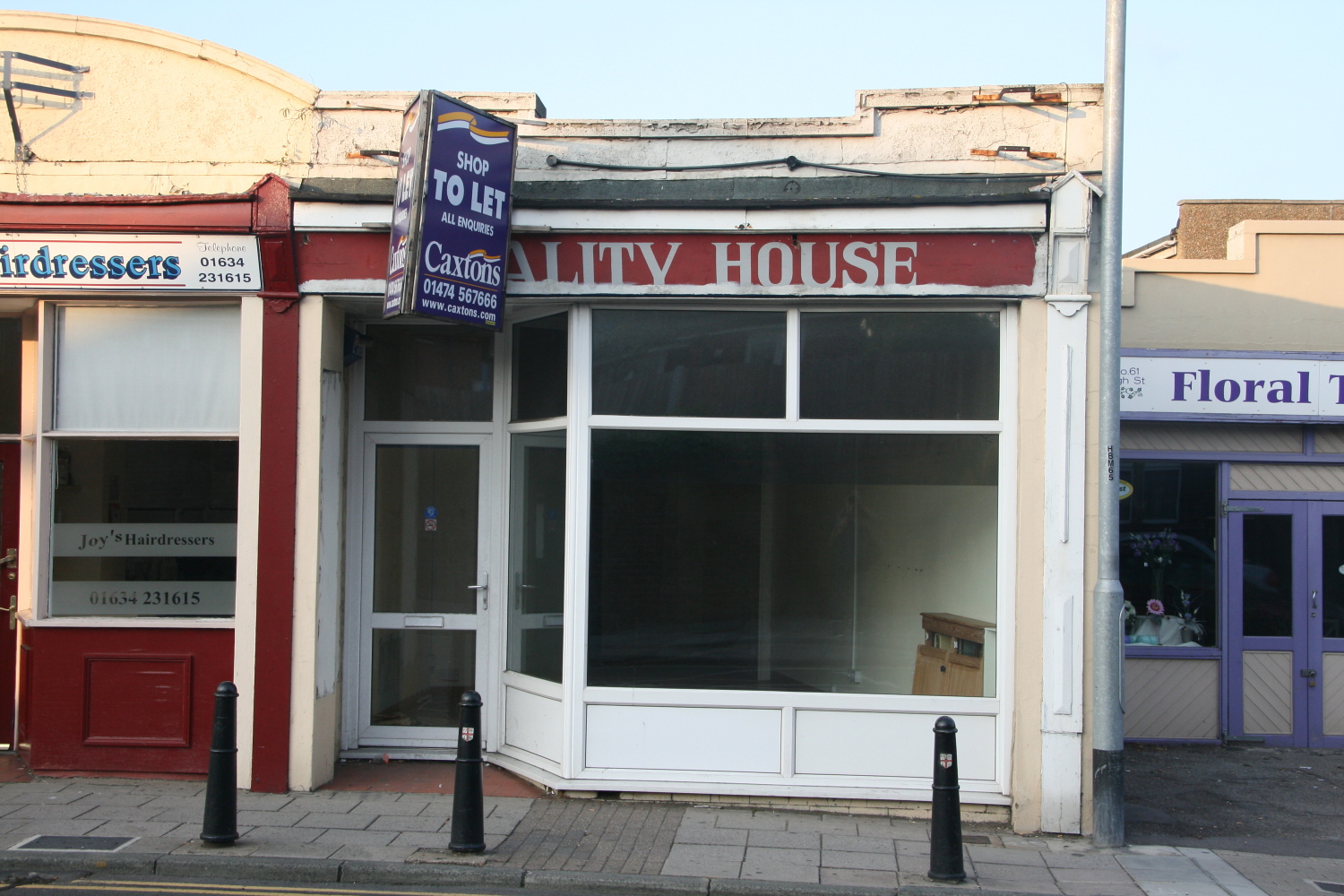
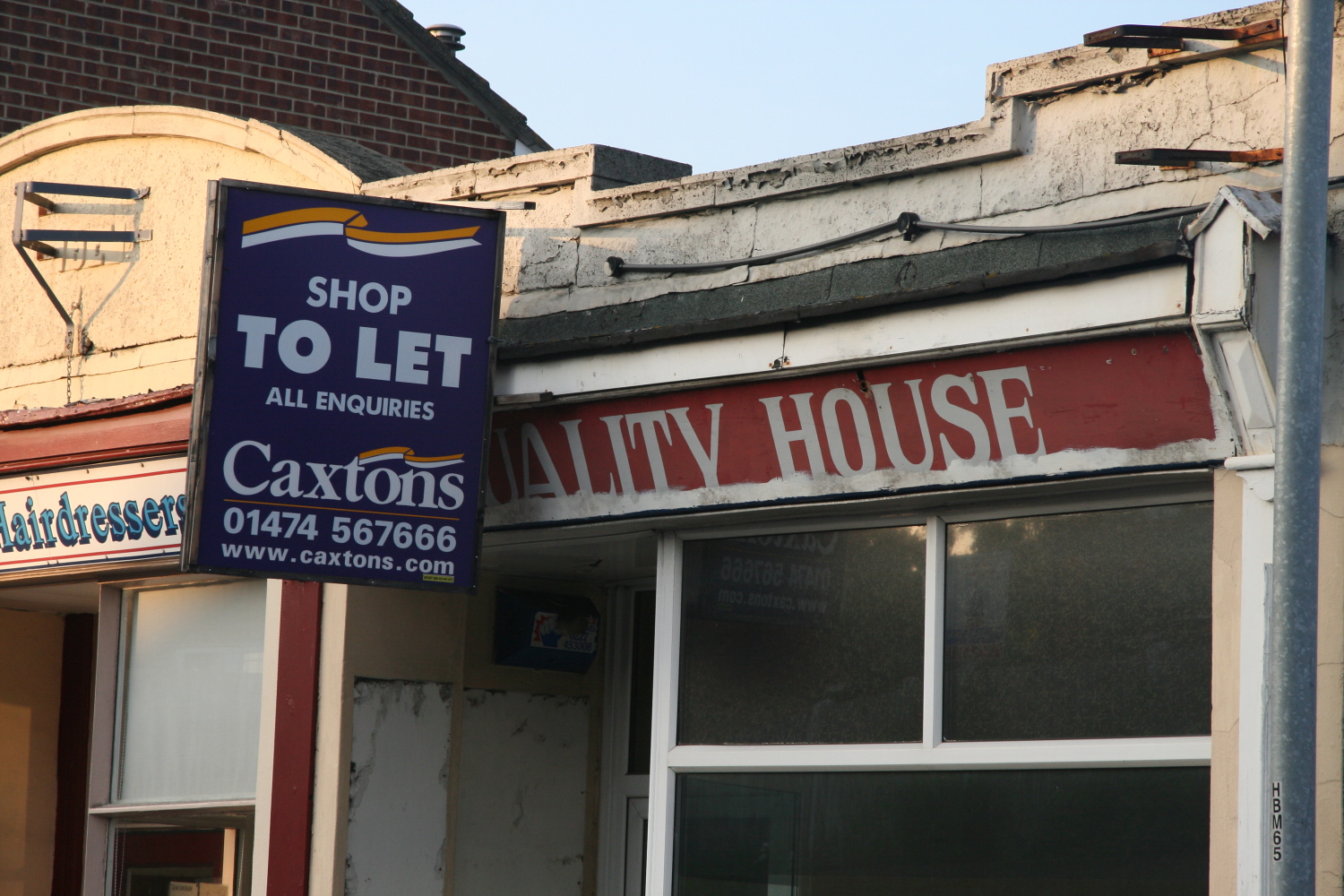
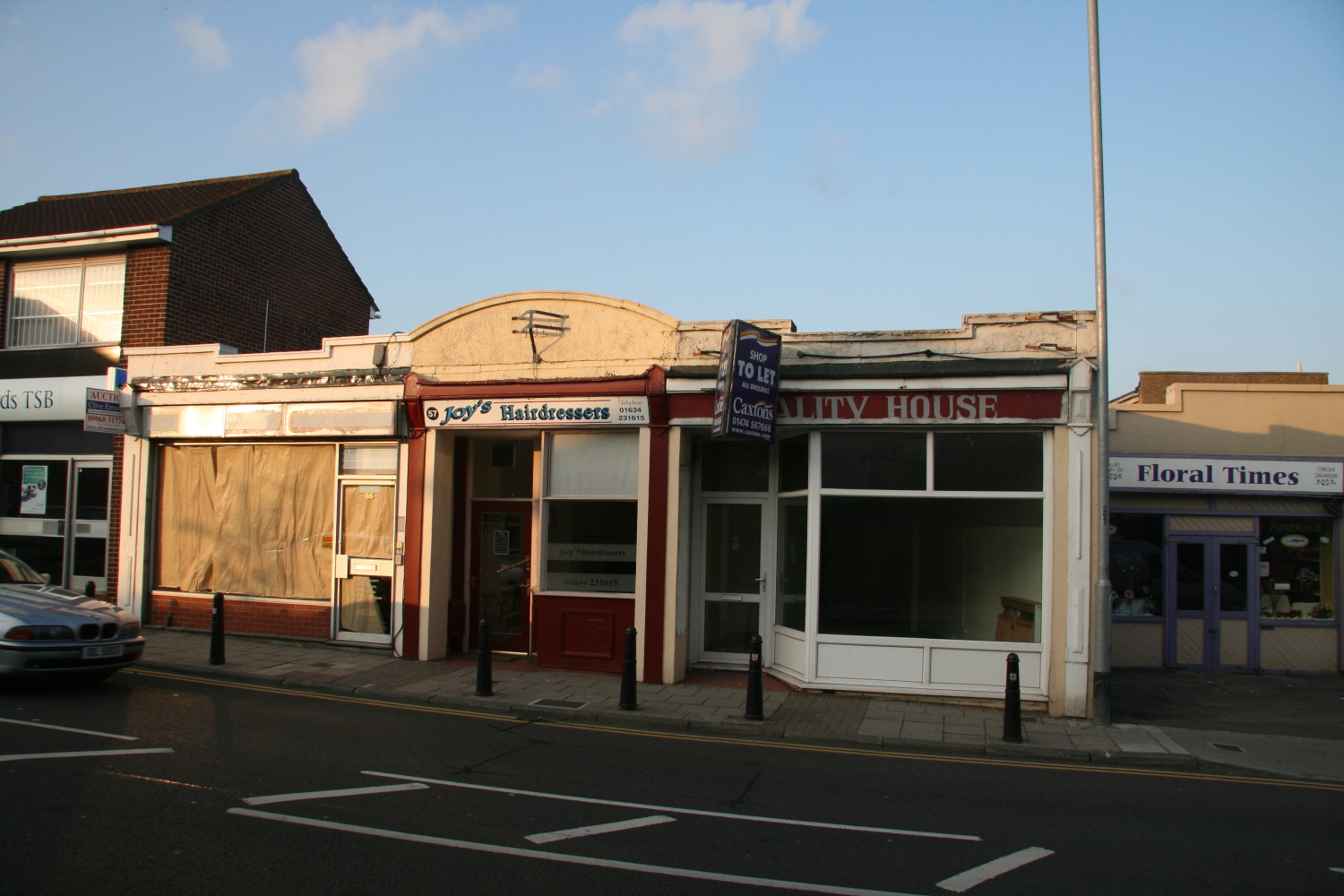
The recent discovery of an old hidden shop sign when Computacabs office was being converted reminded me that a number of other buildings around Rainham have revealed hidden old shop signs when renovation work was taking place
This was H Wells General Stores on Station Road, Rainham

Another shop sign that was uncovered was Quality House back in 2008. There was another shop in Rainham called The Bargain House so I wonder if the two shops were linked in some way
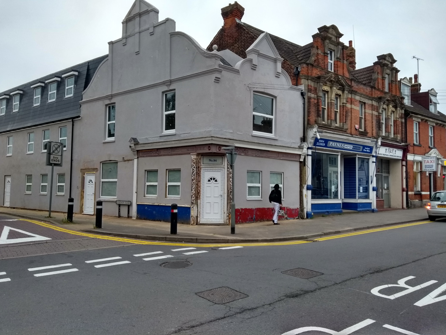
A much more recent "old" sign was uncovered during the works on the building on Station Road that was Paynes Motor spares. The previous Owen Hair Design OHD sign is now showing from around 15 years ago

The names of various roads in Rainham have changed over the years, some by accident and some by design.
Starting at the eastern extremity, in 1867 the present Seymour Lane was Wakeley Lane and by 1901 it had become Moor Street Lane. There is obviously a close association with the Wakeley family who until very recently lived at the house on the corner of the Lane, which incidentally is the only property which has retained the ancient mounting steps by the front gate.
Coming a few hundred yards to the west, Meresborough Road was previously Almshouse Lane, said to have been associated with the alms-houses at the top of Otterham Quay Lane. Mierscourt Road has also had many changes; being Bush Lane then Chapel Lane after the congregational church was first built at the northern end, and then Meres Court Road which was changed for some mind-boggling reason to Mierscourt. At one time I had to draw attention in the press to the spelling at the bottom which was 'Miers' with another nameplate further up as Meres', the latter being more correct as obviously both this road and Meresborough were originally named after the de Mere family who had estates in the area. In some maps Mierscourt is combined, in others it is two separate words.
Maidstone Road was Bredhurst Lane at one time, and in 1929 when Rainham was absorbed into the borough of Gillingham, all roads in Rainham which had a similar name to those within the Gillingham area were altered to avoid misunderstanding. Thus Hamilton Avenue became Salisbury Avenue, Oxford Road became Durham Road, and Shakespeare Road became Hothfield Road. The only name now duplicated is the High Street which has been somewhat complicated by the Post Office now trying to persuade people to leave Rainham out of their address. This means that places in High Street Rainham are stated as High Street Gillingham. Whilst the Post Office may sort by post coding, it can be very misleading to other people.
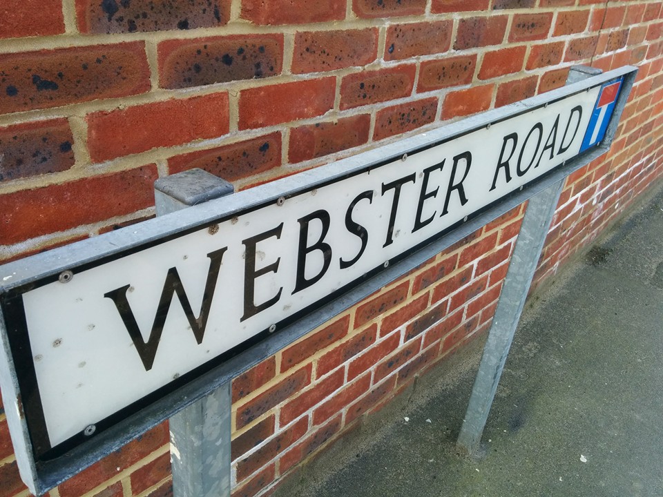
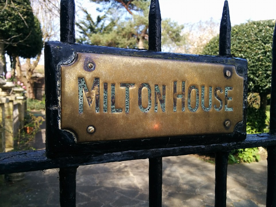
Milton Road is now Webster Road (presumably after Dr Webster) and Station Road was White Horse Lane before the railway came in 1858.
Photo below of Broadwalk Rainham - now High Street
Sign on Webster Road giving indication of the original name of the road, Milton Road

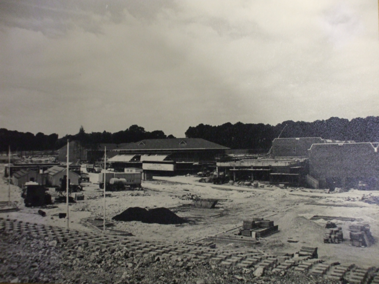
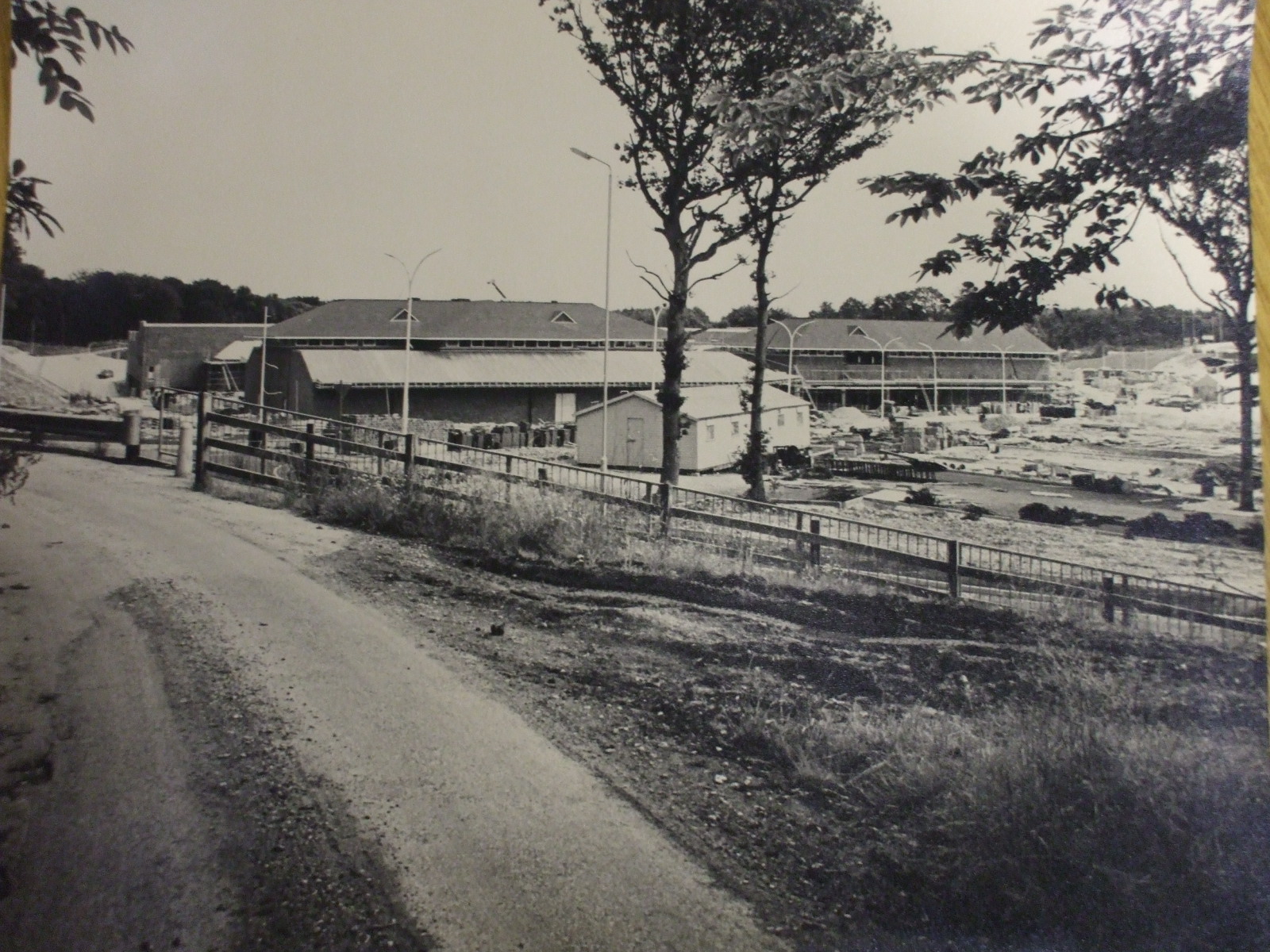
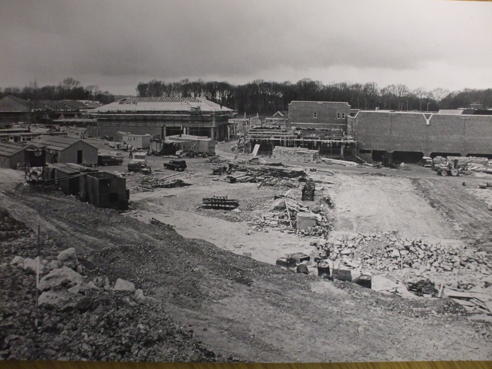
Hempstead Valley Shopping centre (aka Savacentre) near Gillingham Kent was constructed in the late 1970s just outside the village of Hempstead. It opened on 17th October 1978 so has just celebrated its 40th Anniversary in 2018. These photos showing the construction of Hempstead Valley were kindly sent by Chris Shade. You can see the large sign showing the original name of Savacentre. A current photo of Savacentre is shown on the Hempstead Valley website
Since the 30th anniversary in 2008 there has been significant redevelopment at the Hempstead Valley shopping centre to modernise areas of it. You can view the plans on the Hempstead Valley website here When it was completed in 2015 it made a huge difference to the appeal of the centre as a shopping and leisure destination with restaurants added outside.
What may seem commonplace now was groundbreaking in 1978 as there were very few other out of town shopping centres of this size at the time. Hempstead Valley was the second Savacentre (Washington Tyne & Wear opened in 1977). At the time of opening Savacentre was one of the largest out of town shopping centres in the South East. The original Picnic Parlour was the first Food Court in the UK. You can see more info about Sainsburys Savacentre here
When originally opened the main shop was Sainsburys Savacentre, the brand they originally created for their large hypermarkets. At the time Sainsburys was by far the largest supermarket in the UK with Tesco trailing far behind – a far cry from the current situation with Tesco leading the field. The originally Hempstead Valley offered 250,000 square feet of shopping space but when the centre was redeveloped in the early 1990s with an extension and new shops like M&S being added, this was increased to 330,000 square feet.
The challenge is to remember all the original shops that were there when the centre opens….Sainsburys, Presto (which then became Safeway) - but which others?
So far the following shops have been suggested for the original opening
NSS (Newsagents) then became Forbuoys
Our Price
Post Office (not one of the original shops)
Sainsburys Savacentre
Boots
Thomas Cook
Presto Supermarket
Wimpy Burger Bar
Spud-U-Like
Later additions when the extension was added in early 1990s were WHSmith, Marks & Spencer.
Notice in the aerial shot the area to the bottom right which was developed for large housing estates shortly after the shot was taken.
Photos on this page are clickable to view higher resolution versions.
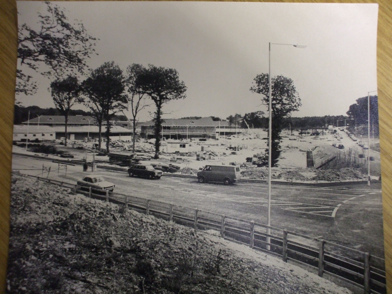
Looking towards Savacentre Hempstead Valley from roundabout
Petrol station would be to middle right of photo
Looking towards Hempstead Valley from Sharsted Way
Underground car park to right of shot, Abbey to left of shot
Looking towards Hempstead Valley from roundabout
Petrol station would be to middle right of photo
Looking towards Hempstead Valley from Sharsted Way
Underground car park to right of shot, Abbey to left of shot
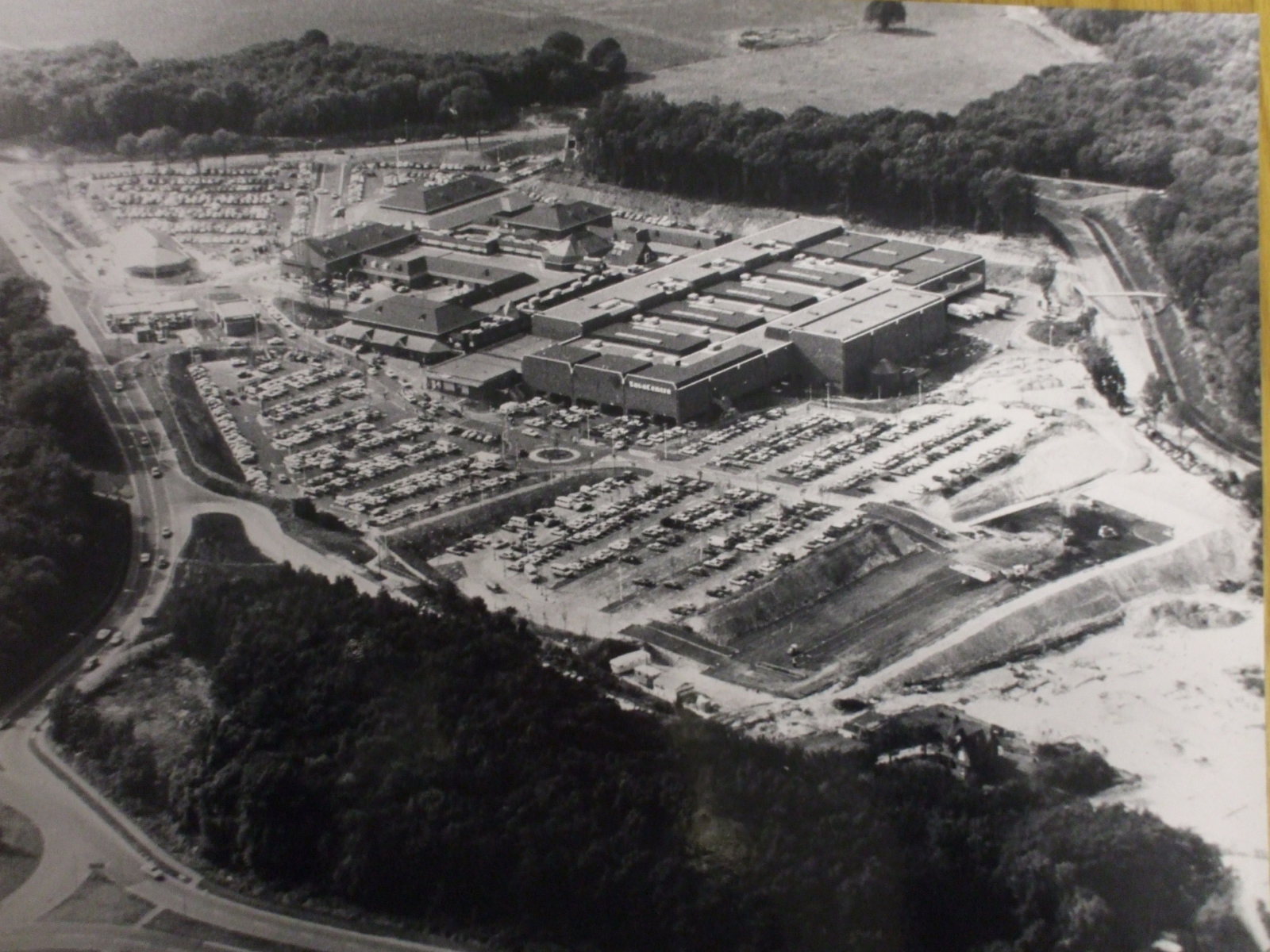
Aerial photo of Hempstead Valley Savacentre 1980
Sharsted Way runs along left hand side of photo
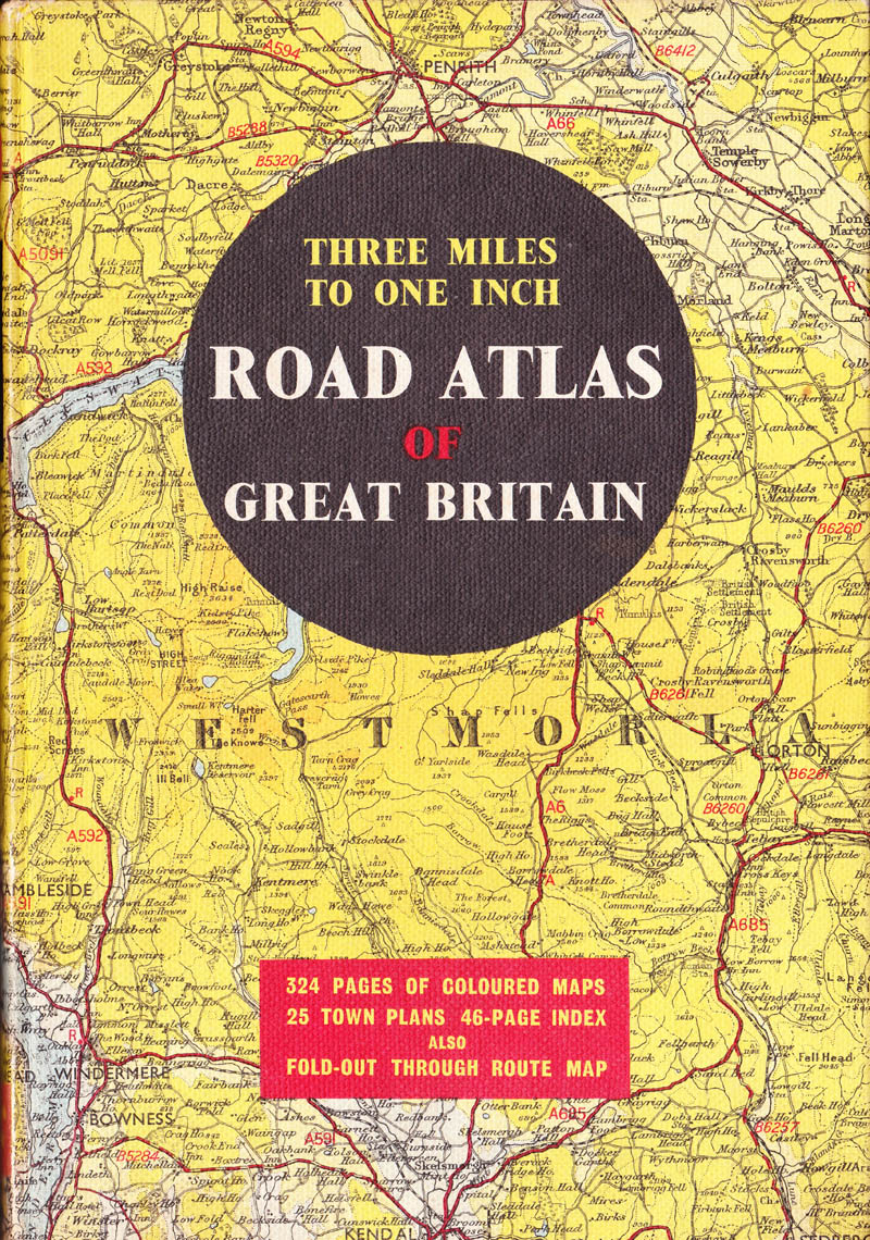
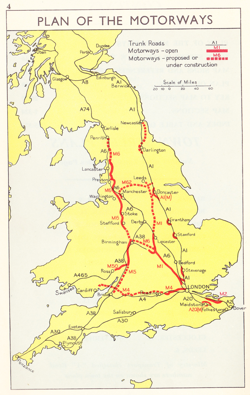
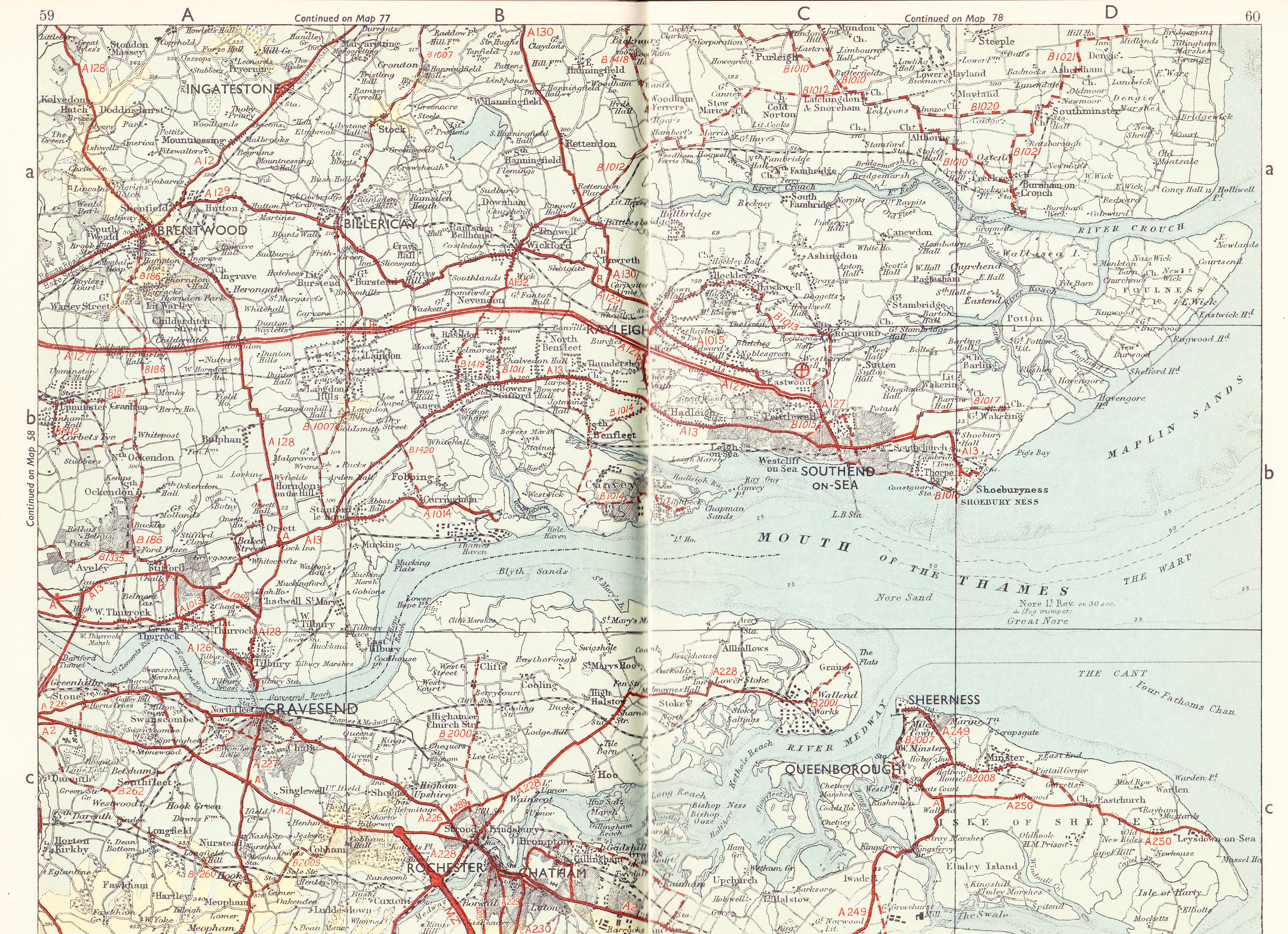
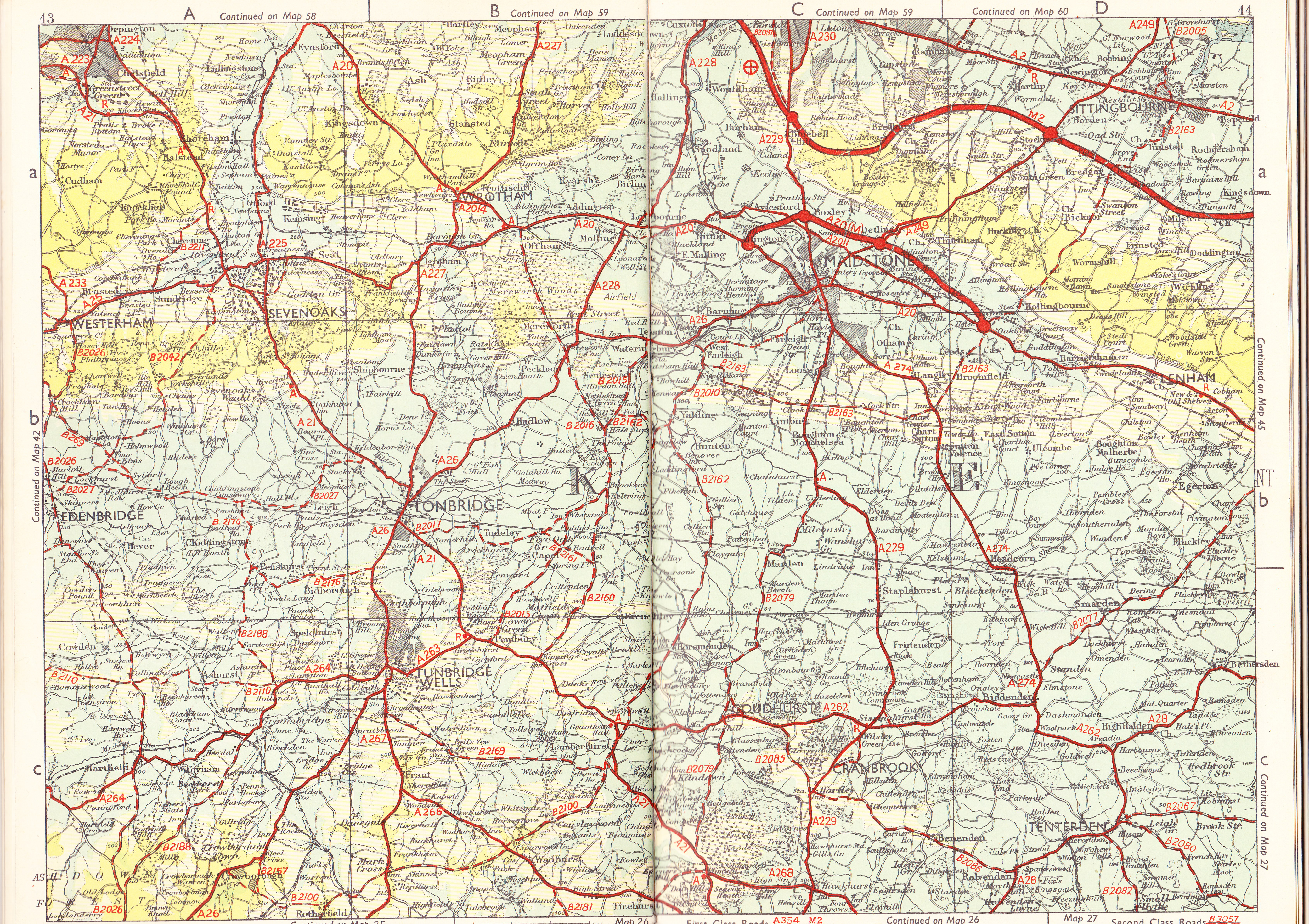
I found this old road atlas that covered the UK and showed the road network in Kent in 1964 when the M2 motorway had just been built and opened and the M20 was known as the A20(M) and only bypassed Maidstone from Allington to Hollingbourne. It's hard to imagine now but the M20 was only completed in 1989 to link Hollingbourne to Folkestone!
Road Atlas of Great Britain 1964 - Front cover
Plan of UK Motorways 1964
Start of M2 going off page
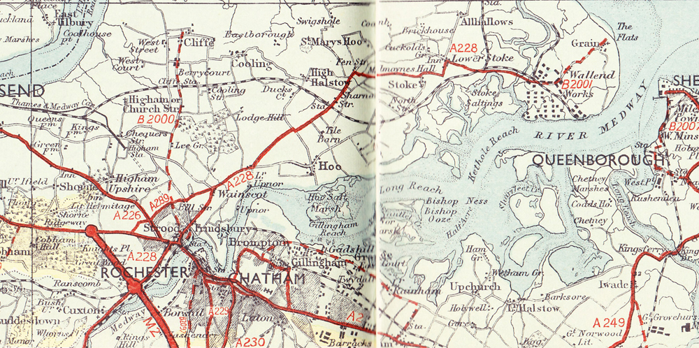
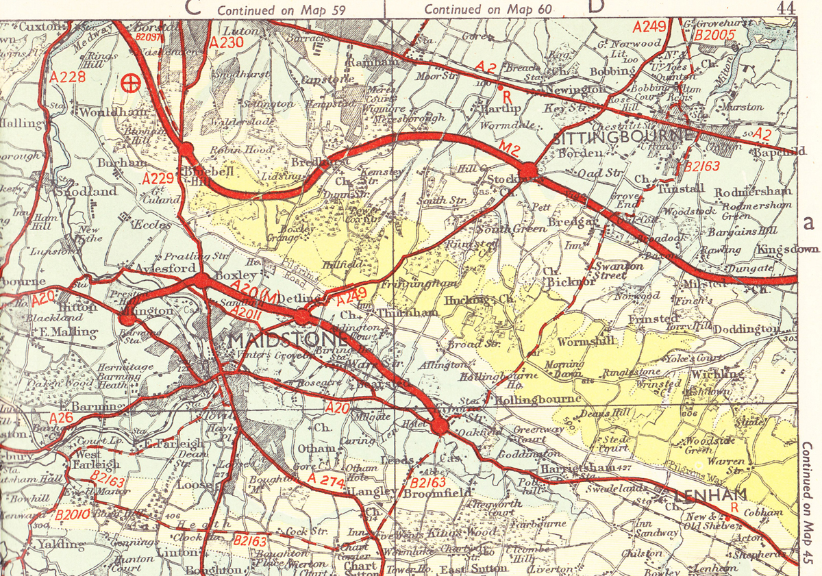
Map showing the new M2 opened in Kent 1964
Map showing the A20(M) Maidstone Bypass now known as the M20
The year began with a serious flu epidemic that affected thousands of people in the Medway area causing high levels of absenteeism from work and school. Blizzard conditions and heavy snow followed causing train cancellations, massive traffic jams, power cuts and severed telephone lines. It wasn't all bad news as Rainham Theatrical Society had staged a successful production of the pantomime 'Robinson Crusoe' to packed audiences at the Oast House Theatre, while Rainham Social Club thrived with tag wrestling matches and regular live bands. Rainham Ladies Choir also did well and at the Llangollen International Musical Eisteddford in Wales they finished sixth out of 24 participating choirs.
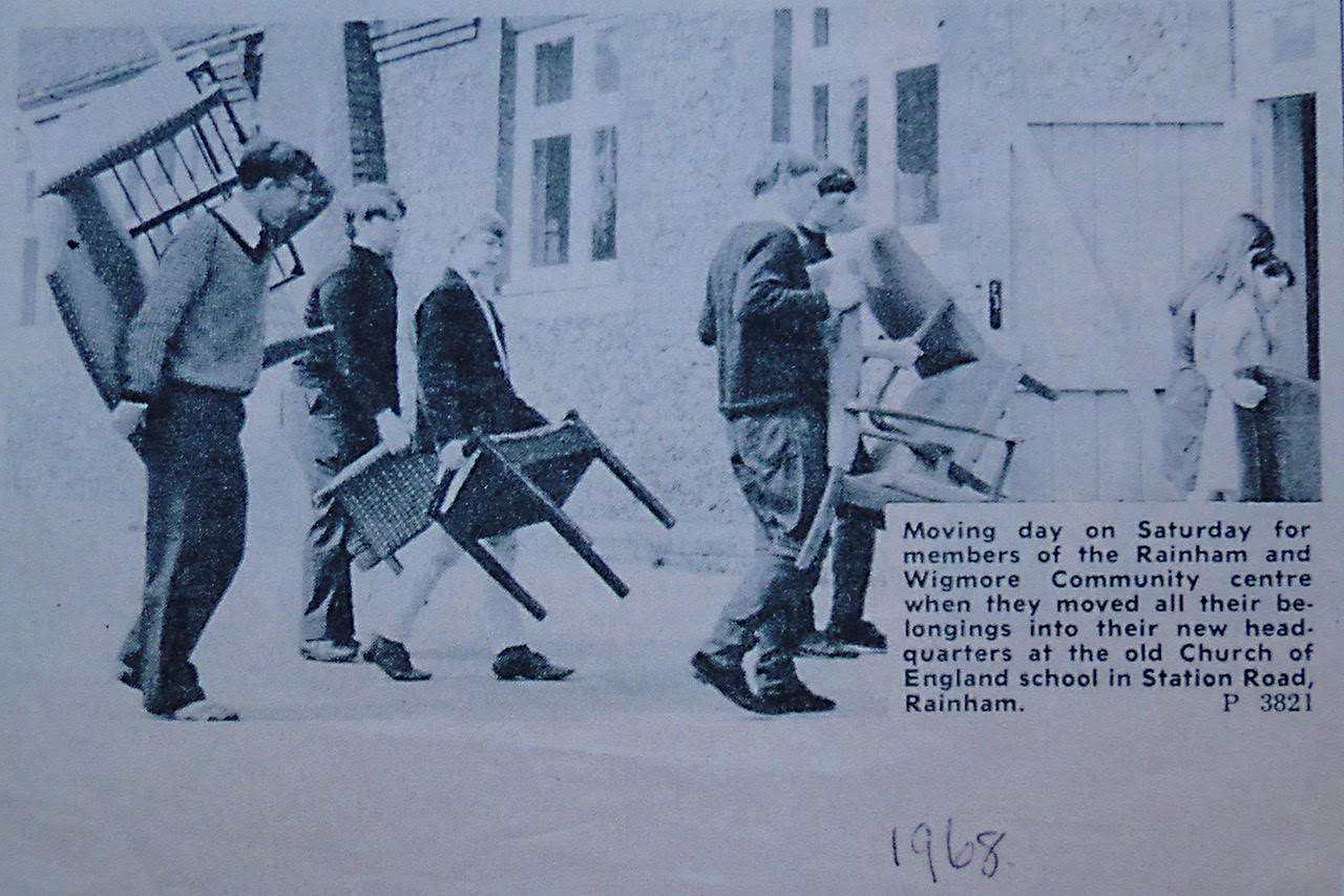
With expansion of the Parkwood Housing Estate and a rise in the local population, modern facilities were increasingly demanded. This led to the former Church of England School in Station Road being earmarked for demolition followed by the construction or Rainham Shopping Centre with a pedestrian precinct and car park as part of a redevelopment plan for central Rainham. Plans were also drawn up to redevelop Rainham Mark with more space for shopping. In June Gillingham Council bought the marsh near Motney Hill from the Rugby Portland Cement Company for development.
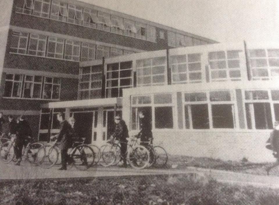
A new school known as the Howard School was constructed at Derwent Way and the teachers and pupils rrom Rainham Secondary Modern School in Orchard Street were transferred there in September. Pupils from the girl's school followed later after the construction of Rainham School for Girls on the same site. With the closure of the Church of England School in Station Road and the transfer of pupils to Orchard Street, the vacant building, which dated back to 1846, was bought by Gillingham Council and temporarily leased to the Rainham and Wigmore Community Association who organised social and recreational evenings at the premises. Local traders contributed 400 items of household furniture for use in the building.
In sporting affairs Rainham Cricketers FC won the Medway Area Sunday League Premier Division Championship and reached the final of the Kent Sunday Premier Cup but were defeated 4-0 by Cat ford United in the final. Rainham Youth won the Medway Minor League Championship while Rainham Football Club First XI finished fifth in the New Brompton League.
During the summer Rainham Cricket Club had an average season while girls from the Rainham Secondary School Athletic Club performed well. At the Faversham Gala Sports Meeting in June Jill Wesson won the 100 yards event and Carol Hooper won the Junior 100 yards. The junior relay team also finished first. Later, at the Bexley Sports Meeting Carol Hooper won three races while Jackie Mudge won the 220 yards event.
In October Rainham held its first ever trade fair which took place at Rainham Social Club attended by an estimated 4,500 people. Opened by the Mayor of Gillingham it proved highly successful. Films were shown, advice given on painting and decorating with dancing, hairdressing and butchery demonstrations and a fashion show.
The year ended with news that farmers Wakeley Brothers were planning to attract young men into farming by providing them with modern four bedroom houses in Rainham. The old nineteenth century cottages which housed Wakeley Brothers workers lacked modern amenities with outside toilets and no bathrooms. By December 1968 twelve new houses were constructed for the farm workers and six of these were situated in Otterham Quay Lane. This ended an important year in the history and development of Rainham.
David Wood
Historical tales
Rainham Life
Local Events
Photos
Roads around the Rainham - old photos of how roads used to look in days gone by
Old photos by decade
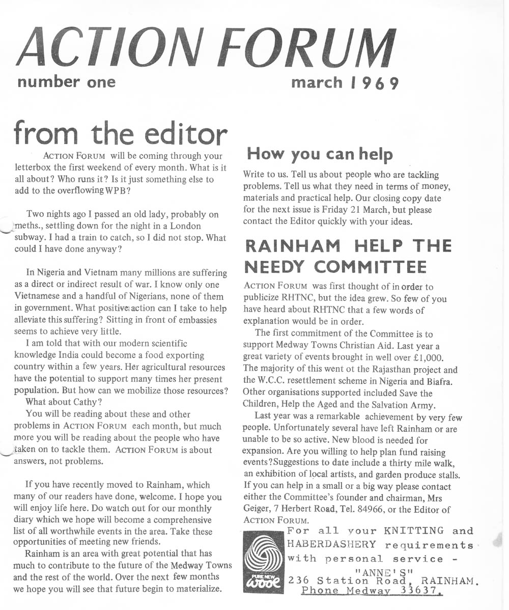
Action Forum is a free monthly magazine that is distributed to the Rainham area covering Wigmore, Parkwood and Hempstead as well. This archive covers old copies of the magazine dating back to its initial publication in 1969 and give a fascinating glimpse into life in Rainham over the last 50 years.
Link to Article Index - Action Forum Index - Photos and Articles from 1969 onwards

Action Forum 2024 magazines
Action Forum 2023
Action Forum 2022
Action Forum 2021
Action Forum 2020
Action Forum 2019
Action Forum magazines from 2018
Action Forum 2017
Action Forum from 2015
Action Forum magazines from 2014
Action Forum 2013
Action Forum 2012
Action Forum magazines from 2011
Action Forum magazines from 2010
Action Forum magazines from 2009
Action Forum magazines from 2008
Action Forum magazines from 2007
Action Forum magazines from 2006
Action Forum magazines from 2005
Action Forum magazines from 2004
Action Forum magazines from 2003
Action Forum 2002
Action Forum 2001
Action Forum - 2000
Action Forum 1999
Copies of Action Forum from 1991
Action Forum 1981
Action Forum 1975
Action Forum 1973
Action Forum 1971
The first year of publication
Link to Article Index - Action Forum Index - Photos and Articles from 1969 onwards
Text from Action Forum for Google indexing
Link to Article Index - Action Forum Index - Photos and Articles from 1969 onwards
.jpg)