
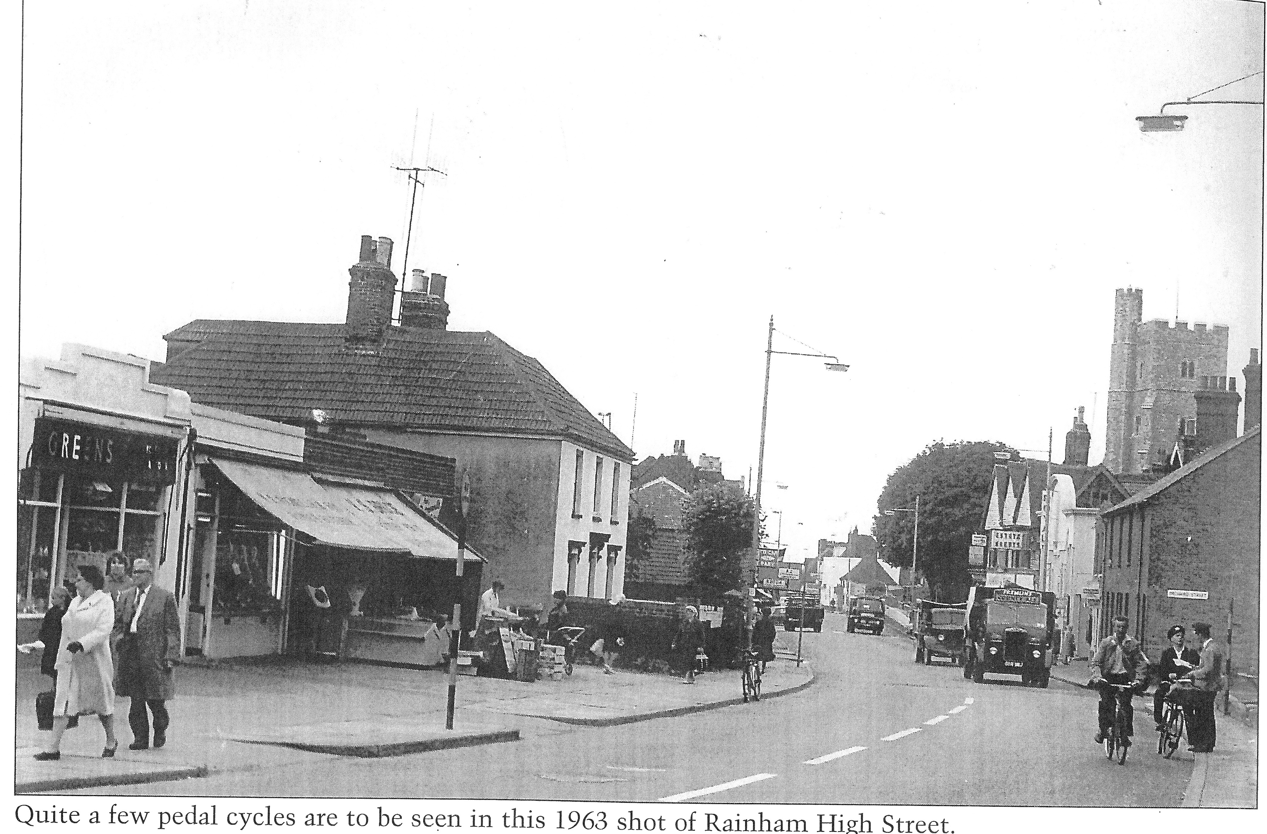
This fascinating photo of Rainham High Street taken in 1963 was kindly provided by Joe Ennis and is one I've not seen before.
There are some notable landmarks visible in the photo. Firstly on the left hand side there is a large house at 69 High Street that was called Coningsby House and a forge that was demolished to make way for Rainham Shopping centre. The shops that are now Nutmegs and Greyfox Estate agents are visible on the left of the picture.
On the right hand side you can see the road sign for Orchard Street showing that the Natwest bank was not built at this time. Next to that is the Royal Cinema known as the Bug Hutch - read more here about the Bug Hutch Rainham - Royal Cinema
There is a lorry with the words Fremlins County Ale on the front passing by the cinema. You can see Estate agents sign in the distance which would be Harris & Bone
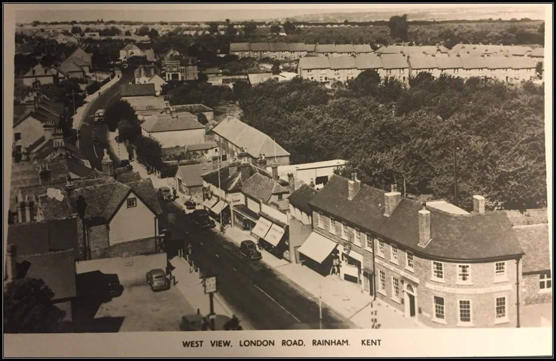
A slightly earlier photo of Rainham High Street looking in the opposite direction gives an idea of the area covered by the picture above. The house now demolished is surrounded by trees in front of it towards the top left of the image.
- Details
- Category: Rainham Roads
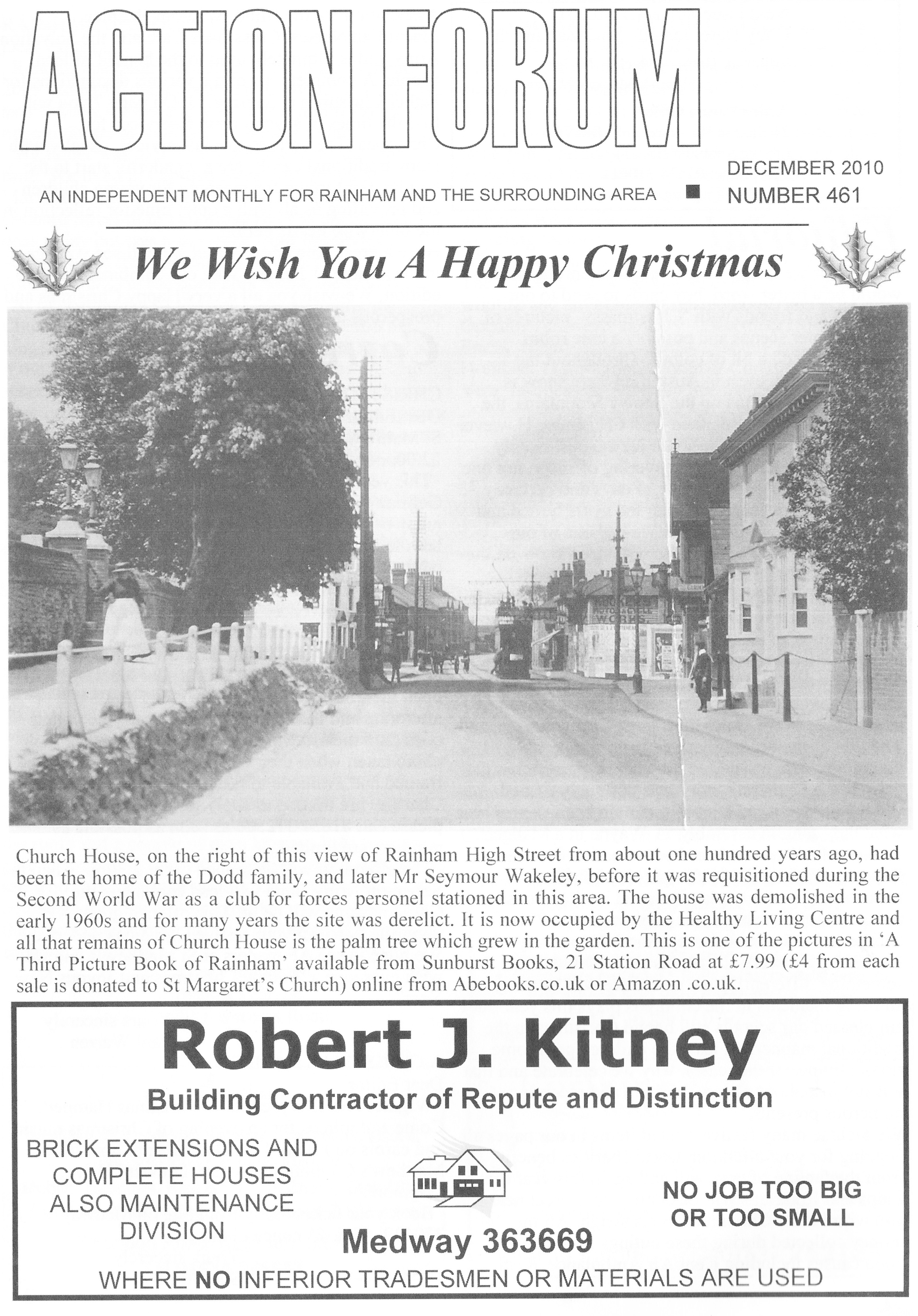
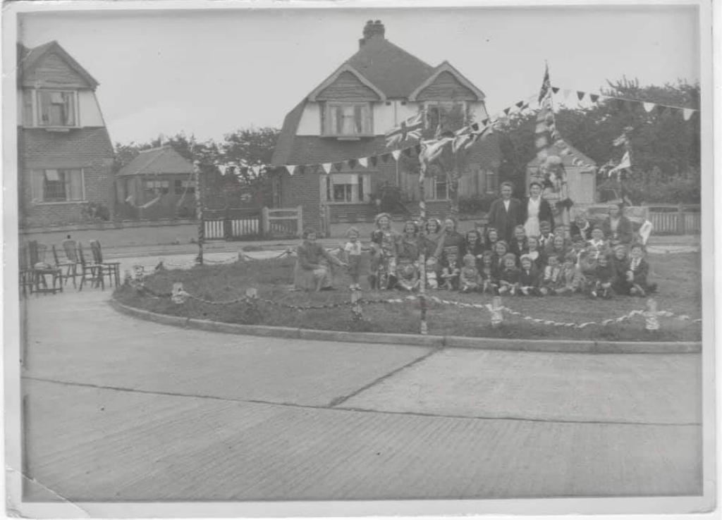
Church House, on the right of this view of Rainham High Street from about one hundred years ago, had been the home of the Dodd family, and later Mr Seymour Wakeley, before it was requisitioned during the Second World War as a club for forces personnel stationed in this area. The house was demolished in the early 1960s and for many years the site was derelict. lt is now occupied by the Healthy Living Centre and all that remains of Church House is the palm tree which grew in the garden. This is one of the pictures in ‘A Third Picture Book of Rainham‘ available from Sunburst Books, 21 Station Road
- Details
- Category: Rainham Roads
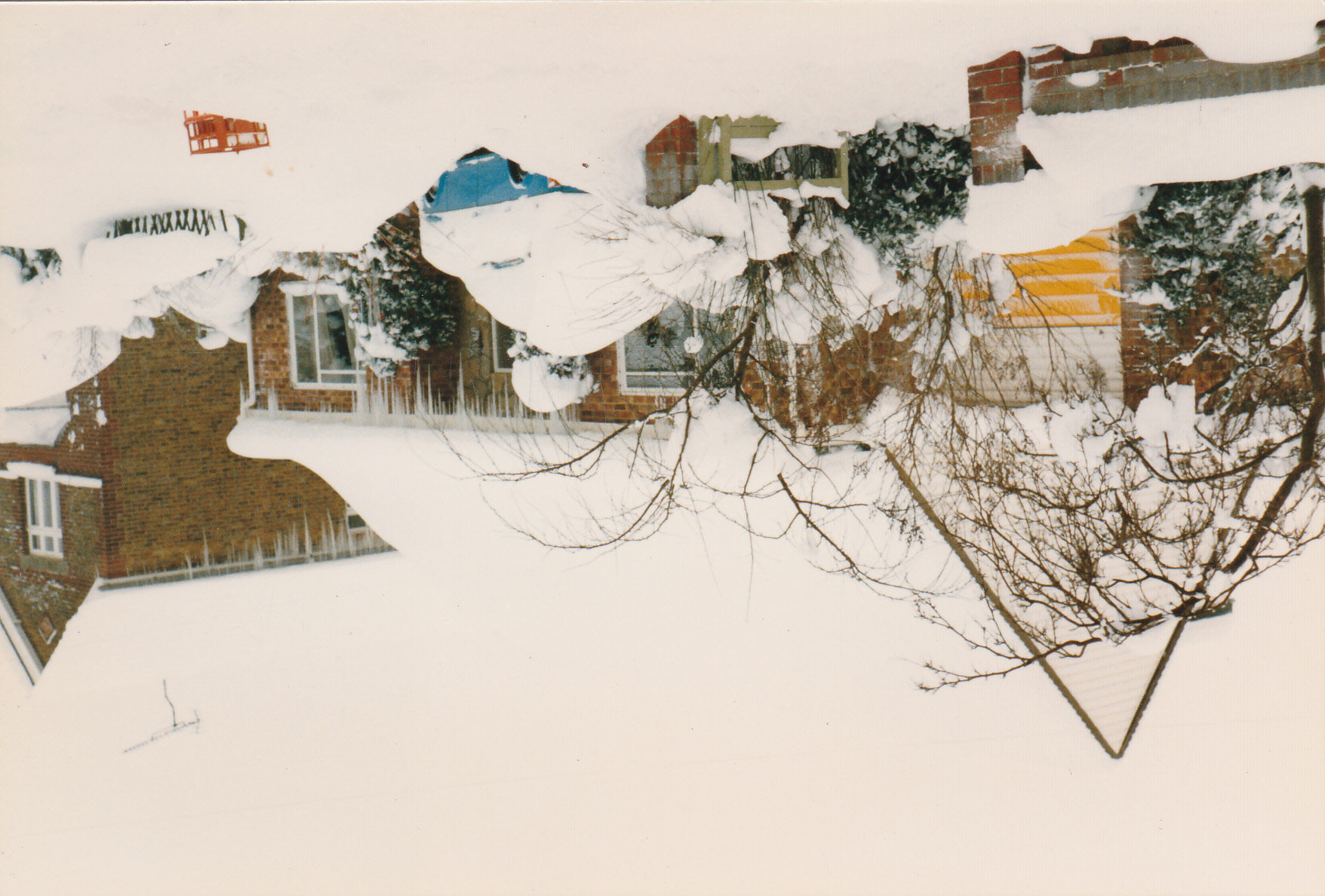
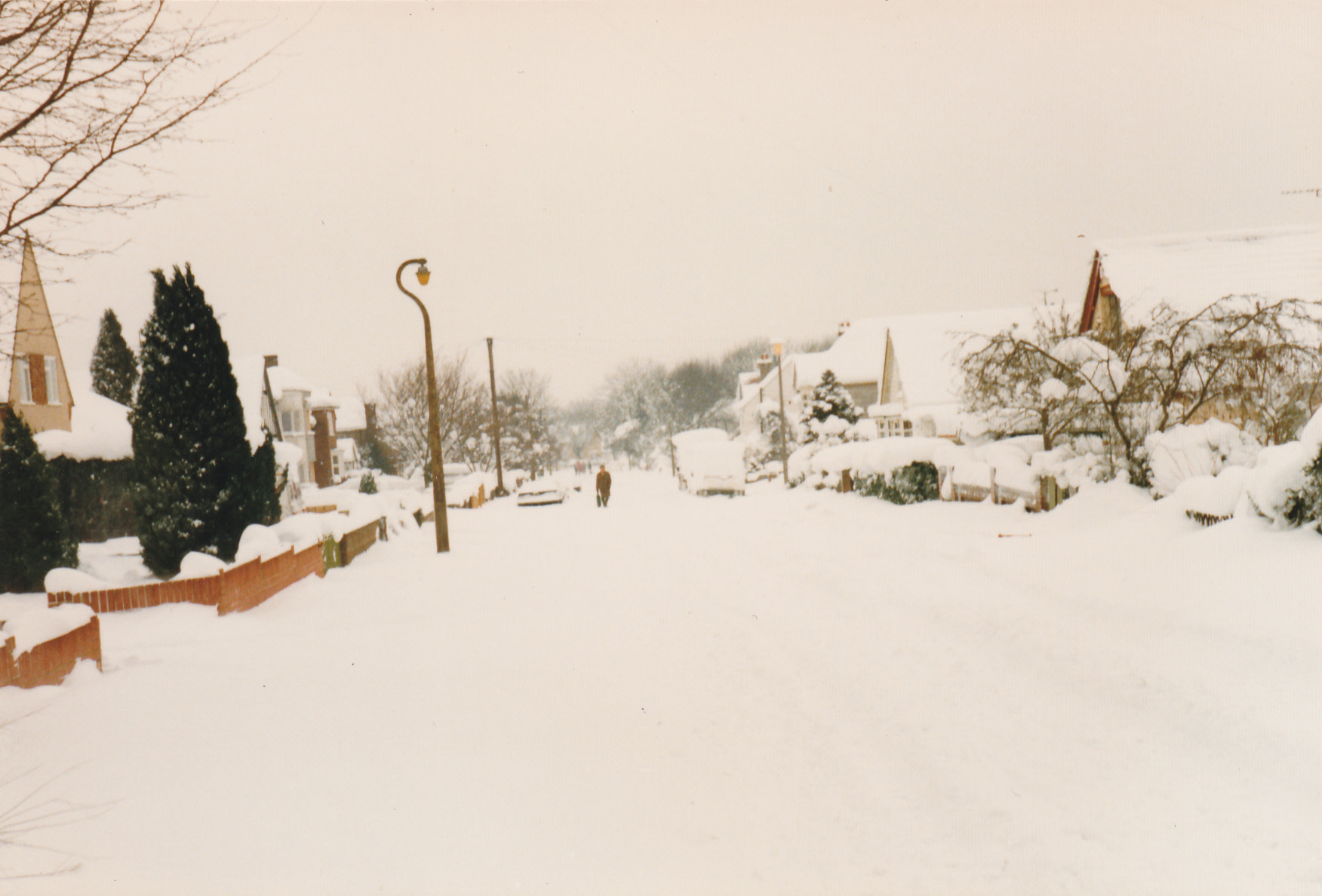
The winter of 1987 was particularly hard with some very heavy snowfall that cut off parts of Kent for a number of days due to the roads becoming blocked. These photos of Marshall Road Rainham Kent show the height of the snow at the front door as well as the cars and roads buried underneath the volume of snow that fell.


- Details
- Category: Rainham Roads
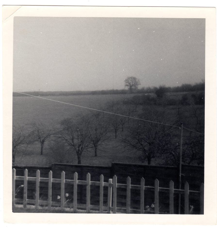
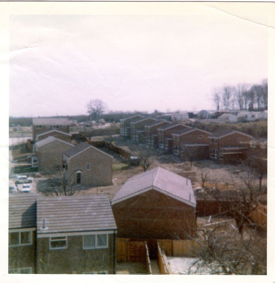
This photo is of Lonsdale Drive Rainham looking towards cherry orchards (hence the name of Cherry Tree Road nearby) and showing the same scene after building. You can see the same tree on the horizon to get an idea of perspective and position.
- Details
- Category: Rainham Roads
- You are here:
-
Home

-
About Site
-
History Articles
-
Photos
- Rainham Roads
FROM PUMP TO RUSSETT(sic)
")
Things Aren't Always What They Seem - Tudor...

Christmas in Rainham in the 1950s

PARLIAMENTARY RECOGNITION FOR RAINHAM

THE BARGAIN HOUSE Rainham Kent

Rainham Kent Snow Photos from 1987:Winter 1987/88 Snow...

Greens of Rainham/Medway Mercedes - Photos of Site...

Savacentre/Hempstead Valley Shopping Centre 30th Anniversary

Jezreel's Tower, Gillingham, Kent

The Ever Changing Face of Rainham

Hop Picking Pictures and Notes from John Godfrey...

THE GREEN LION PUBLIC HOUSE by Hazel Staden...

COUNCIL ACQUIRES EAST HOATH WOOD

LAST PRIZE FIGHT TOOK PLACE HERE by Freddie...

The Real Edmond Drake, Vicar of Upchurch, Father...

Rainham's War Memorial by Paul Bishop

Rainham A Century Ago by Freddie Cooper (Part...
")
THE CHANGING FACE OF RAINHAM Kent (Part 1)...
")
THE CHANGING FACE OF RAINHAM Kent (Part 2)...
")
Dene Holes found in Rainham, Kent

WATTS THE CHEMIST

How Was Berengrave Lane so named? ...

The Lord Stanley Pub

THE LORD STANLEY Public House Upchurch
Rainham Mark, Belisha Beacon, Hop and Vine pub...
Rainham Telephone Numbers

Upchurch Pottery & Tudor Cafe Rainham

Historical Photographs of Rainham, Kent Gallery 4

Rainham Kent Photos from Peter Hales
Pictures of Rainham Kent taken from St Margarets...

Recent Rainham Kent Photos

Gillingham Northern Relief Road A289 & Medway Tunnel...

Old Photos of Wigmore Kent

Historical Old Photos of Gillingham Kent

Photos of Rainham People from Bygone Times

Channel Tunnel Rail Link

Thai Chilli Restaurant at the Green Lion

Local Documents about Rainham

Costs of Building in Woodside,Wigmore 1939

Savacentre/Hempstead Valley Shopping Centre 30th Anniversary

Rainham Kent Snow Photos from 1987

Tudor Cafe - Menu 1938
Friends of St Margaret's Church, Rainham, Kent

Water Saving Ideas to Beat The Drought and...

Programme for Rainham Horticultural Society Show 1957

Maps of Rainham Kent

Local Events
Beneath Your Feet

Manor Farm has photos of wrong Rainham!

View From Rainham to Isle of Grain
Rainham Police Station

A Drive Through Rainham Kent

Walk From Hempstead towards Chatham

Foxborough Woods Parkwood Rainham
Rochester Dickensian Christmas
Rochester Traditional Christmas Market 2011 at Rochester Castle...
Restaurants in Rainham 2010
Memories of Rainham - Part 1 by Colin...

Memories of Rainham - Part 2 by Colin...

The Keg Boys - In Memory Of Stan...
Remembrance Sunday Service & Parade Rainham

Rainham Kent History Forum
Mystery Photographs - Berengrave Lane Rainham 1900s
Southern Water/South East Water Drought

Finds in St Margarets Church Rainham Kent

Shops in Hempstead Valley Shopping Centre 2012

1987 Hurricane/Great Storm in Rainham Kent

The Queens Head Pub Wigmore/Harvester Restaurant Rainham

Snow in June 1989 (or was it!)
")
Nineteenth Century Rainham - Health Reforms after Scarlet...

MEMORIES OF RAINHAM by Doug Kitney

MEMORIES OF RAINHAM Part 1 by Doug Kitney...

The Sheppey Crossing and Kingsferry Bridge History

Rainham School for Girls

Rainham Vicarage & Parsonage

Theatre Royal Chatham

Photos of Rainham in 2001
Rainham Snow 2010

Tesco Bowaters Ball (Water Tower)
")
Photos of 1987 Hurricane in Rainham Kent
MEMORIES OF THE FINAL YEARS OF COZENTON FARM,...

Newspaper Front Pages from the 1980s
LOCAL NATURE RESERVE STATUS FOR FOXBURROW WOOD

Medway Chinese New Year Parade 2012 in Chatham/Rochester...
Rainham A Century Ago by Freddie Cooper (Part...
")
Parkwood Wards Homes Sales Brochures and Promo Leaflets...

The Iron Lady - Newspaper Headlines from the...
Newspaper Front Pages from the 1980s Part Two...
M2 Motorway Widening / Channel Tunnel Rail Link...

The Producers - New Musical from Stage Theatre...

Growing up in Rainham in the 1940s

Falklands War Daily Newspaper Headlines
Rainham Golden Jubilee Parade - June 2002

View from Rainham Church 2012

Photo of Perks grocers Longley Road Rainham ...

My Childhood Memories of Rainham by Vernon Verrall...

The Rose Public House Rainham
Rainham Football Club 1920s

Privacy Policy
Twydall Kent in 1960s

Rainham History Facebook Page
Rainham Kent Snow Photos 1987
Music in the 1980s - Home taping is...

High Speed 1 - HS1 Railway Line Construction...

Rainham Snow 1979

Rainham Snow 1983
Siloam Farm Rainham

Old Petrol Filling Stations in Rainham

Moor Street A2 Rainham Kent

Rochester Sweeps Festival Programme of Events 2013 -...

Rochester Sweeps Festival 2014 - Programme of Events...
Rochester Sweeps Festival 2013 Morris Teams/Dance Sides

Rainham Church Bells 1913

A249 Sheppey Crossing Bridge - Kingsferry Bridge Kent...

Church School Station Road Rainham

Childrens Toys 1900s Rainham

1987 Hurricane Newspaper Headlines

Jacobs Shop - 6 Station Road Rainham Kent...

Holmwood, 27 Wigmore Road, Wigmore, Gillingham

Terrys Dairy Wigmore Hempstead Kent

Manor Farm Pub Beefeater Gas Showroom Rainham

Old Police Station Rainham Kent
Origins of Rainham Street Names

A History of Berengrove Park

Otterham Quay in 1900

Founding of Rainham Recreation Ground

Providence Chapel Orchard Street Rainham Kent 1884

Arthur Percy Light of Gillingham Kent (HMS Hogue)...
")
The Railway Pub, Station Road, Rainham

Rainham in the 1880s

SinkHole/Dene Hole at Rainham Mark Grammar School Kent...

Memories of Well-Known Orchard Street School Teachers

Early Years of the Rainham Flower Show
Rainham Cricket Club 1902
Richard Mansfield Wakeley Junior
Rainham in the Years Leading up to First...

White Horse Pub Rainham Kent
Old Photos of Cricketers Pub Rainham Kent

Broad Walk Rainham

The Upchurch Railway Train Crash Disaster of August...

John Richardson-World War Two Pathfinder Hero and Rainham...

Rainham in the 1850s

The First Rainham Youth Football League Champions

Rainham in the late 18th Century

Bug Hutch Rainham - Royal Cinema

Sir Cecil Wakeley – Famous Surgeon

Rainham Kent Snow Photos from 1987:Winter 1987/88 Snow...
Old Photographs of Rainham, Kent from 1900s

Old Photographs of Rainham, Kent - 1950s
Old Historical Photographs of Rainham - 1920s and...

Historical Photographs of Rainham, Kent Gallery 4
Rainham Kent Photos from Peter Hales
Pictures of Rainham Kent taken from St Margarets...
Recent Rainham Kent Photos
Gillingham Northern Relief Road A289 & Medway Tunnel...
Old Photos of Wigmore Kent
Historical Old Photos of Gillingham Kent
Photos of Rainham People from Bygone Times
Channel Tunnel Rail Link
Savacentre/Hempstead Valley Shopping Centre 30th Anniversary
Rainham Kent Snow Photos from 1987
Old Photos of Smallholders Club Wigmore Rainham Kent...

Pictures of Woodside Road, Wigmore

Old Photos of London Road Rainham Mark Kent...

Old Photos of High Street Rainham Kent

Bygone Old Photos of Marshall Road Rainham Kent...

Old Photos of Berengrave Lane Rainham Kent
Old Photos of Rock Avenue Gillingham Kent


Old Photos of Bredhurst Road Wigmore Gillingham Kent...

Old Photos of Ivy Street Rainham Kent

Old Pictures of Historic Hempstead kent

Construction of The Goldings Rainham 1980

Where was Broadwalk Rainham?

Old Photo of Moor Street / High Street...
Theatre Royal Chatham
Photos of Rainham in 2001
Rainham Snow 2010
Photos of 1987 Hurricane in Rainham Kent
Newspaper Front Pages from the 1980s
M2 Motorway Widening / Channel Tunnel Rail Link...
Rainham Kent Snow Photos 1987
Rainham Snow 1979
Rainham Snow 1983
William Keutenius - Fire Officer Rainham Kent
