
The blueprint for Rainham Shopping Centre was developed during the 1960s as part of a grand plan to revitalise the centre of Rainham and make it pedestrianised by building a bypass to take the A2 traffic away from the town. Until then shops had been spread out along the A2 and Station Road with the associated difficulties of deliveries and parking for customers which continue today!

The scheme went through many iterations from its intial airing in 1965 through a public enquiry and eventually only being partially completed. Similar plans for other parts of the Medway Towns were implemented with varying degrees of success so it's a moot point whether it was a good or bad decision overall.
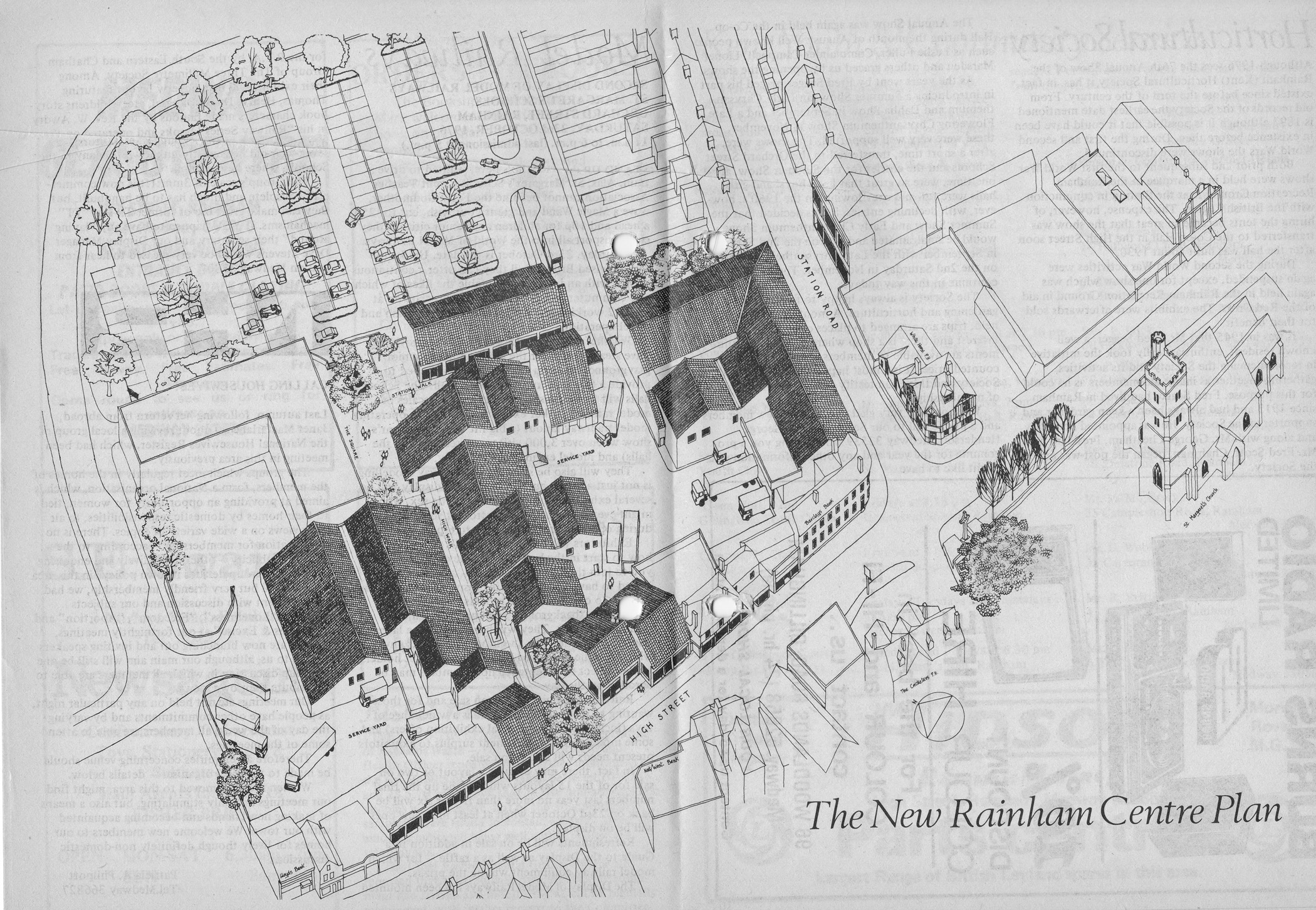
The map below is the 1972 version following public enquiry

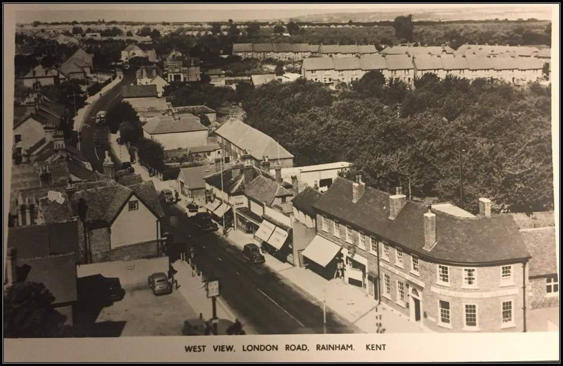
While the plans for just the shopping centre were approved the rest of the changes such as shutting the A2 for pedestrians and bypassing the centre were put on hold. The shopping centre plans required the demolition of the church school at the top of Station Road (see Church School Demolition 1977 (Station Road now Rainham Shopping Centre) and some businesses that were on the A2 opposite Orchard Street. This 1950s photo shows the area now covered by Rainham Shopping Centre. The woods are some of the shops and car park. The church school is to the right of the old Barclays Bank. The large house (Conningsby House) opposite Orchard Street was now demolished and the forge/car dealership was also demolished to make way for the pedestrian entrance to the shops from the A2.
The map below shows the plan for the shops at the time they opened in 1978. All the darker grey roofed buildings are the new ones built for the shopping centre.
Below: Rainham Church school that was demolished to make way for the shopping centre
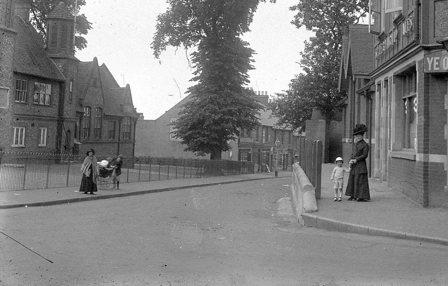
Below: The Church School at the top of Station Road was demolished to make way for the centre. More photos here: Church School Demolition 1977 (Station Road now Rainham Shopping Centre)

Below: Construction of the shopping centre in 1977

Below: Rainham Shopping centre under construction 1977

Below: The shopping centre in 1983 looking towards Holding Street. Note that the shops where Boyce's bakers are now haven't been built at this stage.

Aerial view of Rainham Shopping Centre in 1984

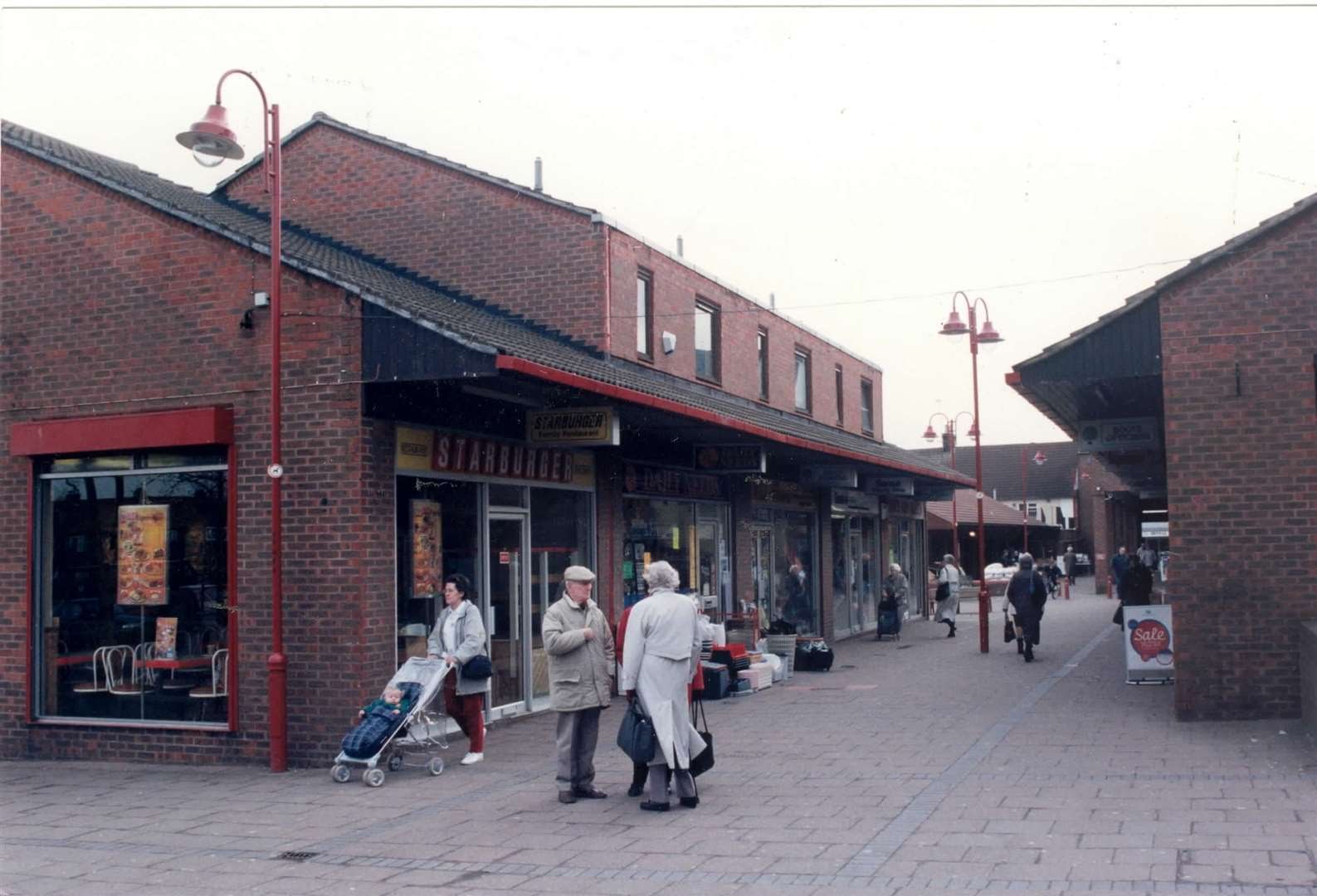
Below: Shopping centre in 1987 looking towards Station Road. Star burger became the Star Grill.
The blueprint of the Rainham Plan was finally abandoned some 30 years after being proposed when the land reserved for the bypass, the Rainham Southern Relief Road was released for development in 1997. This led to the building of the houses in Gatekeeper Chase as well as the Millennium Centre behind St Margaret's church. The Missing Rainham Bypass - Rainham Southern Relief Road
Below: Photo of Rainham Shopping Centre in 2003
