
It's puzzled me when travelling around the area to see where Rainham ends and where Upchurch begins. It appears that the boundary has been rather fluid and may have extended to increase the desirability of new housing built off Otterham Quay Lane.
After crossing the railway line, about halfway down Otterham Quay Lane you see a sign that you're now in Upchurch.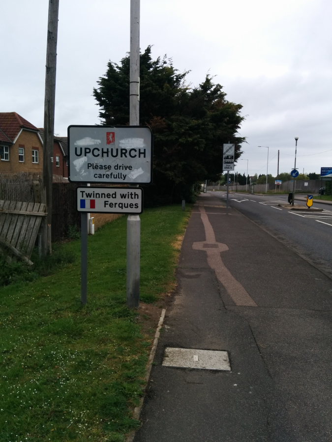
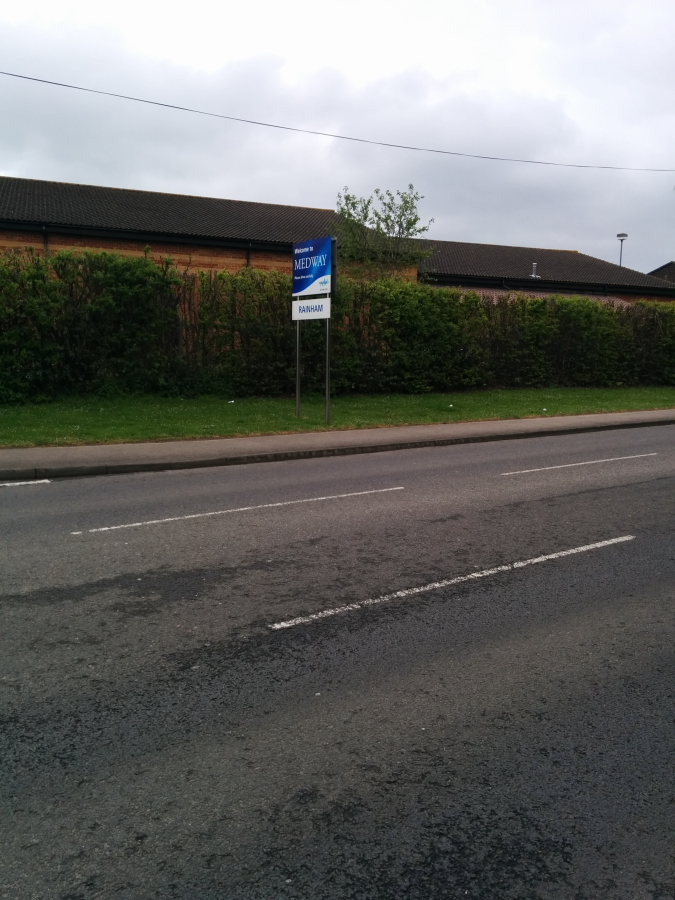
And to emphasise this on the opposite side of the road another sign welcomes you back to Medway and Rainham.
Even the new housing estate just past the sign shows it is part of the Borough of Swale - I bet they wished they were part of Rainham with the lower council tax!
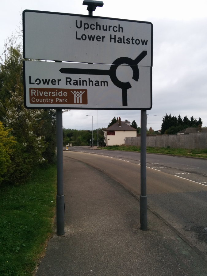
Yet further down the road - well past the sign that has already announced that you are in Upchurch, the sign by the Three Sisters pub shows that Upchurch is still further on.
So where does Rainham end and Upchurch start? Has it changed recently with the development of new estates? Was the Three Sisters pub always in Upchurch or was it originally considered to be part of Rainham?
- Details
- Category: Historical tales
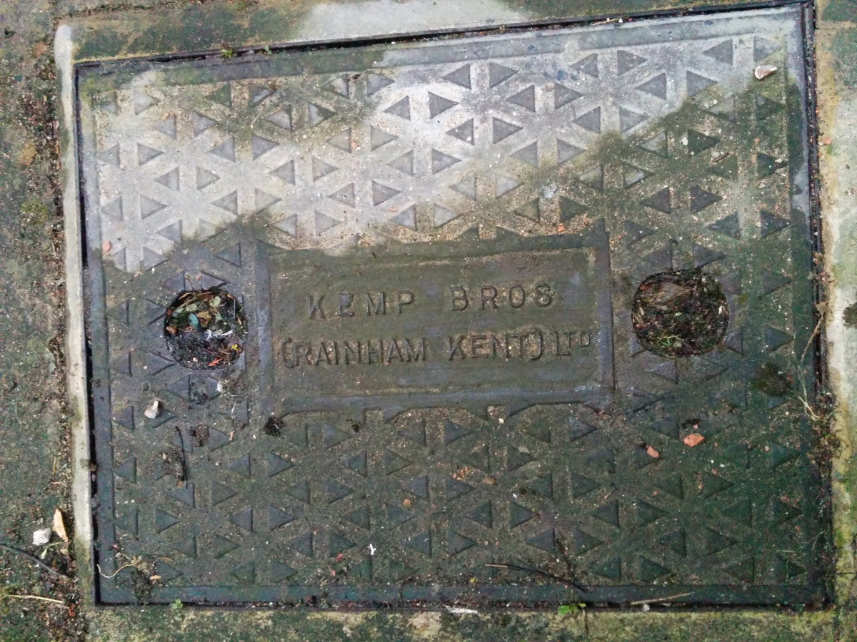
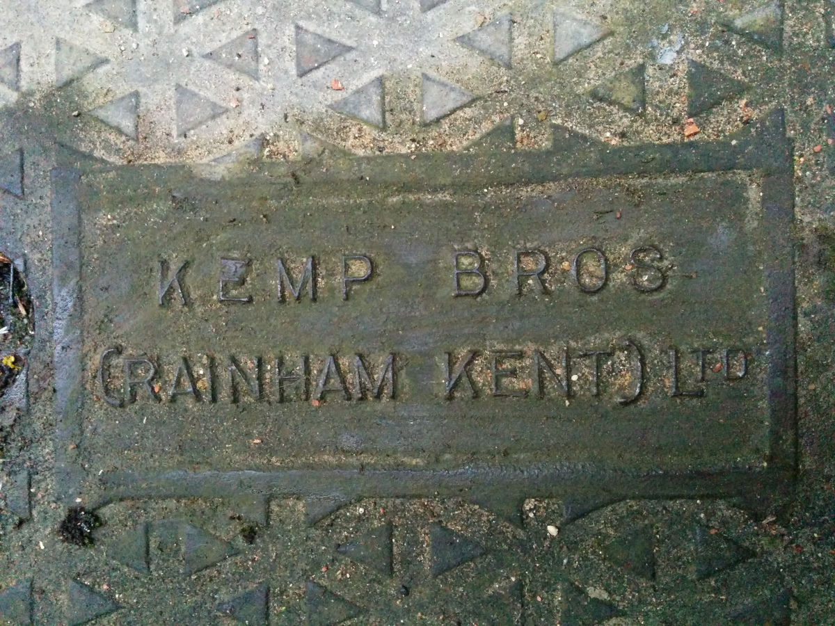
Kemp Brothers (Kemp Bros Rainham Kent Ltd) was a local building firm in Rainham that operated before the Second World War. Our house was built in 1935 and I spotted this manhole cover in our path. The signs of local history are all around us! Obviously Kemp Brothers were large enough to be able to commission their own cast iron drain covers.
- Details
- Category: Historical tales
Photo of Church School at top of Station Road Rainham Kent around 1900 with Ye Old White Horse pub on right hand side of photo. The Church school was demolished and the site is now occupied by Barclays Bank and Rainham Shopping centre (Wilkinsons)

- Details
- Category: Historical tales
- You are here:
-
Home

-
Photos of Rainham
-
Rainham Then and Now
-
History Articles
- Historical tales
-

Old Photos of Rainham in the 1970s
These photos of Rainham were taken in the 1970s prior to the construction of the shopping centre as ... -

Old Photographs of Rainham, Kent from 1900s
Photographs of Rainham, Kent This collection of photos are of Rainham Kent from the 1900s to around... -

Old Photographs of Rainham, Kent - 2000s
Photos of Rainham in the 2000s -

Old Photographs of Rainham, Kent - 1990s
Photos of Rainham from the 1990s View looking down Station Road towards Childscroft Road and parade... -

Old Photographs of Rainham, Kent - 1980s
Photos of Rainham taken in the 1980s -

Old Photographs of Rainham, Kent - 1960s
Photos of Rainham from the 1960s. This isn't a decade that is well represented so if you have any ph... -

Old Photographs of Rainham, Kent - 1950s
Old Historical Photographs of Rainham, Kent from the 1950s Belisha Beacon pub, now Domino's Pizza a... -

Old Historical Photographs of Rainham - 1920s and 1930s
Old Photos of Rainham Kent from the 1920s and 1930s Historical Photographs of Rainham, Kent: Galler... -

Farm Shop & Bayswater High Street Rainham 1987
The Farm Shop & Bayswater were located on 164/162 High Street Rainham. This photo was taken in 1...


