Savacentre/Hempstead Valley Shopping Centre 40th Anniversary

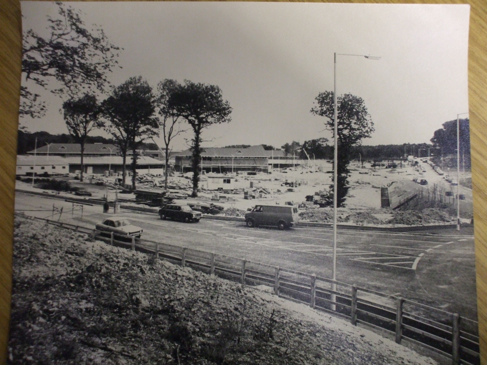
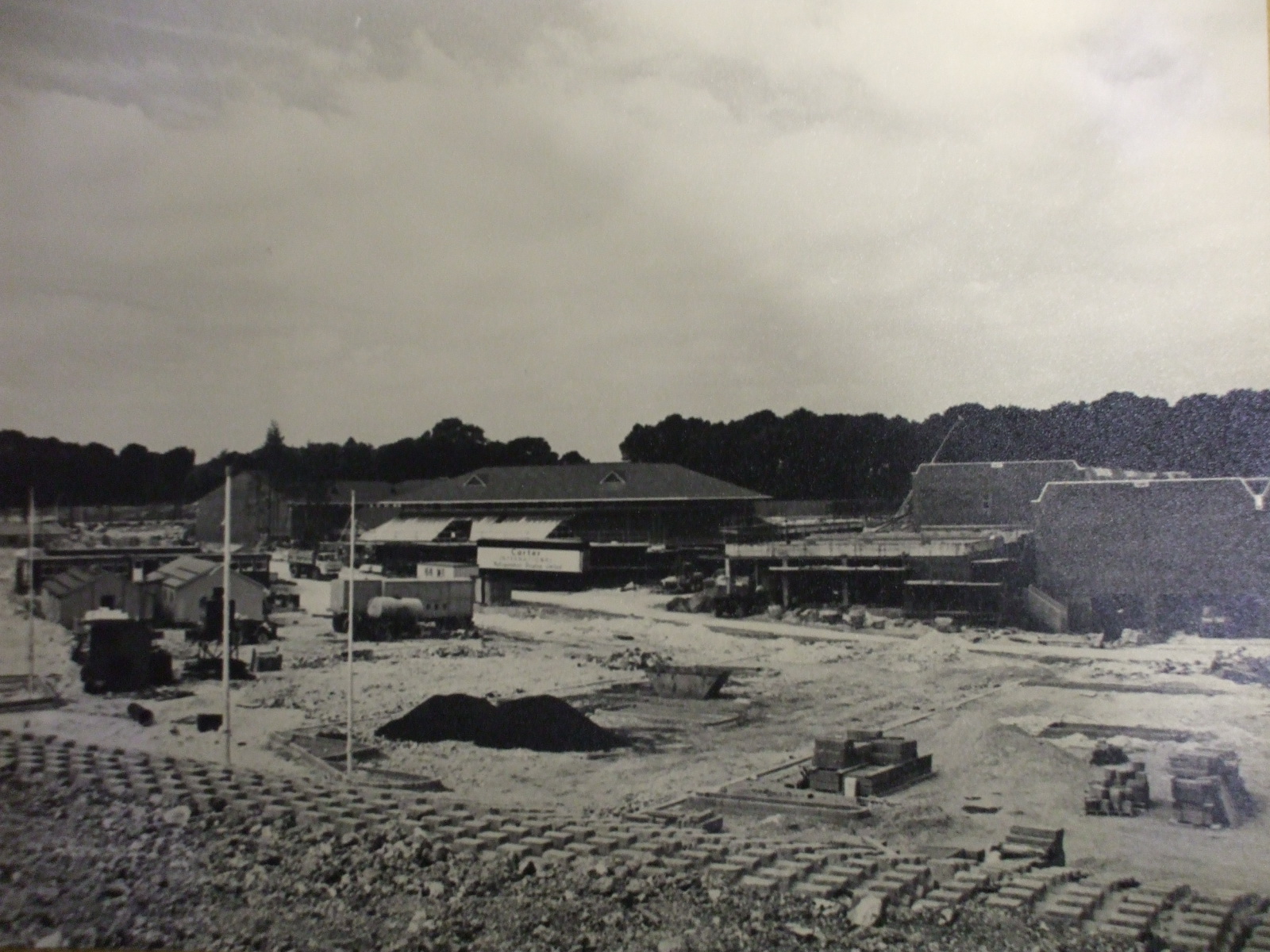
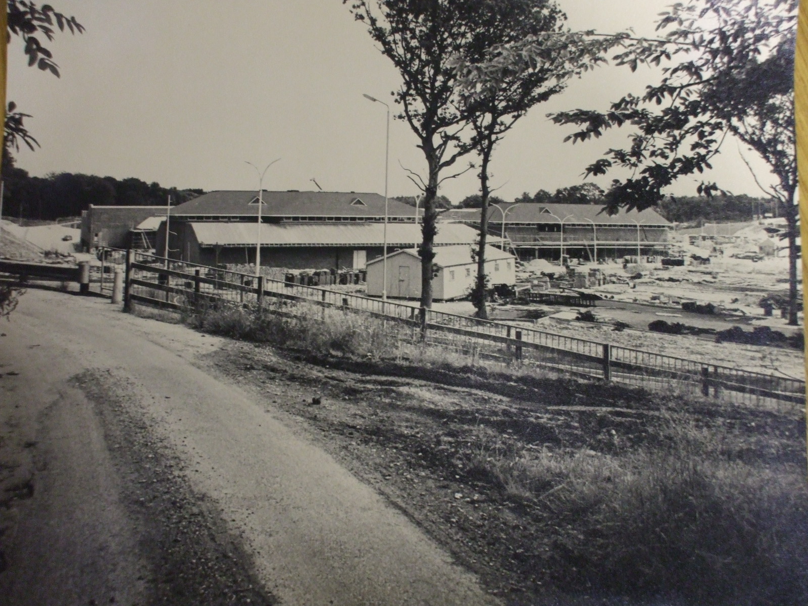
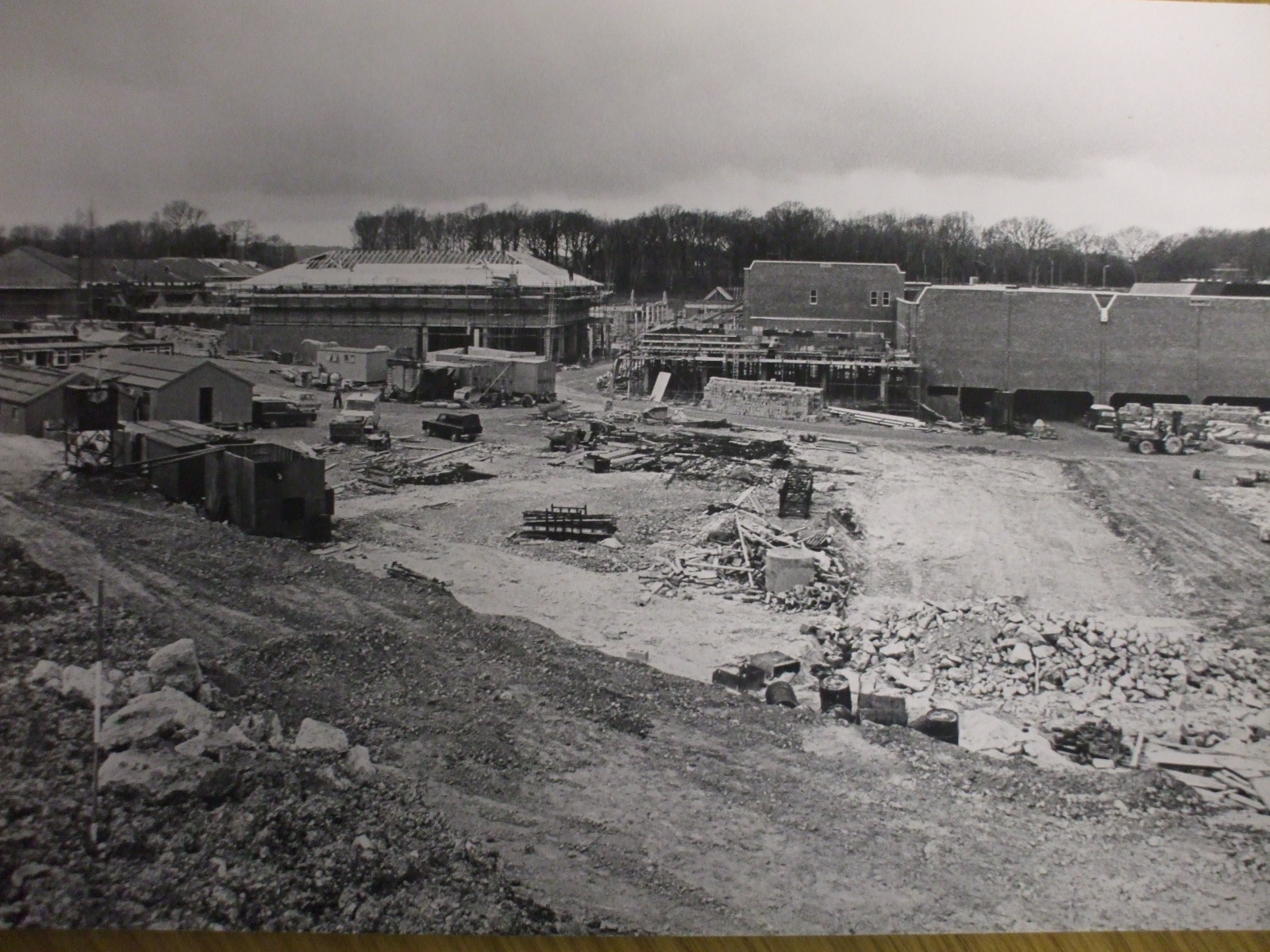
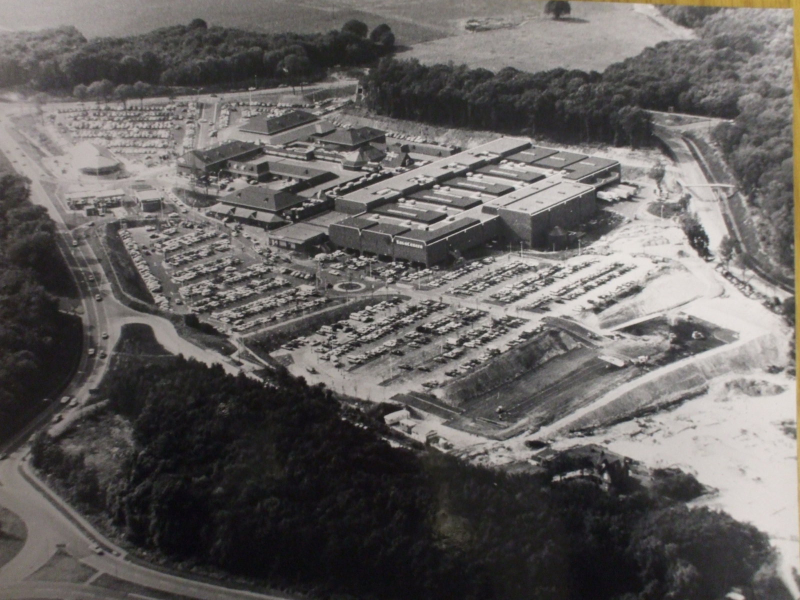
Hempstead Valley Shopping centre (aka Savacentre) near Gillingham Kent was constructed in the late 1970s just outside the village of Hempstead. It opened on 17th October 1978 so has just celebrated its 40th Anniversary in 2018. These photos showing the construction of Hempstead Valley were kindly sent by Chris Shade. You can see the large sign showing the original name of Savacentre. A current photo of Savacentre is shown on the Hempstead Valley website

Since the 30th anniversary in 2008 there has been significant redevelopment at the Hempstead Valley shopping centre to modernise areas of it. You can view the plans on the Hempstead Valley website here When it was completed in 2015 it made a huge difference to the appeal of the centre as a shopping and leisure destination with restaurants added outside.

What may seem commonplace now was groundbreaking in 1978 as there were very few other out of town shopping centres of this size at the time. Hempstead Valley was the second Savacentre (Washington Tyne & Wear opened in 1977). At the time of opening Savacentre was one of the largest out of town shopping centres in the South East. The original Picnic Parlour was the first Food Court in the UK. You can see more info about Sainsburys Savacentre here

When originally opened the main shop was Sainsburys Savacentre, the brand they originally created for their large hypermarkets. At the time Sainsburys was by far the largest supermarket in the UK with Tesco trailing far behind – a far cry from the current situation with Tesco leading the field. The originally Hempstead Valley offered 250,000 square feet of shopping space but when the centre was redeveloped in the early 1990s with an extension and new shops like M&S being added, this was increased to 330,000 square feet.

The challenge is to remember all the original shops that were there when the centre opens….Sainsburys, Presto (which then became Safeway) - but which others?
So far the following shops have been suggested for the original opening

NSS (Newsagents) then became Forbuoys
Our Price
Post Office (not one of the original shops)
Sainsburys Savacentre
Boots
Thomas Cook
Presto Supermarket
Wimpy Burger Bar
Spud-U-Like

Later additions when the extension was added in early 1990s were WHSmith, Marks & Spencer.

Notice in the aerial shot the area to the bottom right which was developed for large housing estates shortly after the shot was taken.

Photos on this page are clickable to view higher resolution versions.


Savacentre, Photos of Hempstead Valley Shopping Centre 1978:Looking towards Savacentre Hempstead Valley from roundabout

Looking towards Savacentre Hempstead Valley from roundabout


Petrol station would be to middle right of photo

Photos of Savacentre Hempstead Valley Shopping Centre 1978:Looking towards Hempstead Valley from Sharsted Way

Looking towards Hempstead Valley from Sharsted Way

Underground car park to right of shot, Abbey to left of shot

Photos of Hempstead Valley Savacentre 1978

Looking towards Hempstead Valley from roundabout
Petrol station would be to middle right of photo

Photos of Hempstead Valley Shopping Centre 1978: Looking towards Hempstead Valley from Sharsted Way

Looking towards Hempstead Valley from Sharsted Way
Underground car park to right of shot, Abbey to left of shot

Aerial photo of Hempstead Valley Savacentre 1978

Aerial photo of Hempstead Valley Savacentre 1980
Sharsted Way runs along left hand side of photo

Rainham Maps of 1869 & 1931 Compared to 2018 Planned Developments

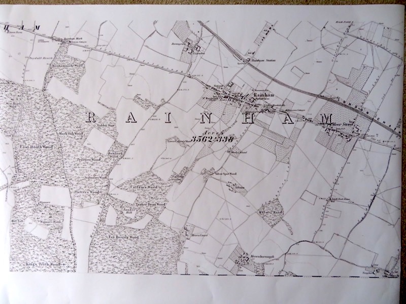
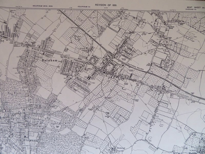
These are copie of the 1869 local OS map and an original 1931. It’s alarming to look at the total loss of the orchards and farmland even since 1931….which I suppose is getting on for 100 years ago now.
 
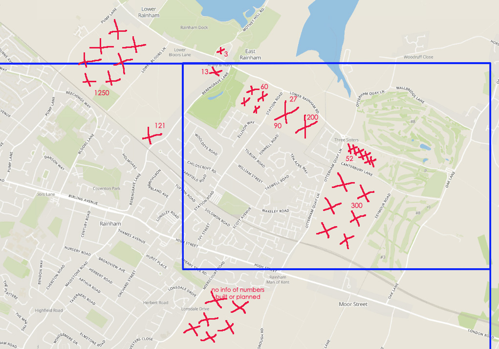
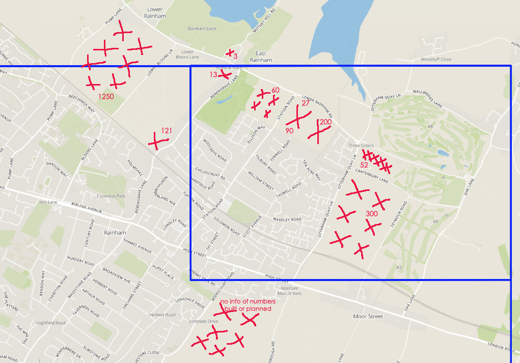
The third map shows the planned developments known about as of September 2018 - there are lots of new houses planned for Rainham, can it cope with such an increase?


Rainham Map - 1869


Rainham Map - 1931


Rainham Map - 2018 Planned New Housing Development


Planned Rainham Developments as of 2018

This is purely indicative, kindly produced by Maggie Francis
 
These seem to be the main development areas currently in the planning system (or newly completed). Doesn’t include the Methodist Church (9 flats i think) or Arcola Factory site on Station Road (6), nor the new conversion of Paynes on the corner of Solomon Road or other odd small bits and pieces!
 
Make scary viewing!

How Rainham Kent Street Road Names have changed over the years

HOW STREET NAMES HAVE CHANGED by Freddie Cooper from Action Forum, July 2004

The names of various roads in Rainham have changed over the years, some by accident and some by design. 

  • Maidstone Road was Bredhurst Lane
  • Meresborough Road was previously Almshouse Lane
  • Seymour Lane was Wakeley Lane & Moor Street Lane
  • Mierscourt Road has also had many changes; being Bush Lane then Chapel Lane
  • Salisbury Avenue was Hamilton Avenue
  • Asquith Road was Oxford Road
  • Durham Road was York Road
  • Hothfield Road was Shakespeare Road 
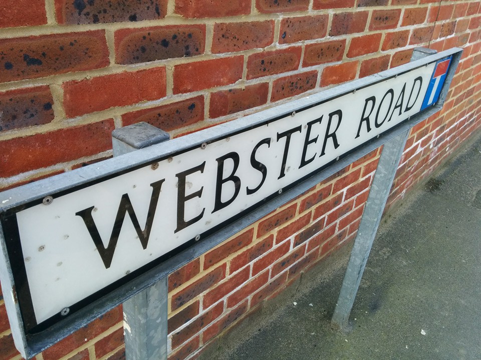
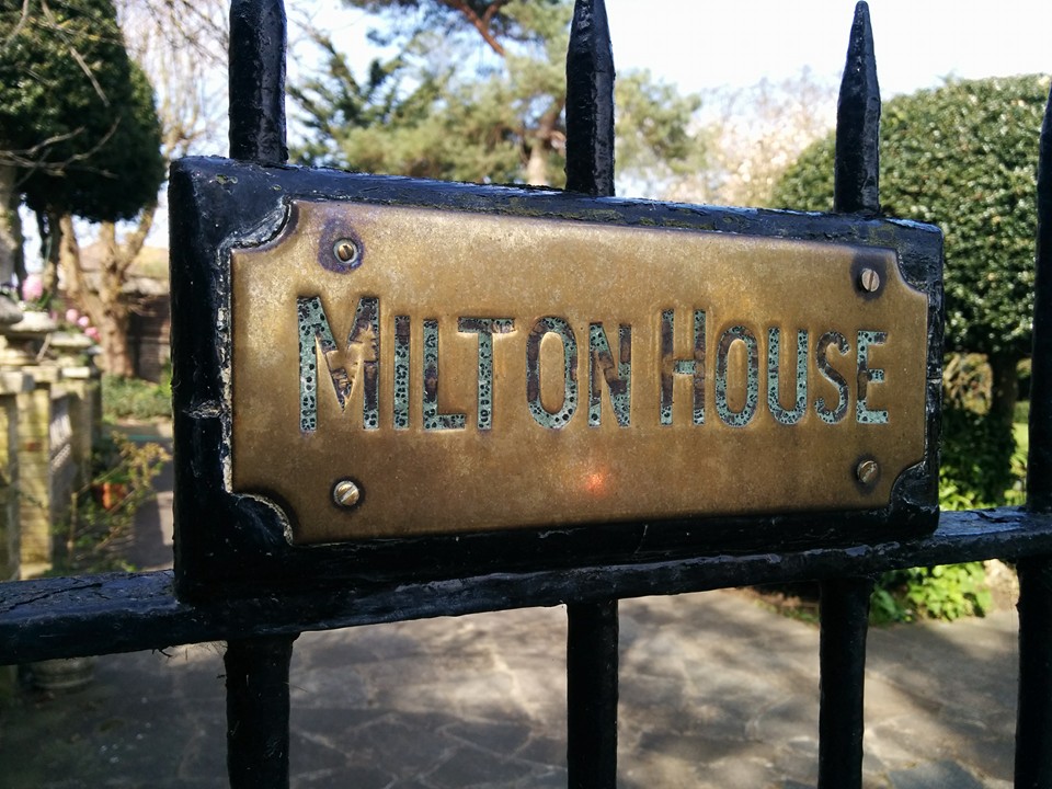
  • Webster Road was Milton Road 
  • Station Road was White Horse Lane
  • Broadwalk became High Street

How Rainham Kent Street Names have changed over the years

Starting at the eastern extremity, in 1867 the present Seymour Lane was Wakeley Lane and by 1901 it had become Moor Street Lane. There is obviously a close association with the Wakeley family who until very recently lived at the house on the corner of the Lane, which incidentally is the only property which has retained the ancient mounting steps by the front gate.

Coming a few hundred yards to the west, Meresborough Road was previously Almshouse Lane, said to have been associated with the alms-houses at the top of Otterham Quay Lane. Mierscourt Road has also had many changes; being Bush Lane then Chapel Lane after the congregational church was first built at the northern end, and then Meres Court Road which was changed for some mind-boggling reason to Mierscourt. At one time I had to draw attention in the press to the spelling at the bottom which was 'Miers' with another nameplate further up as Meres', the latter being more correct as obviously both this road and Meresborough were originally named after the de Mere family who had estates in the area. In some maps Mierscourt is combined, in others it is two separate words.

Maidstone Road was Bredhurst Lane at one time, and in 1929 when Rainham was absorbed into the borough of Gillingham, all roads in Rainham which had a similar name to those within the Gillingham area were altered to avoid misunderstanding. Thus Hamilton Avenue became Salisbury Avenue, Oxford Road became Durham Road, and Shakespeare Road became Hothfield Road. The only name now duplicated is the High Street which has been somewhat complicated by the Post Office now trying to persuade people to leave Rainham out of their address. This means that places in High Street Rainham are stated as High Street Gillingham. Whilst the Post Office may sort by post coding, it can be very misleading to other people.

Milton Road is now Webster Road (presumably after Dr Webster) and Station Road was White Horse Lane before the railway came in 1858.


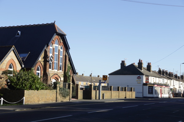
 Photo below of Broadwalk Rainham - now High Street

How Rainham Kent Street Names have changed over the years

Sign on Webster Road giving indication of the original name of the road, Milton Road

Subcategories

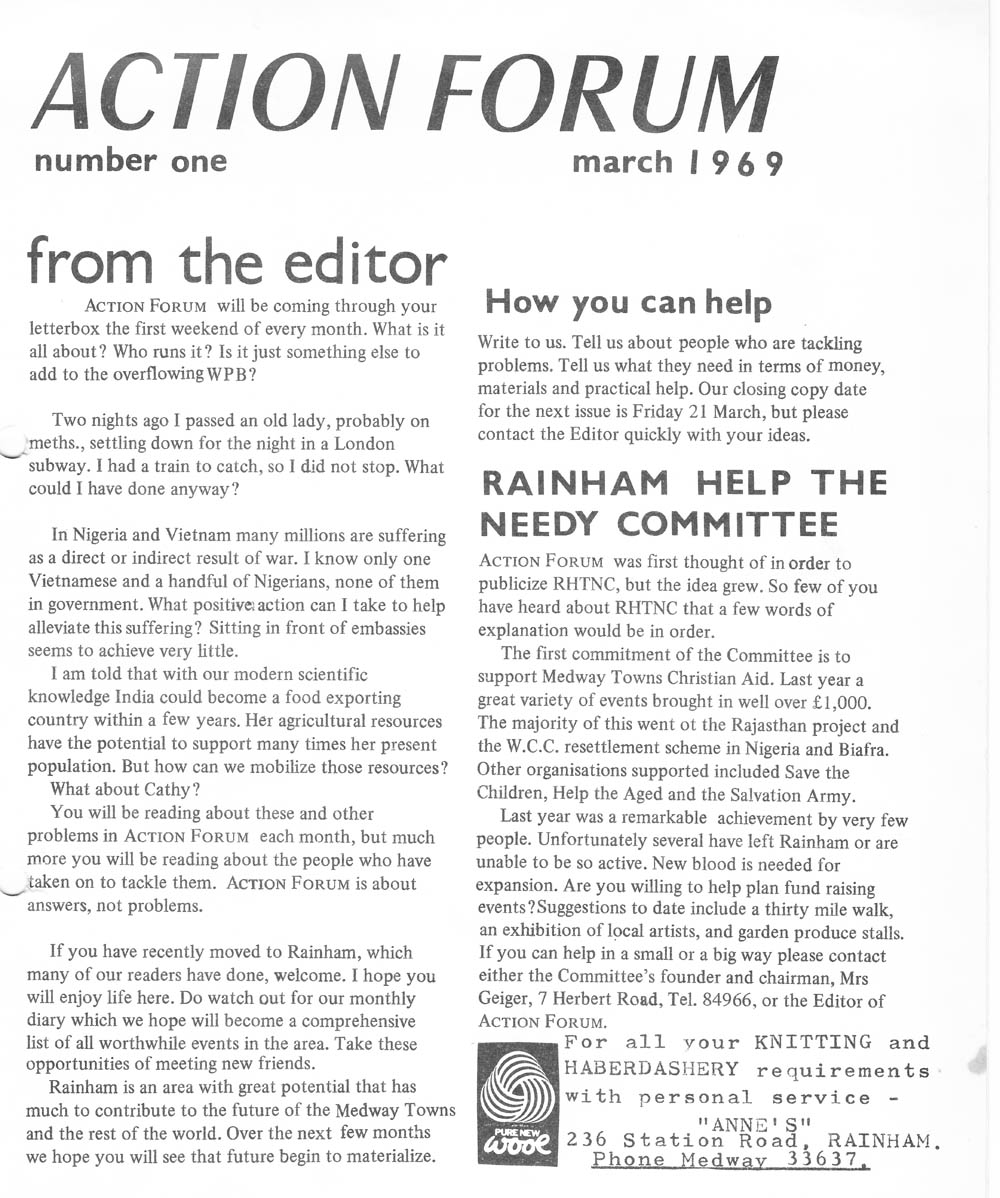
Action Forum is a free monthly magazine that is distributed to the Rainham area covering Wigmore, Parkwood and Hempstead as well. This archive covers old copies of the magazine dating back to its initial publication in 1969 and give a fascinating glimpse into life in Rainham over the last 50 years.

Link to Article Index - Action Forum Index - Photos and Articles from 1969 onwards

Historical tales

Local Events

Photos

Rainham Life

Free Joomla! templates by AgeThemes